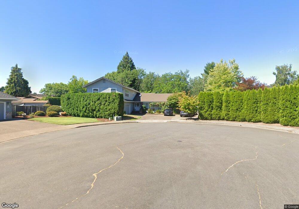
686 NW Jakes Ct McMinnville, OR 97128
Estimated Value: $563,000 - $781,000
4
Beds
3
Baths
3,234
Sq Ft
$213/Sq Ft
Est. Value
About This Home
This home is located at 686 NW Jakes Ct, McMinnville, OR 97128 and is currently estimated at $689,045, approximately $213 per square foot. 686 NW Jakes Ct is a home located in Yamhill County with nearby schools including Memorial Elementary School, Patton Middle School, and McMinnville High School.
Ownership History
Date
Name
Owned For
Owner Type
Purchase Details
Closed on
Jun 15, 2004
Sold by
Squires Jack E and Squires Elinore L
Bought by
Bristow Ladd L and Bristow Cindy M
Current Estimated Value
Home Financials for this Owner
Home Financials are based on the most recent Mortgage that was taken out on this home.
Original Mortgage
$100,000
Outstanding Balance
$47,634
Interest Rate
5.62%
Mortgage Type
Purchase Money Mortgage
Estimated Equity
$641,411
Create a Home Valuation Report for This Property
The Home Valuation Report is an in-depth analysis detailing your home's value as well as a comparison with similar homes in the area
Home Values in the Area
Average Home Value in this Area
Purchase History
| Date | Buyer | Sale Price | Title Company |
|---|---|---|---|
| Bristow Ladd L | $235,000 | Northwest Title Company |
Source: Public Records
Mortgage History
| Date | Status | Borrower | Loan Amount |
|---|---|---|---|
| Open | Bristow Ladd L | $100,000 | |
| Closed | Bristow Ladd L | $88,000 |
Source: Public Records
Tax History Compared to Growth
Tax History
| Year | Tax Paid | Tax Assessment Tax Assessment Total Assessment is a certain percentage of the fair market value that is determined by local assessors to be the total taxable value of land and additions on the property. | Land | Improvement |
|---|---|---|---|---|
| 2024 | $7,377 | $424,423 | -- | -- |
| 2023 | $6,965 | $412,061 | $0 | $0 |
| 2022 | $6,598 | $400,059 | $0 | $0 |
| 2021 | $6,442 | $388,407 | $0 | $0 |
| 2020 | $6,391 | $377,094 | $0 | $0 |
| 2019 | $6,217 | $366,111 | $0 | $0 |
| 2018 | $6,094 | $355,448 | $0 | $0 |
| 2017 | $5,882 | $345,095 | $0 | $0 |
| 2016 | $5,672 | $335,044 | $0 | $0 |
| 2015 | $5,533 | $325,287 | $0 | $0 |
| 2014 | $5,235 | $315,814 | $0 | $0 |
Source: Public Records
Map
Nearby Homes
- 2221 NW Elm St
- 2286 NW Michelbook Ln
- 700 NW 18th Place
- 2735 NW Pinehurst Dr Unit 5
- 3192 NW Pinehurst Dr Unit 76
- 1564 NW Pinehurst Dr Unit 106
- 2799 NW Pinehurst Dr Unit 11
- 2787 NW Pinehurst Dr Unit 10
- 2897 NW Pinehurst Dr Unit 13
- 2719 NW Pinehurst Dr Unit 3
- 2743 NW Pinehurst Dr Unit 6
- 3106 NW Pinehurst Dr Unit 49
- 2805 NW Pinehurst Dr Unit 12
- 1536 NW Pinehurst Dr Unit 108
- 3200 NW Pinehurst Dr Unit 75
- 2769 NW Pinehurst Dr Unit 8
- 2925 NW Pinehurst Dr Unit 14
- 2713 NW Pinehurst Dr Unit 2
- 3164 NW Pinehurst Dr Unit 77
- 3046 NW Pinehurst Dr Unit 46
- 1960 NW Thomsen Ln
- 1947 NW Fir St
- 662 NW Jakes Ct
- 1948 NW Thomsen Ln
- 1984 NW Thomsen Ln
- 671 NW Jakes Ct
- 1946 NW Fir St
- 1929 NW Fir St
- 1930 NW Thomsen Ln
- 648 NW Jakes Ct
- 724 NW 21st St
- 758 NW 21st St
- 1930 NW Fir St
- 708 NW 21st St
- 643 NW Jakes Ct
- 1959 NW Thomsen Ln
- 1947 NW Thomsen Ln
- 715 NW 19th St
- 1981 NW Thomsen Ln
- 731 NW 19th St