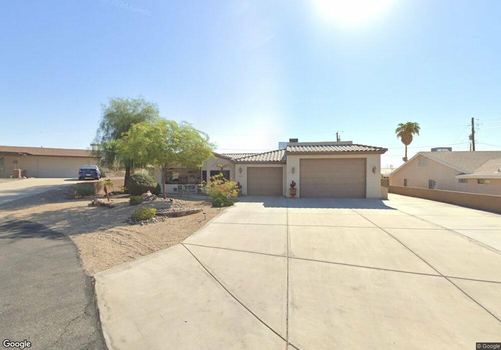
688 Yosemite Ct Lake Havasu City, AZ 86406
Estimated Value: $585,042 - $689,000
--
Bed
1
Bath
1,993
Sq Ft
$322/Sq Ft
Est. Value
About This Home
This home is located at 688 Yosemite Ct, Lake Havasu City, AZ 86406 and is currently estimated at $640,761, approximately $321 per square foot. 688 Yosemite Ct is a home located in Mohave County with nearby schools including Starline Elementary School, Thunderbolt Middle School, and Lake Havasu High School.
Ownership History
Date
Name
Owned For
Owner Type
Purchase Details
Closed on
Aug 1, 2024
Sold by
Fuscardo Sandee L
Bought by
Sandra L Fuscardo Revocable Living Trust and Fuscardo
Current Estimated Value
Purchase Details
Closed on
Nov 21, 2016
Sold by
Fuscardo Richard L and Fuscardo Sandee L
Bought by
Fuscardo Richard and Fuscardo Sandee L
Home Financials for this Owner
Home Financials are based on the most recent Mortgage that was taken out on this home.
Original Mortgage
$268,000
Interest Rate
3.42%
Mortgage Type
New Conventional
Purchase Details
Closed on
Aug 9, 2011
Sold by
Fuscardo Richard L
Bought by
Fuscardo Richard L and Fuscardo Sandee L
Home Financials for this Owner
Home Financials are based on the most recent Mortgage that was taken out on this home.
Original Mortgage
$211,140
Interest Rate
4.46%
Mortgage Type
New Conventional
Create a Home Valuation Report for This Property
The Home Valuation Report is an in-depth analysis detailing your home's value as well as a comparison with similar homes in the area
Home Values in the Area
Average Home Value in this Area
Purchase History
| Date | Buyer | Sale Price | Title Company |
|---|---|---|---|
| Sandra L Fuscardo Revocable Living Trust | -- | None Listed On Document | |
| Fuscardo Richard | -- | Stewart Title Arizona Agency | |
| Fuscardo Richard L | -- | Stewart Title & Trust Of Pho |
Source: Public Records
Mortgage History
| Date | Status | Borrower | Loan Amount |
|---|---|---|---|
| Previous Owner | Fuscardo Richard | $268,000 | |
| Previous Owner | Fuscardo Richard L | $211,140 |
Source: Public Records
Tax History Compared to Growth
Tax History
| Year | Tax Paid | Tax Assessment Tax Assessment Total Assessment is a certain percentage of the fair market value that is determined by local assessors to be the total taxable value of land and additions on the property. | Land | Improvement |
|---|---|---|---|---|
| 2026 | $990 | -- | -- | -- |
| 2025 | $2,005 | $55,740 | $0 | $0 |
| 2024 | $2,005 | $54,376 | $0 | $0 |
| 2023 | $2,005 | $47,334 | $0 | $0 |
| 2022 | $1,931 | $36,080 | $0 | $0 |
| 2021 | $2,150 | $33,083 | $0 | $0 |
| 2019 | $2,042 | $29,078 | $0 | $0 |
| 2018 | $1,973 | $27,167 | $0 | $0 |
| 2017 | $1,938 | $25,900 | $0 | $0 |
| 2016 | $1,713 | $24,744 | $0 | $0 |
| 2015 | $1,667 | $22,017 | $0 | $0 |
Source: Public Records
Map
Nearby Homes
- 700 Apache Dr
- 680 Yosemite Dr
- 2910 Coconino Dr
- 786 Powder Dr
- 2741 Jericho Dr
- 670 Avenida Laredo
- 2970 War Eagle Dr
- 677 Avenida Laredo
- 2890 Yuma Dr
- 2820 Indian Springs Dr
- 532 Roanoke Dr
- 2750 Via Naranja
- 3066 Star Dr
- 3135 Cotati Dr
- 701 Paseo Granada
- 2876 Plaza Del Oro
- 2951 Saddleback Dr
- 3040 Gypsy Dr
- 1031 Gleneagles Dr
- 2997 Edgewood Dr
- 692 Yosemite Ct
- 684 Yosemite Ct
- 676 Yosemite Ct
- 672 Yosemite Ct
- 700 Yosemite Ct
- 706 Apache Dr
- 668 Yosemite Ct
- 2840 War Eagle Dr
- 702 Apache Dr
- 708 Apache Dr
- 2846 War Eagle Dr
- 2850 War Eagle Dr
- 664 Yosemite Dr
- 710 Apache Dr
- 2820 War Eagle Dr
- 2856 War Eagle Dr
- 698 Apache Dr
- 658 Yosemite Dr
- 707 Apache Dr
- 791 Yosemite Dr