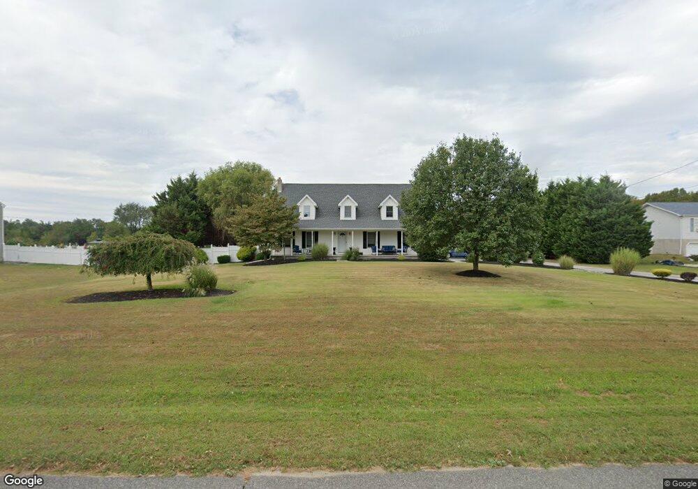
689 Woodstown Rd Swedesboro, NJ 08085
Woolwich Township NeighborhoodEstimated Value: $534,000 - $608,000
--
Bed
--
Bath
2,681
Sq Ft
$215/Sq Ft
Est. Value
About This Home
This home is located at 689 Woodstown Rd, Swedesboro, NJ 08085 and is currently estimated at $577,545, approximately $215 per square foot. 689 Woodstown Rd is a home located in Gloucester County with nearby schools including Margaret C Clifford School, Gen. Charles G. Harker School, and Gov. Charles C. Stratton School.
Ownership History
Date
Name
Owned For
Owner Type
Purchase Details
Closed on
Feb 19, 2015
Sold by
Devito Steven J and Devito Karen L
Bought by
Devito Steven and Devito Karen L
Current Estimated Value
Home Financials for this Owner
Home Financials are based on the most recent Mortgage that was taken out on this home.
Original Mortgage
$263,000
Outstanding Balance
$89,707
Interest Rate
2.92%
Mortgage Type
New Conventional
Estimated Equity
$487,838
Purchase Details
Closed on
May 5, 1998
Sold by
Andover Country Estates Inc
Bought by
Devito Steven J and Burman Karen L
Create a Home Valuation Report for This Property
The Home Valuation Report is an in-depth analysis detailing your home's value as well as a comparison with similar homes in the area
Home Values in the Area
Average Home Value in this Area
Purchase History
| Date | Buyer | Sale Price | Title Company |
|---|---|---|---|
| Devito Steven | -- | Attorney | |
| Devito Steven J | $25,000 | -- |
Source: Public Records
Mortgage History
| Date | Status | Borrower | Loan Amount |
|---|---|---|---|
| Open | Devito Steven | $263,000 |
Source: Public Records
Tax History Compared to Growth
Tax History
| Year | Tax Paid | Tax Assessment Tax Assessment Total Assessment is a certain percentage of the fair market value that is determined by local assessors to be the total taxable value of land and additions on the property. | Land | Improvement |
|---|---|---|---|---|
| 2025 | $11,018 | $328,100 | $34,200 | $293,900 |
| 2024 | $10,824 | $328,100 | $34,200 | $293,900 |
| 2023 | $10,824 | $328,100 | $34,200 | $293,900 |
| 2022 | $11,047 | $328,100 | $34,200 | $293,900 |
| 2021 | $11,274 | $328,100 | $34,200 | $293,900 |
| 2020 | $11,257 | $328,100 | $34,200 | $293,900 |
| 2019 | $10,814 | $287,900 | $33,000 | $254,900 |
| 2018 | $10,770 | $287,900 | $33,000 | $254,900 |
| 2017 | $10,560 | $287,900 | $33,000 | $254,900 |
| 2016 | $10,457 | $287,900 | $33,000 | $254,900 |
| 2015 | $10,218 | $285,200 | $33,000 | $252,200 |
| 2014 | $9,617 | $285,200 | $33,000 | $252,200 |
Source: Public Records
Map
Nearby Homes
- 34 Main St
- 555 Woodstown Rd
- 0 Woodstown Rd Unit NJSA2016854
- 11 Mimosa Ln
- 0 Birch Ln Unit NJSA2015664
- 195 Hunters Run
- 15 Laurel Ln
- 194 Jockey Hollow Run
- 1573 Oldmans Creek Rd
- 34 2 Penny Run E
- 33 Buttonwood Dr
- 361 Rainey Rd
- 115 Fox Chase Ct
- 23 Waterview Dr
- 230 Point Airy Rd
- 201 Weston Dr
- 5 James Ct
- 137 Davidson Rd
- 81 Wexford Dr S
- 180 Cambridge Blvd
- 687 Woodstown Rd
- 699 Woodstown Rd
- 180 Oliphants Mill Rd
- 180 Oliphant's Mill Rd
- 677 Woodstown Rd
- 158 Oliphants Mill Rd
- 0 Porches Mill Rd
- 675 Woodstown Rd
- 175 Oliphants Mill Rd
- 197 Porches Mill Rd
- 171 Oliphants Mill Rd
- 1130 Russell Mill Rd
- 667 Woodstown Rd
- 108 Homestead Ct
- 1142 Russell Mill Rd
- 150 Oliphants Mill Rd
- 120 Homestead Ct
- 105 Homestead Ct
- 1109 Russell Mill Rd
- 245 Colony Place