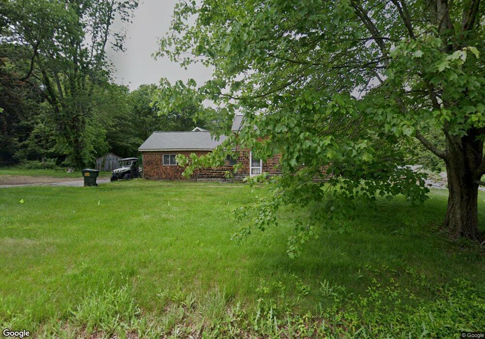
69 Colburn Rd Charlton, MA 01507
Estimated Value: $607,188 - $692,000
3
Beds
2
Baths
1,692
Sq Ft
$377/Sq Ft
Est. Value
About This Home
This home is located at 69 Colburn Rd, Charlton, MA 01507 and is currently estimated at $637,797, approximately $376 per square foot. 69 Colburn Rd is a home with nearby schools including Shepherd Hill Regional High School.
Ownership History
Date
Name
Owned For
Owner Type
Purchase Details
Closed on
May 10, 2024
Sold by
Helgerson Andrew J and French Anne E
Bought by
Helgerson French Irt and Helgerson
Current Estimated Value
Purchase Details
Closed on
Jul 20, 2022
Sold by
Helgerson Andrew J
Bought by
Helgerson Andrew J and French Anne E
Home Financials for this Owner
Home Financials are based on the most recent Mortgage that was taken out on this home.
Original Mortgage
$341,480
Interest Rate
3.75%
Mortgage Type
Adjustable Rate Mortgage/ARM
Purchase Details
Closed on
Oct 23, 1992
Sold by
Saulnier Ora M
Bought by
Helgerson Andrew J
Create a Home Valuation Report for This Property
The Home Valuation Report is an in-depth analysis detailing your home's value as well as a comparison with similar homes in the area
Home Values in the Area
Average Home Value in this Area
Purchase History
| Date | Buyer | Sale Price | Title Company |
|---|---|---|---|
| Helgerson French Irt | -- | None Available | |
| Helgerson French Irt | -- | None Available | |
| Helgerson Andrew J | -- | None Available | |
| Helgerson Andrew J | -- | None Available | |
| Helgerson Andrew J | -- | None Available | |
| Helgerson Andrew J | $54,000 | -- | |
| Helgerson Andrew J | $54,000 | -- |
Source: Public Records
Mortgage History
| Date | Status | Borrower | Loan Amount |
|---|---|---|---|
| Previous Owner | Helgerson Andrew J | $341,480 | |
| Previous Owner | Helgerson Andrew J | $12,300 | |
| Previous Owner | Helgerson Andrew J | $40,800 | |
| Previous Owner | Helgerson Andrew J | $15,000 |
Source: Public Records
Tax History Compared to Growth
Tax History
| Year | Tax Paid | Tax Assessment Tax Assessment Total Assessment is a certain percentage of the fair market value that is determined by local assessors to be the total taxable value of land and additions on the property. | Land | Improvement |
|---|---|---|---|---|
| 2025 | $5,931 | $532,900 | $92,500 | $440,400 |
| 2024 | $6,134 | $540,900 | $92,400 | $448,500 |
| 2023 | $3,091 | $254,000 | $88,700 | $165,300 |
| 2022 | $2,714 | $204,200 | $80,600 | $123,600 |
| 2021 | $2,783 | $185,400 | $76,400 | $109,000 |
| 2020 | $2,725 | $182,400 | $73,400 | $109,000 |
| 2019 | $2,694 | $182,400 | $73,400 | $109,000 |
| 2018 | $2,462 | $182,400 | $73,400 | $109,000 |
| 2017 | $2,280 | $161,700 | $67,400 | $94,300 |
| 2016 | $2,228 | $161,700 | $67,400 | $94,300 |
| 2015 | $2,170 | $161,700 | $67,400 | $94,300 |
| 2014 | $2,056 | $162,400 | $70,100 | $92,300 |
Source: Public Records
Map
Nearby Homes
- 58 Colburn Rd
- 0 Freeman Rd Unit 73369281
- 0 Partridge Hill Rd
- 2 Lelandville Rd
- 3 Lelandville Rd
- 76 Number 6 Schoolhouse Rd
- 65 Haggerty Rd
- 2 Potter Village Rd
- 91 Burlingame Rd
- 16 Sandersdale Rd
- 18 Mckinstry Dr
- 13 Boucher Dr
- 0 Blood Rd
- 7 L Stevens Rd Unit A
- 7 L Stevens Rd Unit B
- 20 Drury Ln
- 18 Old Worcester Rd
- 8 Northside Rd
- 60 Saundersdale Rd
- 44 Buffum Rd