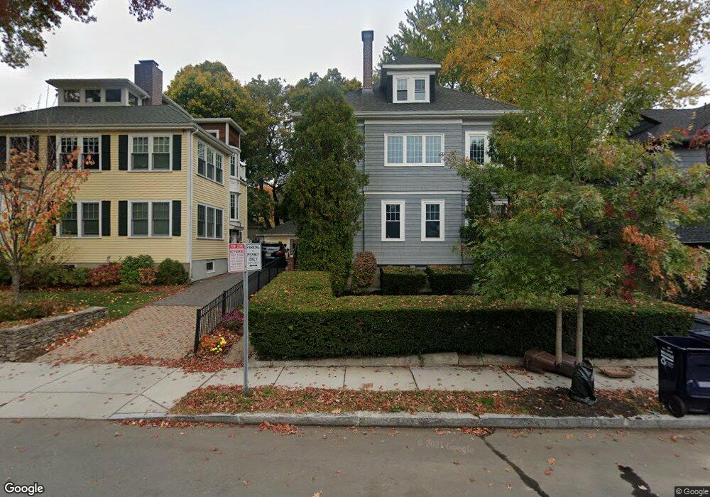
69 Grozier Rd Cambridge, MA 02138
West Cambridge NeighborhoodEstimated Value: $2,322,000 - $3,386,000
2
Beds
1
Bath
1,500
Sq Ft
$1,923/Sq Ft
Est. Value
About This Home
This home is located at 69 Grozier Rd, Cambridge, MA 02138 and is currently estimated at $2,883,830, approximately $1,922 per square foot. 69 Grozier Rd is a home located in Middlesex County with nearby schools including Cambridge Montessori School, St Peter School, and Cambridge Friends School.
Ownership History
Date
Name
Owned For
Owner Type
Purchase Details
Closed on
May 3, 2024
Sold by
Kahn Peter J
Bought by
71 Grozier Road Llc
Current Estimated Value
Purchase Details
Closed on
Mar 18, 2015
Sold by
Ohanesian Harry M
Bought by
Harry M Ohanesian Lt and Ohanesian
Purchase Details
Closed on
Sep 20, 1976
Bought by
Lt Harry M Ohanesian
Create a Home Valuation Report for This Property
The Home Valuation Report is an in-depth analysis detailing your home's value as well as a comparison with similar homes in the area
Home Values in the Area
Average Home Value in this Area
Purchase History
| Date | Buyer | Sale Price | Title Company |
|---|---|---|---|
| 71 Grozier Road Llc | -- | None Available | |
| 71 Grozier Road Llc | -- | None Available | |
| Harry M Ohanesian Lt | -- | -- | |
| Harry M Ohanesian Lt | -- | -- | |
| Lt Harry M Ohanesian | -- | -- |
Source: Public Records
Tax History Compared to Growth
Tax History
| Year | Tax Paid | Tax Assessment Tax Assessment Total Assessment is a certain percentage of the fair market value that is determined by local assessors to be the total taxable value of land and additions on the property. | Land | Improvement |
|---|---|---|---|---|
| 2025 | $15,170 | $2,389,000 | $1,124,900 | $1,264,100 |
| 2024 | $14,149 | $2,390,100 | $1,173,400 | $1,216,700 |
| 2023 | $13,259 | $2,262,600 | $1,195,500 | $1,067,100 |
| 2022 | $12,086 | $2,041,600 | $1,077,400 | $964,200 |
| 2021 | $11,609 | $1,984,400 | $1,056,100 | $928,300 |
| 2020 | $10,326 | $1,795,900 | $1,045,600 | $750,300 |
| 2019 | $9,440 | $1,589,300 | $882,600 | $706,700 |
| 2018 | $8,986 | $1,428,600 | $795,100 | $633,500 |
| 2017 | $9,142 | $1,408,600 | $775,300 | $633,300 |
| 2016 | $8,871 | $1,269,100 | $679,900 | $589,200 |
| 2015 | $8,752 | $1,119,200 | $596,400 | $522,800 |
| 2014 | $8,186 | $976,900 | $508,900 | $468,000 |
Source: Public Records
Map
Nearby Homes
- 107 Grozier Rd Unit 1
- 465 Huron Ave Unit 1
- 134 Lexington Ave Unit 2
- 182 Larch Rd
- 382 Huron Ave
- 243 Lexington Ave
- 43 Larch Rd
- 31 Chilton St Unit 1
- 71-73 Reservoir St
- 1 Aberdeen Way Unit 113
- 422-424 Walden St
- 172 Brattle St
- 47 Homer Ave Unit 5-3
- 35 Homer Ave Unit 7
- 234 Huron Ave
- 156 Fayerweather St Unit 156
- 158 Brattle St
- 32 Copley St Unit 2
- 87 Holworthy St Unit 2
- 87 Holworthy St Unit 3
- 65 Grozier Rd
- 73 Grozier Rd
- 61 Grozier Rd
- 61 Grozier Rd Unit 61
- 77 Grozier Rd Unit 1
- 77 Grozier Rd Unit 2,1
- 168A Lexington Ave Unit 168
- 170 Lexington Ave
- 170 Lexington Ave Unit 1
- 168 Lexington Ave Unit A
- 168 Lexington Ave
- 168B Lexington Ave Unit 168
- 168 Lexington Ave Unit 168
- 168B Lexington Ave
- 57 Grozier Rd Unit 2
- 57 Grozier Rd Unit 1
- 81 Grozier Rd
- 68 Grozier Rd
- 66 Grozier Rd
- 68 Grozier Rd Unit 2