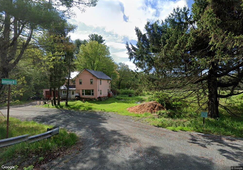
69 Kostige Rd Lakeville, PA 18438
Estimated Value: $608,000 - $799,000
4
Beds
2
Baths
2,226
Sq Ft
$311/Sq Ft
Est. Value
About This Home
This home is located at 69 Kostige Rd, Lakeville, PA 18438 and is currently estimated at $692,037, approximately $310 per square foot. 69 Kostige Rd is a home located in Wayne County with nearby schools including Wallenpaupack Area High School.
Ownership History
Date
Name
Owned For
Owner Type
Purchase Details
Closed on
Dec 6, 2011
Sold by
Csc Land Development Llc
Bought by
Neal Michael R and Neal Amy M
Current Estimated Value
Home Financials for this Owner
Home Financials are based on the most recent Mortgage that was taken out on this home.
Original Mortgage
$292,000
Outstanding Balance
$199,652
Interest Rate
4%
Mortgage Type
Assumption
Estimated Equity
$492,385
Create a Home Valuation Report for This Property
The Home Valuation Report is an in-depth analysis detailing your home's value as well as a comparison with similar homes in the area
Home Values in the Area
Average Home Value in this Area
Purchase History
| Date | Buyer | Sale Price | Title Company |
|---|---|---|---|
| Neal Michael R | $365,000 | None Available |
Source: Public Records
Mortgage History
| Date | Status | Borrower | Loan Amount |
|---|---|---|---|
| Open | Neal Michael R | $292,000 |
Source: Public Records
Tax History Compared to Growth
Tax History
| Year | Tax Paid | Tax Assessment Tax Assessment Total Assessment is a certain percentage of the fair market value that is determined by local assessors to be the total taxable value of land and additions on the property. | Land | Improvement |
|---|---|---|---|---|
| 2025 | $7,502 | $515,100 | $65,400 | $449,700 |
| 2024 | $7,162 | $515,100 | $65,400 | $449,700 |
| 2023 | $10,037 | $515,100 | $65,400 | $449,700 |
| 2022 | $8,086 | $373,000 | $35,600 | $337,400 |
| 2021 | $7,942 | $373,000 | $35,600 | $337,400 |
| 2020 | $7,920 | $373,000 | $35,600 | $337,400 |
| 2019 | $8,137 | $408,500 | $35,600 | $372,900 |
| 2018 | $5,734 | $293,600 | $35,600 | $258,000 |
| 2017 | $1,343 | $293,600 | $35,600 | $258,000 |
| 2016 | $5,420 | $293,600 | $35,600 | $258,000 |
| 2014 | -- | $293,600 | $35,600 | $258,000 |
Source: Public Records
Map
Nearby Homes
- 784 Purdytown Turnpike
- 00 Purdytown Turnpike
- 177 Crane Rd
- 0 Crane Rd
- 12C Ridge Crest Dr
- Lot 62 Oak Mountain Dr
- 7 Oak Mountain Dr
- 146 Cove Point Cir
- 0 Address Withheld Unit PWBPW251950
- 140 Poplar St
- 20 Pine St
- 5 Lakefront Cir Unit 206
- 116 Daniels Rd
- 329 Lakeshore Dr
- 102 Crestview Dr
- 102 Rocky Rd
- 294 Florence Trail
- 30 Vista Ct
- 103 Lakeside Rd
- 24 Lakeside Dr