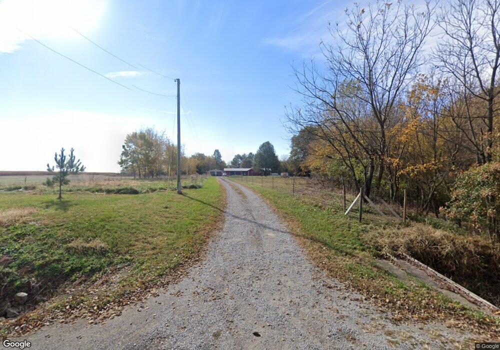
6910 Cemetery Rd Breese, IL 62230
Estimated Value: $257,000 - $331,000
--
Bed
--
Bath
1,592
Sq Ft
$181/Sq Ft
Est. Value
About This Home
This home is located at 6910 Cemetery Rd, Breese, IL 62230 and is currently estimated at $287,450, approximately $180 per square foot. 6910 Cemetery Rd is a home located in Clinton County with nearby schools including St Rose Elementary School and Central Community High School.
Ownership History
Date
Name
Owned For
Owner Type
Purchase Details
Closed on
Jul 13, 2018
Sold by
Schellenger Jean M and Schellenger Harold L
Bought by
Stock Emily and Stock Karl
Current Estimated Value
Home Financials for this Owner
Home Financials are based on the most recent Mortgage that was taken out on this home.
Original Mortgage
$163,840
Outstanding Balance
$141,992
Interest Rate
4.5%
Mortgage Type
VA
Estimated Equity
$145,458
Purchase Details
Closed on
Dec 20, 2008
Sold by
Schellenger Jean M and Schellenger Jean M
Bought by
Schellenger Jean M and Schellenger Harold L
Purchase Details
Closed on
Jan 1, 2002
Sold by
Shcumacher Richard and Shcumacher Ruth
Bought by
Schumacher Jean M
Create a Home Valuation Report for This Property
The Home Valuation Report is an in-depth analysis detailing your home's value as well as a comparison with similar homes in the area
Home Values in the Area
Average Home Value in this Area
Purchase History
| Date | Buyer | Sale Price | Title Company |
|---|---|---|---|
| Stock Emily | $160,000 | Highland Community Title | |
| Schellenger Jean M | -- | Highland Community Title Llc | |
| Schumacher Jean M | $17,500 | None Available |
Source: Public Records
Mortgage History
| Date | Status | Borrower | Loan Amount |
|---|---|---|---|
| Open | Stock Emily | $163,840 |
Source: Public Records
Tax History Compared to Growth
Tax History
| Year | Tax Paid | Tax Assessment Tax Assessment Total Assessment is a certain percentage of the fair market value that is determined by local assessors to be the total taxable value of land and additions on the property. | Land | Improvement |
|---|---|---|---|---|
| 2024 | $5,223 | $81,460 | $14,660 | $66,800 |
| 2023 | $5,223 | $74,060 | $13,330 | $60,730 |
| 2022 | $4,760 | $74,420 | $15,120 | $59,300 |
| 2021 | $4,463 | $69,550 | $14,130 | $55,420 |
| 2020 | $4,081 | $65,610 | $13,330 | $52,280 |
| 2019 | $4,162 | $65,610 | $13,330 | $52,280 |
| 2018 | $4,200 | $62,710 | $12,330 | $50,380 |
| 2017 | $4,297 | $62,710 | $12,330 | $50,380 |
| 2016 | $4,265 | $62,710 | $12,330 | $50,380 |
| 2015 | $4,188 | $62,710 | $12,330 | $50,380 |
| 2013 | $4,188 | $63,540 | $12,330 | $51,210 |
Source: Public Records
Map
Nearby Homes
- 17811 East St
- 22809 Saint Rose Rd
- 13636 Alpine Way
- 13613 Alpine Way
- 13642 Saint Rose Rd
- 12740 Iberg Rd
- 13964 Best One Dr
- 305 Kingsbury Ct
- 255 Regency Ct
- 13898 Lincoln Dr
- 310 Devonshire Ct
- 10675 Buckingham Ct
- 2131 Hill Crest Dr
- 180 Keeven Dr
- 751 E 4th St
- 10 S Hull St
- 2130 Saint Raphael Ct
- 1632 24th St
- 923 N 6th St
- XXX 26th St
- 6828 Cemetery Rd
- 6929 Cemetery Rd
- 18050 Spanker Branch Rd
- 18000 Spanker Branch Rd
- 6732 Cemetery Rd
- 7196 Cemetery Rd
- 17818 Spanker Branch Rd
- 7198 Cemetery Rd
- 7202 Cemetery Rd
- 7215 Cemetery Rd
- 17901 Spanker Branch Rd
- 17815 Spanker Branch Rd
- 7213 Cemetery Rd
- 6600 Cemetery Rd
- 7304 Cemetery Rd
- 7216 Iberg Rd
- 7615 Cemetery Rd
- 17449 Spanker Branch Rd
- 7655 Cemetery Rd
- 7663 Cemetery Rd
