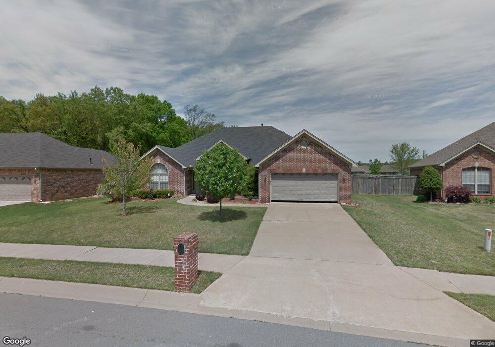
6932 Austin Bay Ct Sherwood, AR 72120
Estimated Value: $306,715 - $359,000
--
Bed
2
Baths
2,199
Sq Ft
$153/Sq Ft
Est. Value
About This Home
This home is located at 6932 Austin Bay Ct, Sherwood, AR 72120 and is currently estimated at $336,679, approximately $153 per square foot. 6932 Austin Bay Ct is a home located in Pulaski County with nearby schools including Clinton Elementary School, Sylvan Hills Middle School, and Sylvan Hills High School.
Ownership History
Date
Name
Owned For
Owner Type
Purchase Details
Closed on
May 31, 2005
Sold by
Katka Michael B and Katka Kimberly L
Bought by
Butler Richard C and Butler Pok S
Current Estimated Value
Home Financials for this Owner
Home Financials are based on the most recent Mortgage that was taken out on this home.
Original Mortgage
$136,600
Outstanding Balance
$70,995
Interest Rate
5.79%
Mortgage Type
Fannie Mae Freddie Mac
Estimated Equity
$265,684
Purchase Details
Closed on
May 20, 2004
Sold by
Jon Young Homebuilders Inc
Bought by
Katka Michael B and Katka Kimberly L
Home Financials for this Owner
Home Financials are based on the most recent Mortgage that was taken out on this home.
Original Mortgage
$191,683
Interest Rate
6.02%
Mortgage Type
Purchase Money Mortgage
Create a Home Valuation Report for This Property
The Home Valuation Report is an in-depth analysis detailing your home's value as well as a comparison with similar homes in the area
Home Values in the Area
Average Home Value in this Area
Purchase History
| Date | Buyer | Sale Price | Title Company |
|---|---|---|---|
| Butler Richard C | $200,000 | Lenders Title Co | |
| Katka Michael B | $187,000 | Lenders Title Co |
Source: Public Records
Mortgage History
| Date | Status | Borrower | Loan Amount |
|---|---|---|---|
| Open | Butler Richard C | $136,600 | |
| Previous Owner | Katka Michael B | $191,683 |
Source: Public Records
Tax History Compared to Growth
Tax History
| Year | Tax Paid | Tax Assessment Tax Assessment Total Assessment is a certain percentage of the fair market value that is determined by local assessors to be the total taxable value of land and additions on the property. | Land | Improvement |
|---|---|---|---|---|
| 2025 | $1,841 | $50,047 | $5,800 | $44,247 |
| 2024 | $1,841 | $50,047 | $5,800 | $44,247 |
| 2023 | $1,841 | $50,047 | $5,800 | $44,247 |
| 2022 | $2,101 | $50,047 | $5,800 | $44,247 |
| 2021 | $2,027 | $39,580 | $6,600 | $32,980 |
| 2020 | $1,643 | $39,580 | $6,600 | $32,980 |
| 2019 | $1,643 | $39,580 | $6,600 | $32,980 |
| 2018 | $1,668 | $39,580 | $6,600 | $32,980 |
| 2017 | $1,663 | $39,580 | $6,600 | $32,980 |
| 2016 | $1,663 | $40,160 | $6,200 | $33,960 |
| 2015 | $1,795 | $35,339 | $6,200 | $29,139 |
| 2014 | $1,795 | $35,339 | $6,200 | $29,139 |
Source: Public Records
Map
Nearby Homes
- 106 Winona Dr
- 6608 Southshore Ln
- 201 Bearskin Dr
- 606 Bay View Ct
- 6 W Laramie Dr
- 400 Cherrie Ave
- 2226 Bearskin Dr
- 404 May St
- 7524 Glenn Hills Dr
- 401 Calloway Ave
- 309 May St
- 608 Hemphill Rd
- 2216 Sage Meadows Cir
- 3116 Maxine Ave
- 2724 E Maryland Ave
- 7416 Glenn Hills Dr
- 112 Sugar Maple Dr
- 3600 E Kiehl Ave
- 2125 Gap Creek Dr
- 2712 E Maryland Ave
- 6940 Austin Bay Ct
- 6924 Austin Bay Ct
- 3187 Austin Bayside Dr
- 6916 Austin Bay Ct
- 3179 Austin Bayside Dr
- 6933 Austin Bay Ct
- 3195 Austin Bayside Dr
- 6941 Austin Bay Ct
- 6925 Austin Bay Ct
- 6948 Austin Bay Ct
- 6908 Austin Bay Ct
- 6949 Austin Bay Ct
- 3129 Austin Bayside Dr
- 6917 Austin Bay Ct
- 3141 Austin Bayside Dr
- 3117 Austin Bayside Dr
- 3149 Austin Bayside Dr
- 6909 Austin Bay Ct
- 6956 Austin Bay Ct
- 6900 Austin Bay Ct