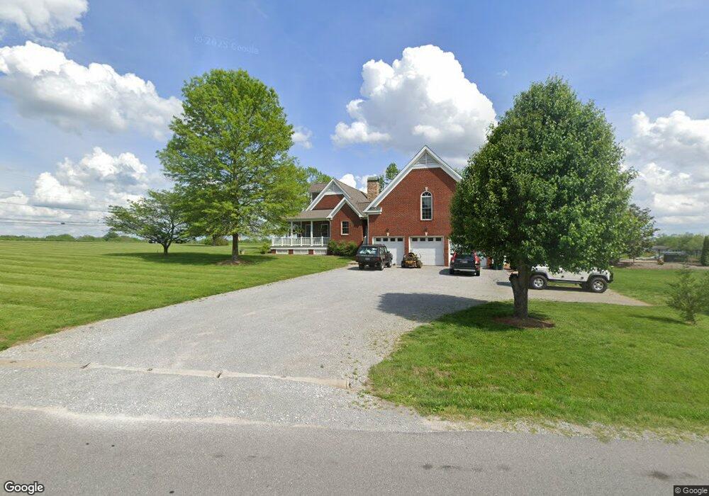
695 Bradford Dr Gallatin, TN 37066
Estimated Value: $500,000 - $690,000
--
Bed
3
Baths
2,361
Sq Ft
$260/Sq Ft
Est. Value
About This Home
This home is located at 695 Bradford Dr, Gallatin, TN 37066 and is currently estimated at $612,877, approximately $259 per square foot. 695 Bradford Dr is a home located in Sumner County with nearby schools including Howard Elementary School, Rucker Stewart Middle School, and Station Camp High School.
Ownership History
Date
Name
Owned For
Owner Type
Purchase Details
Closed on
Dec 21, 2017
Sold by
Bandy David
Bought by
Harris Douglas Leon and Harris Jennifer
Current Estimated Value
Home Financials for this Owner
Home Financials are based on the most recent Mortgage that was taken out on this home.
Original Mortgage
$331,173
Outstanding Balance
$282,064
Interest Rate
4.4%
Mortgage Type
FHA
Estimated Equity
$330,813
Purchase Details
Closed on
Dec 22, 1999
Sold by
R & R Investments Ltd Partnership
Bought by
Graham Kelly R
Create a Home Valuation Report for This Property
The Home Valuation Report is an in-depth analysis detailing your home's value as well as a comparison with similar homes in the area
Home Values in the Area
Average Home Value in this Area
Purchase History
| Date | Buyer | Sale Price | Title Company |
|---|---|---|---|
| Harris Douglas Leon | $337,283 | Tennessee Title Services Llc | |
| Graham Kelly R | $44,000 | -- |
Source: Public Records
Mortgage History
| Date | Status | Borrower | Loan Amount |
|---|---|---|---|
| Open | Harris Douglas Leon | $331,173 |
Source: Public Records
Tax History Compared to Growth
Tax History
| Year | Tax Paid | Tax Assessment Tax Assessment Total Assessment is a certain percentage of the fair market value that is determined by local assessors to be the total taxable value of land and additions on the property. | Land | Improvement |
|---|---|---|---|---|
| 2024 | $2,313 | $162,750 | $51,750 | $111,000 |
| 2023 | $2,670 | $87,475 | $26,150 | $61,325 |
| 2022 | $2,679 | $87,475 | $26,150 | $61,325 |
| 2021 | $2,679 | $87,475 | $26,150 | $61,325 |
| 2020 | $2,679 | $87,475 | $26,150 | $61,325 |
| 2019 | $2,679 | $0 | $0 | $0 |
| 2018 | $2,405 | $0 | $0 | $0 |
| 2017 | $2,591 | $0 | $0 | $0 |
| 2016 | $1,856 | $0 | $0 | $0 |
| 2015 | $2,591 | $0 | $0 | $0 |
| 2014 | $2,248 | $0 | $0 | $0 |
Source: Public Records
Map
Nearby Homes
- 608 Bradford Dr
- 415 Buckingham Blvd
- 420 Dorchester Place
- 1036 Middleton Ln
- 376 Huntington Dr
- 540 Bradford Dr
- 3023 Duvall Dr
- 559 Becks Place
- 156 Hackney Ln
- 1273 Wentworth Dr
- 1239 Wentworth Dr
- 638 Wassil Dr
- 294 Buckingham Blvd
- 653 Weathervane Dr
- 806 Warrington Ct
- 1328 Wentworth Dr
- 462 Mya Marie Dr
- 1017 Wickshire Dr
- 177 Hedgeway Ct
- 548 Dottie Dr
- 668 Bradford Dr
- 698 Bradford Dr
- 654 Bradford Dr
- 1388 Branch Creek Rd
- 1268 Highway 25
- 1362 Branch Creek Rd
- 644 Bradford Dr
- 1231 Highway 25
- 640 Bradford Dr
- 1346 Branch Creek Rd
- 1361 Branch Creek Rd
- 643 Bradford Dr
- 636 Bradford Dr
- 1330 Branch Creek Rd
- 639 Bradford Dr
- 1355 Branch Creek Rd
- 635 Bradford Dr
- 1318 Branch Creek Rd
- 1351 Branch Creek Rd
- 1216 Brockton Ct