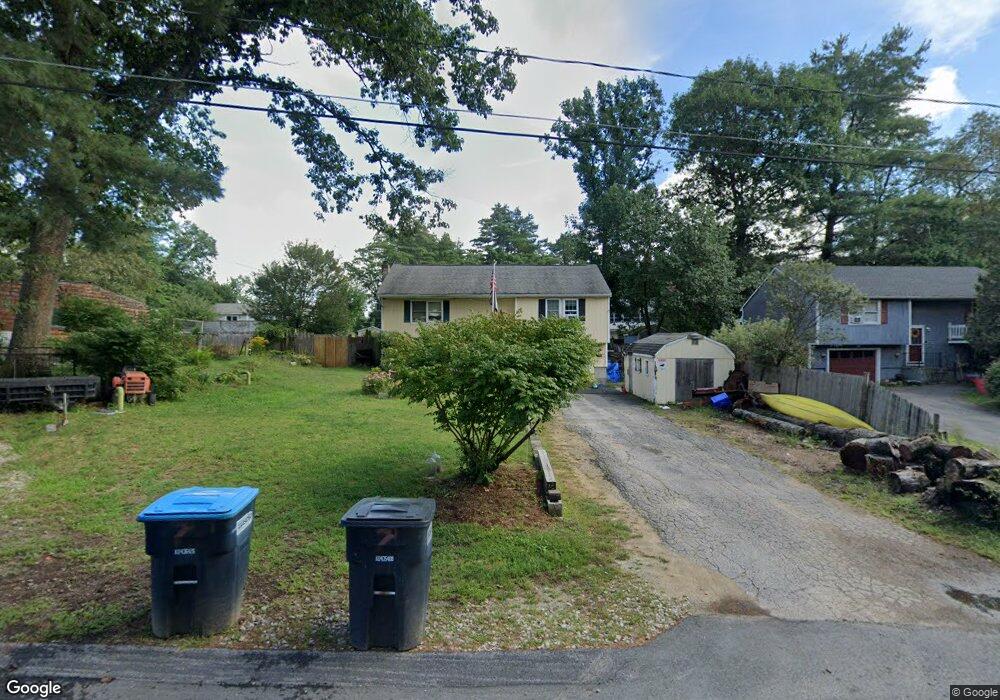
7 Albin Ave Allenstown, NH 03275
Estimated Value: $386,000 - $422,033
3
Beds
2
Baths
960
Sq Ft
$425/Sq Ft
Est. Value
About This Home
This home is located at 7 Albin Ave, Allenstown, NH 03275 and is currently estimated at $407,758, approximately $424 per square foot. 7 Albin Ave is a home located in Merrimack County with nearby schools including Allenstown Elementary School, Armand R. Dupont School, and Tender Years Child Care & Learning Center.
Ownership History
Date
Name
Owned For
Owner Type
Purchase Details
Closed on
Apr 2, 2018
Sold by
Stgermain Corie and Stgermain Kurt
Bought by
Rutherford Rachel M and Rutherford Timothy R
Current Estimated Value
Home Financials for this Owner
Home Financials are based on the most recent Mortgage that was taken out on this home.
Original Mortgage
$208,650
Outstanding Balance
$183,134
Interest Rate
5.37%
Mortgage Type
FHA
Estimated Equity
$224,624
Purchase Details
Closed on
Feb 16, 2000
Sold by
Bresse William and Bresse Norma
Bought by
St Germain Kurt D and St Germain Corie M
Home Financials for this Owner
Home Financials are based on the most recent Mortgage that was taken out on this home.
Original Mortgage
$102,000
Interest Rate
8.11%
Create a Home Valuation Report for This Property
The Home Valuation Report is an in-depth analysis detailing your home's value as well as a comparison with similar homes in the area
Home Values in the Area
Average Home Value in this Area
Purchase History
| Date | Buyer | Sale Price | Title Company |
|---|---|---|---|
| Rutherford Rachel M | $212,533 | -- | |
| St Germain Kurt D | $102,900 | -- |
Source: Public Records
Mortgage History
| Date | Status | Borrower | Loan Amount |
|---|---|---|---|
| Open | Rutherford Rachel M | $208,650 | |
| Previous Owner | St Germain Kurt D | $102,000 |
Source: Public Records
Tax History Compared to Growth
Tax History
| Year | Tax Paid | Tax Assessment Tax Assessment Total Assessment is a certain percentage of the fair market value that is determined by local assessors to be the total taxable value of land and additions on the property. | Land | Improvement |
|---|---|---|---|---|
| 2024 | $8,442 | $332,100 | $137,600 | $194,500 |
| 2023 | $7,041 | $332,100 | $137,600 | $194,500 |
| 2022 | $6,476 | $332,100 | $137,600 | $194,500 |
| 2021 | $5,717 | $181,500 | $82,100 | $99,400 |
| 2020 | $5,318 | $181,500 | $82,100 | $99,400 |
| 2019 | $5,645 | $181,500 | $82,100 | $99,400 |
| 2018 | $5,472 | $181,500 | $82,100 | $99,400 |
| 2017 | $5,796 | $180,500 | $82,100 | $98,400 |
| 2016 | $4,910 | $145,000 | $53,800 | $91,200 |
| 2015 | $4,718 | $143,700 | $51,200 | $92,500 |
| 2014 | $4,854 | $143,700 | $51,200 | $92,500 |
| 2013 | $4,531 | $143,700 | $51,200 | $92,500 |
Source: Public Records
Map
Nearby Homes
- 9 Pine Acres Rd
- 307 Dearborn Rd
- 5 Catamount Hill Dr
- 101 4th Range Rd Unit 4
- 1 Jefferson Ave
- 11 Presidential Dr
- 6 Jackson Ave
- 8 Bush Ave
- 233 Pembroke St
- 43 Catamount Hill Dr
- 1 1/2 Bartlett St
- 111 Glass St
- 19 Sullivan Dr
- 259 Pembroke St
- 12-14 Church St Unit 12,14
- 10 Lane Dr
- 2 Cheryl Dr
- 100 Main St Unit M10
- 100 Main St Unit 204
- 422 Dawn Dr Unit 23