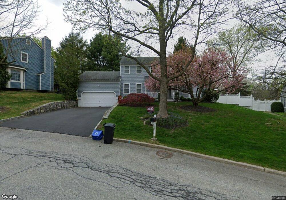
7 Pheasant Ridge Rd Ossining, NY 10562
North Ossining NeighborhoodEstimated Value: $673,000 - $824,000
3
Beds
3
Baths
2,265
Sq Ft
$340/Sq Ft
Est. Value
About This Home
This home is located at 7 Pheasant Ridge Rd, Ossining, NY 10562 and is currently estimated at $771,215, approximately $340 per square foot. 7 Pheasant Ridge Rd is a home located in Westchester County with nearby schools including Park School, Brookside Elementary School, and Claremont School.
Ownership History
Date
Name
Owned For
Owner Type
Purchase Details
Closed on
Jul 11, 2001
Sold by
Sandor Lorraine L and Rella Lorraine L
Bought by
Amster David J and Periu Anamaria
Current Estimated Value
Home Financials for this Owner
Home Financials are based on the most recent Mortgage that was taken out on this home.
Original Mortgage
$348,000
Outstanding Balance
$134,305
Interest Rate
7.16%
Mortgage Type
Unknown
Estimated Equity
$636,910
Create a Home Valuation Report for This Property
The Home Valuation Report is an in-depth analysis detailing your home's value as well as a comparison with similar homes in the area
Home Values in the Area
Average Home Value in this Area
Purchase History
| Date | Buyer | Sale Price | Title Company |
|---|---|---|---|
| Amster David J | $435,000 | Commonwealth Land Title Ins |
Source: Public Records
Mortgage History
| Date | Status | Borrower | Loan Amount |
|---|---|---|---|
| Open | Amster David J | $348,000 |
Source: Public Records
Tax History Compared to Growth
Tax History
| Year | Tax Paid | Tax Assessment Tax Assessment Total Assessment is a certain percentage of the fair market value that is determined by local assessors to be the total taxable value of land and additions on the property. | Land | Improvement |
|---|---|---|---|---|
| 2024 | $19,425 | $652,500 | $160,300 | $492,200 |
| 2023 | $18,740 | $605,300 | $160,300 | $445,000 |
| 2022 | $18,470 | $550,800 | $160,300 | $390,500 |
| 2021 | $18,606 | $496,200 | $160,300 | $335,900 |
| 2020 | $18,841 | $496,200 | $160,300 | $335,900 |
| 2019 | $18,880 | $487,500 | $178,100 | $309,400 |
| 2018 | $16,546 | $487,500 | $178,100 | $309,400 |
| 2017 | $10,118 | $482,800 | $178,100 | $304,700 |
| 2016 | $228,114 | $473,300 | $178,100 | $295,200 |
| 2015 | $17,607 | $29,700 | $4,840 | $24,860 |
| 2014 | $17,607 | $29,700 | $4,840 | $24,860 |
| 2013 | $17,607 | $29,700 | $4,840 | $24,860 |
Source: Public Records
Map
Nearby Homes
- 200 Route 9a
- 26 Fawn Ct
- 113 Antler Ridge Unit 113
- 112 Woods Brooke Cir
- 7 Grandview Ave
- 126 Whitetail Cir
- 78 Croton Dam Rd
- 283 Horse Shoe Cir
- 313 Saddle Trail Unit 31-3
- 7 Birchbrook Rd
- 58 Narragansett Ave
- 24 Oakbrook Rd
- 41 Bridle Path Rd
- 14 Gates Ave
- 7 Hawkes Ave
- 7 Locust Rd
- 53 Park Ave
- 11 Knollwood Dr
- 110 Pine Ave
- 135 - 6 Highland Ave S Unit D1
- 5 Pheasant Ridge Rd
- 9 Pheasant Ridge Rd
- 14 Thornton Hill
- 14 Thornton Hill
- 16 Thornton Hill
- 16 Thornton Hill
- 4 Pheasant Ridge Rd
- 12 Thornton Hill
- 3 Pheasant Ridge Rd
- 15 Thornton Hill
- 15 Thornton Hill
- 11 Pheasant Ridge Rd
- 10 Thornton Hill
- 2 Pheasant Ridge Rd
- 1 Pheasant Ridge Rd
- 10 Thornton Hill
- 13 Thornton Hill
- 13 Thornton Hill Unit (Lot 10)
- 2 Kitchawan State Rd
- 6 Quail Hollow Rd