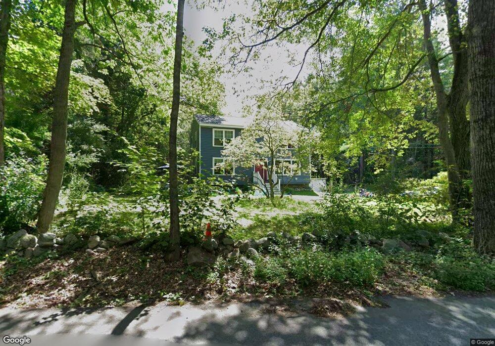
7 Rocky Pond Rd Brookline, NH 03033
Estimated Value: $496,000 - $611,590
3
Beds
2
Baths
2,250
Sq Ft
$248/Sq Ft
Est. Value
About This Home
This home is located at 7 Rocky Pond Rd, Brookline, NH 03033 and is currently estimated at $557,898, approximately $247 per square foot. 7 Rocky Pond Rd is a home located in Hillsborough County with nearby schools including Richard Maghakian Memorial School, Captain Samuel Douglass Academy, and Hollis-Brookline Middle School.
Ownership History
Date
Name
Owned For
Owner Type
Purchase Details
Closed on
Jun 30, 2010
Sold by
Russell Ret Theodore S and Russell Theodore S
Bought by
Dejesus Jill A
Current Estimated Value
Home Financials for this Owner
Home Financials are based on the most recent Mortgage that was taken out on this home.
Original Mortgage
$197,240
Outstanding Balance
$132,113
Interest Rate
4.88%
Mortgage Type
Purchase Money Mortgage
Estimated Equity
$425,785
Create a Home Valuation Report for This Property
The Home Valuation Report is an in-depth analysis detailing your home's value as well as a comparison with similar homes in the area
Home Values in the Area
Average Home Value in this Area
Purchase History
| Date | Buyer | Sale Price | Title Company |
|---|---|---|---|
| Dejesus Jill A | $199,900 | -- |
Source: Public Records
Mortgage History
| Date | Status | Borrower | Loan Amount |
|---|---|---|---|
| Open | Dejesus Jill A | $40,181 | |
| Closed | Dejesus Jill A | $58,185 | |
| Open | Dejesus Jill A | $197,240 |
Source: Public Records
Tax History Compared to Growth
Tax History
| Year | Tax Paid | Tax Assessment Tax Assessment Total Assessment is a certain percentage of the fair market value that is determined by local assessors to be the total taxable value of land and additions on the property. | Land | Improvement |
|---|---|---|---|---|
| 2024 | $11,190 | $494,900 | $188,100 | $306,800 |
| 2023 | $10,284 | $494,900 | $188,100 | $306,800 |
| 2022 | $4,351 | $146,400 | $116,600 | $29,800 |
| 2021 | $8,691 | $304,100 | $116,600 | $187,500 |
| 2020 | $8,454 | $304,100 | $116,600 | $187,500 |
| 2019 | $9,083 | $304,100 | $116,600 | $187,500 |
| 2018 | $8,989 | $304,100 | $116,600 | $187,500 |
| 2017 | $8,228 | $249,800 | $94,600 | $155,200 |
| 2016 | $8,133 | $249,800 | $94,600 | $155,200 |
| 2015 | $7,756 | $249,800 | $94,600 | $155,200 |
| 2014 | $8,206 | $249,800 | $94,600 | $155,200 |
| 2013 | $7,901 | $249,800 | $94,600 | $155,200 |
Source: Public Records
Map
Nearby Homes
- 22 Hobart Hill Rd
- 25 Rocky Pond Rd
- 12 Old Milford Rd
- 5 Carons Way
- 18 Sawtelle Rd
- 4 Bohanon Bridge Rd
- 42 Pepperell Rd
- 6 Flint Meadow Dr
- 47 Pepperell Rd
- 46 Oak Hill Rd
- 23 Austin Ln
- 22 Austin Ln
- 9 Marjorie Dr
- 91 Deacon Ln
- 55 Oak Hill Rd
- 59 Cleveland Hill Rd
- 7 Winterberry Rd
- 9 Winterberry Rd
- 84 Irene Dr
- 8 Colburn Rd
- lot 10 Hobart Hill Rd
- 3 Hobart Hill Rd
- 4 Hobart Hill Rd
- 37 Old Milford Rd
- 10 Rocky Pond Rd
- 35 Old Milford Rd
- 12 Rocky Pond Rd
- 5 Louis Dr
- 8 Hobart Hill Rd
- 15 Rocky Pond Rd
- 7 Louis Dr
- 5 Hobart Hill Rd
- 5 Hobart Hill Rd Unit 32-45-8
- 36 Old Milford Rd
- 3 Louis Dr
- 9 Louis Dr
- 48 Old Milford Rd
- 6 Louis Dr
- 45 Old Milford Rd
- 34 Hobart Hill Rd