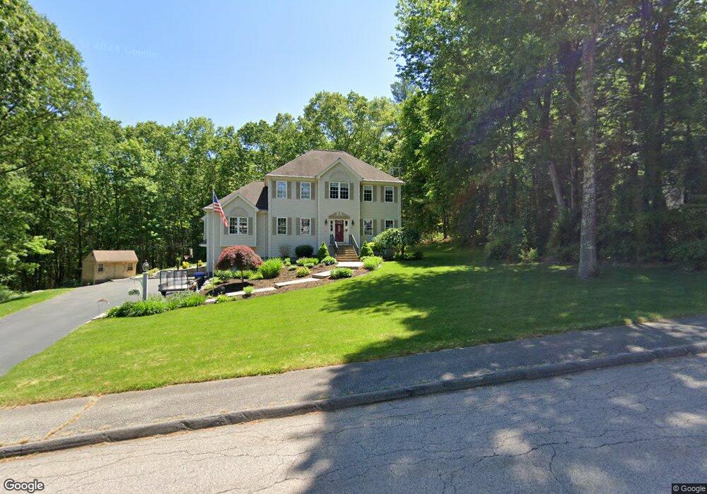
70 Elmshade Dr Uxbridge, MA 01569
Estimated Value: $770,789 - $1,003,000
4
Beds
3
Baths
2,548
Sq Ft
$335/Sq Ft
Est. Value
About This Home
This home is located at 70 Elmshade Dr, Uxbridge, MA 01569 and is currently estimated at $854,697, approximately $335 per square foot. 70 Elmshade Dr is a home located in Worcester County with nearby schools including Uxbridge High School and Our Lady of the Valley Regional School.
Ownership History
Date
Name
Owned For
Owner Type
Purchase Details
Closed on
Feb 22, 2011
Sold by
Gall John and Gall Rebecca
Bought by
Ferrage Joseph C and Ferrage Shelley L
Current Estimated Value
Home Financials for this Owner
Home Financials are based on the most recent Mortgage that was taken out on this home.
Original Mortgage
$340,200
Outstanding Balance
$232,680
Interest Rate
4.77%
Mortgage Type
Purchase Money Mortgage
Estimated Equity
$622,017
Purchase Details
Closed on
Oct 26, 2007
Sold by
Kowalski David H and Kowalski Mariane
Bought by
Gall John and Gall Rebecca
Home Financials for this Owner
Home Financials are based on the most recent Mortgage that was taken out on this home.
Original Mortgage
$315,146
Interest Rate
6.39%
Mortgage Type
Purchase Money Mortgage
Purchase Details
Closed on
Jun 30, 2000
Sold by
New American Homes Llc
Bought by
Kowalski David H and Kowalski Marianne
Create a Home Valuation Report for This Property
The Home Valuation Report is an in-depth analysis detailing your home's value as well as a comparison with similar homes in the area
Home Values in the Area
Average Home Value in this Area
Purchase History
| Date | Buyer | Sale Price | Title Company |
|---|---|---|---|
| Ferrage Joseph C | $378,000 | -- | |
| Gall John | $424,000 | -- | |
| Kowalski David H | $292,500 | -- |
Source: Public Records
Mortgage History
| Date | Status | Borrower | Loan Amount |
|---|---|---|---|
| Open | Ferrage Joseph C | $340,200 | |
| Previous Owner | Gall John | $315,146 | |
| Previous Owner | Kowalski David H | $265,200 | |
| Previous Owner | Kowalski David H | $263,700 | |
| Previous Owner | Kowalski David H | $281,000 |
Source: Public Records
Tax History Compared to Growth
Tax History
| Year | Tax Paid | Tax Assessment Tax Assessment Total Assessment is a certain percentage of the fair market value that is determined by local assessors to be the total taxable value of land and additions on the property. | Land | Improvement |
|---|---|---|---|---|
| 2025 | $84 | $642,900 | $154,500 | $488,400 |
| 2024 | $7,987 | $618,200 | $146,700 | $471,500 |
| 2023 | $7,592 | $544,200 | $126,800 | $417,400 |
| 2022 | $6,834 | $450,800 | $111,100 | $339,700 |
| 2021 | $7,132 | $450,800 | $111,100 | $339,700 |
| 2020 | $7,471 | $446,300 | $118,900 | $327,400 |
| 2019 | $7,584 | $437,100 | $130,700 | $306,400 |
| 2018 | $7,354 | $428,300 | $130,700 | $297,600 |
| 2017 | $7,042 | $415,200 | $125,400 | $289,800 |
| 2016 | $6,380 | $363,100 | $96,200 | $266,900 |
| 2015 | $6,224 | $357,700 | $96,200 | $261,500 |
Source: Public Records
Map
Nearby Homes
- The Contemporary Villager Plan at Patriot's Landing
- Karenrose Sunnery Plan at Patriot's Landing
- 24 Road Ahr
- 328 Millville Rd
- 129 Quaker Hwy Unit 6
- 346 Millville Rd
- 288 High St
- 128 Mantell Rd
- 100 Spring Hill Dr Unit 100
- 37 Elizabeth St
- 286 Blackstone St
- 395 High St
- Layla Plan at Pine Ridge
- Ashley Plan at Pine Ridge
- Lily Plan at Pine Ridge
- Brooklyn Plan at Pine Ridge
- Tucker Plan at Pine Ridge
- Everleigh Plan at Pine Ridge
- 23 Rifleman Way
- 24 Olde Canal Way Unit 24
- 80 Elmshade Dr
- 71 Elmshade Dr
- 61 Elmshade Dr
- 81 Elmshade Dr
- 60 Elmshade Dr
- 90 Elmshade Dr
- 50 Elmshade Dr
- 51 Elmshade Dr
- 100 Elmshade Dr
- 53 Spinning Wheel Dr
- 40 Elmshade Dr
- 96 Country Squire Rd
- 94 Country Squire Rd
- 90 Country Squire Rd
- 88 Country Squire Rd
- 14 Ascot Ln
- 16 Ascot Ln
- 11 Crowns Way
- 14 Ascot Ln Unit D-4
- 9 Crowns Way