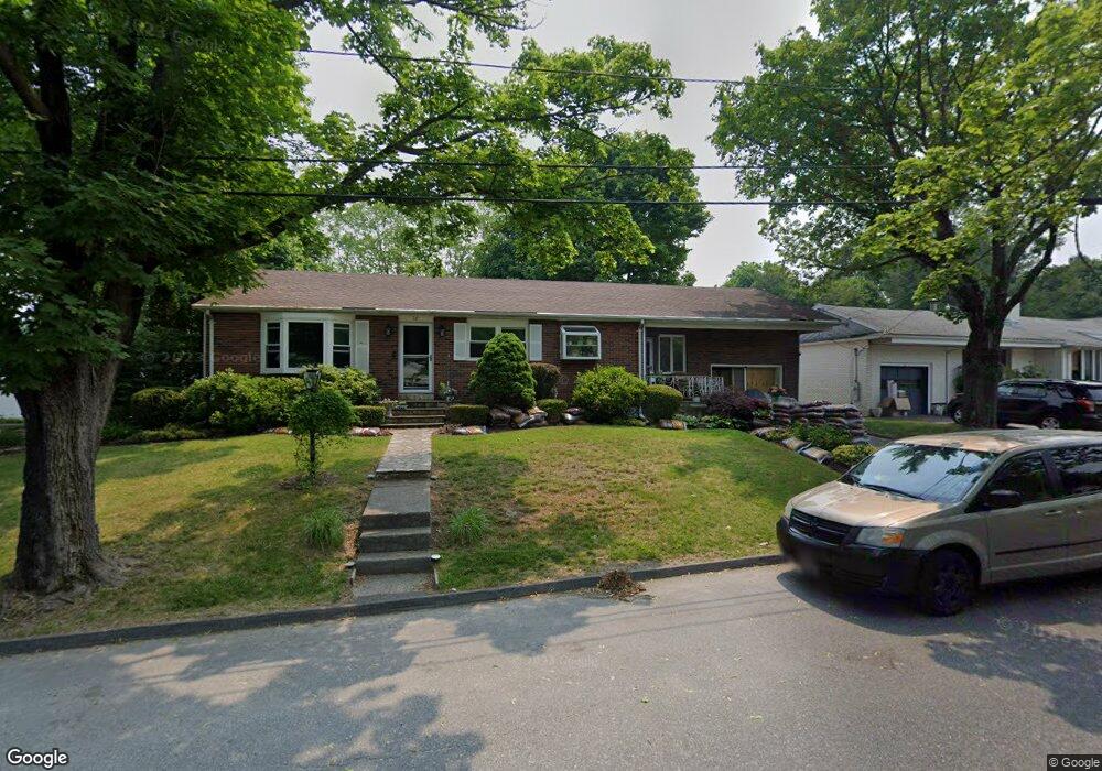
70 Ernest Ave Worcester, MA 01604
Grafton Hill NeighborhoodEstimated Value: $431,000 - $483,000
3
Beds
1
Bath
1,515
Sq Ft
$297/Sq Ft
Est. Value
About This Home
This home is located at 70 Ernest Ave, Worcester, MA 01604 and is currently estimated at $449,681, approximately $296 per square foot. 70 Ernest Ave is a home located in Worcester County with nearby schools including Jacob Hiatt Magnet School, Chandler Magnet, and Lake View Elementary School.
Ownership History
Date
Name
Owned For
Owner Type
Purchase Details
Closed on
Oct 20, 1998
Sold by
Abdella Alfred P and Abdella Phyllis L
Bought by
Candela Steven A and Candela Nancy J
Current Estimated Value
Create a Home Valuation Report for This Property
The Home Valuation Report is an in-depth analysis detailing your home's value as well as a comparison with similar homes in the area
Home Values in the Area
Average Home Value in this Area
Purchase History
| Date | Buyer | Sale Price | Title Company |
|---|---|---|---|
| Candela Steven A | $60,000 | -- |
Source: Public Records
Mortgage History
| Date | Status | Borrower | Loan Amount |
|---|---|---|---|
| Open | Candela Steven A | $30,000 | |
| Previous Owner | Candela Steven A | $30,000 | |
| Previous Owner | Candela Steven A | $20,000 |
Source: Public Records
Tax History Compared to Growth
Tax History
| Year | Tax Paid | Tax Assessment Tax Assessment Total Assessment is a certain percentage of the fair market value that is determined by local assessors to be the total taxable value of land and additions on the property. | Land | Improvement |
|---|---|---|---|---|
| 2025 | $5,076 | $384,800 | $119,000 | $265,800 |
| 2024 | $5,169 | $375,900 | $119,000 | $256,900 |
| 2023 | $5,012 | $349,500 | $103,400 | $246,100 |
| 2022 | $4,469 | $293,800 | $82,800 | $211,000 |
| 2021 | $4,461 | $274,000 | $66,200 | $207,800 |
| 2020 | $4,287 | $252,200 | $66,200 | $186,000 |
| 2019 | $4,048 | $224,900 | $59,700 | $165,200 |
| 2018 | $3,933 | $208,000 | $59,700 | $148,300 |
| 2017 | $3,998 | $208,000 | $59,700 | $148,300 |
| 2016 | $3,953 | $191,800 | $44,400 | $147,400 |
| 2015 | $3,849 | $191,800 | $44,400 | $147,400 |
| 2014 | $3,748 | $191,800 | $44,400 | $147,400 |
Source: Public Records
Map
Nearby Homes
- 24 Benham St Unit B
- 11 Phoenix St
- 22 Anderson Ave
- 15 Anderson Ave
- 21 Middlesex Ave Unit 102
- 340 Hamilton St
- 360 Hamilton St
- 4 Harold St
- 63 Progressive St
- 65 Progressive St
- 119 Orton Street Extension
- 70 Harrington Way
- 496 Hamilton St
- 55 Standish St
- 573 Grafton St
- 10 Lamar Ave
- 91 Standish St
- 11 Benson St
- 94 Massasoit Rd
- 121 Pilgrim Ave