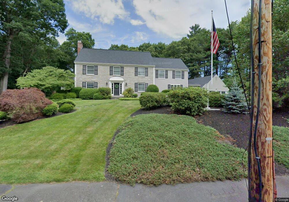
70 Greylock Rd Wellesley Hills, MA 02481
Estimated Value: $3,696,000 - $4,300,000
6
Beds
4
Baths
5,015
Sq Ft
$798/Sq Ft
Est. Value
About This Home
This home is located at 70 Greylock Rd, Wellesley Hills, MA 02481 and is currently estimated at $3,999,946, approximately $797 per square foot. 70 Greylock Rd is a home located in Norfolk County with nearby schools including Katharine Lee Bates Elementary School, Wellesley Middle School, and Wellesley Sr High School.
Ownership History
Date
Name
Owned For
Owner Type
Purchase Details
Closed on
Oct 15, 2010
Sold by
Currie Graeme M
Bought by
Salerno Robert M
Current Estimated Value
Home Financials for this Owner
Home Financials are based on the most recent Mortgage that was taken out on this home.
Original Mortgage
$1,698,700
Outstanding Balance
$1,121,532
Interest Rate
4.36%
Mortgage Type
Purchase Money Mortgage
Estimated Equity
$2,878,414
Purchase Details
Closed on
May 15, 2009
Sold by
Elfers William and Elfers Ann R
Bought by
Currie Graeme M
Home Financials for this Owner
Home Financials are based on the most recent Mortgage that was taken out on this home.
Original Mortgage
$900,000
Interest Rate
4.85%
Mortgage Type
Purchase Money Mortgage
Create a Home Valuation Report for This Property
The Home Valuation Report is an in-depth analysis detailing your home's value as well as a comparison with similar homes in the area
Home Values in the Area
Average Home Value in this Area
Purchase History
| Date | Buyer | Sale Price | Title Company |
|---|---|---|---|
| Salerno Robert M | $2,265,000 | -- | |
| Currie Graeme M | $1,750,000 | -- |
Source: Public Records
Mortgage History
| Date | Status | Borrower | Loan Amount |
|---|---|---|---|
| Open | Salerno Robert M | $1,698,700 | |
| Previous Owner | Currie Graeme M | $900,000 |
Source: Public Records
Tax History Compared to Growth
Tax History
| Year | Tax Paid | Tax Assessment Tax Assessment Total Assessment is a certain percentage of the fair market value that is determined by local assessors to be the total taxable value of land and additions on the property. | Land | Improvement |
|---|---|---|---|---|
| 2025 | $34,387 | $3,345,000 | $1,992,000 | $1,353,000 |
| 2024 | $31,761 | $3,051,000 | $1,732,000 | $1,319,000 |
| 2023 | $31,316 | $2,735,000 | $1,535,000 | $1,200,000 |
| 2022 | $29,317 | $2,510,000 | $1,375,000 | $1,135,000 |
| 2021 | $28,823 | $2,453,000 | $1,318,000 | $1,135,000 |
| 2020 | $28,357 | $2,453,000 | $1,318,000 | $1,135,000 |
| 2019 | $28,381 | $2,453,000 | $1,318,000 | $1,135,000 |
| 2018 | $25,908 | $2,168,000 | $952,000 | $1,216,000 |
| 2017 | $25,537 | $2,166,000 | $950,000 | $1,216,000 |
| 2016 | $25,742 | $2,176,000 | $934,000 | $1,242,000 |
| 2015 | $25,201 | $2,180,000 | $936,000 | $1,244,000 |
Source: Public Records
Map
Nearby Homes
- 62 Greylock Rd
- 8 Scotch Pine Rd
- 65 Greylock Rd
- 16 Scotch Pine Rd
- 81 Greylock Rd
- 57 Greylock Rd
- 21 Greylock Rd
- 58 Greylock Rd
- 15 Greylock Rd
- 29 Greylock Rd
- 30 Scotch Pine Rd Unit Hse Only
- 30 Scotch Pine Rd Unit Hse+Lot
- 30 Scotch Pine Rd
- 54 Greylock Rd
- 43 Greylock Rd
- 75 Cliff Rd
- 50 Greylock Rd
- 46 Scotch Pine Rd
- 22 Greylock Rd
- 104 Westcliff Rd