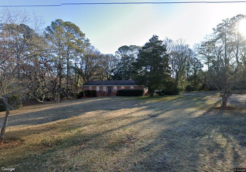
70 White St Watkinsville, GA 30677
Estimated Value: $482,000 - $513,920
4
Beds
2
Baths
2,000
Sq Ft
$249/Sq Ft
Est. Value
About This Home
This home is located at 70 White St, Watkinsville, GA 30677 and is currently estimated at $497,730, approximately $248 per square foot. 70 White St is a home located in Oconee County with nearby schools including Oconee County Elementary School, Oconee County Primary School, and Oconee County Middle School.
Ownership History
Date
Name
Owned For
Owner Type
Purchase Details
Closed on
Aug 26, 2009
Sold by
Ivy Holly
Bought by
Holly Homes
Current Estimated Value
Purchase Details
Closed on
Jan 29, 2007
Sold by
Not Provided
Bought by
Holly Homes
Purchase Details
Closed on
Nov 14, 2006
Sold by
Not Provided
Bought by
Holly Homes
Purchase Details
Closed on
Jun 30, 2003
Sold by
Camp Paul G and Camp Aka Paul George Camp
Bought by
Ivy John and Ivy Holly
Create a Home Valuation Report for This Property
The Home Valuation Report is an in-depth analysis detailing your home's value as well as a comparison with similar homes in the area
Home Values in the Area
Average Home Value in this Area
Purchase History
| Date | Buyer | Sale Price | Title Company |
|---|---|---|---|
| Holly Homes | -- | -- | |
| Holly Homes | -- | -- | |
| Holly Homes | -- | -- | |
| Holly Homes | -- | -- | |
| Ivy John | $125,000 | -- |
Source: Public Records
Tax History Compared to Growth
Tax History
| Year | Tax Paid | Tax Assessment Tax Assessment Total Assessment is a certain percentage of the fair market value that is determined by local assessors to be the total taxable value of land and additions on the property. | Land | Improvement |
|---|---|---|---|---|
| 2024 | $3,705 | $162,707 | $69,624 | $93,083 |
| 2023 | $3,642 | $143,458 | $58,020 | $85,438 |
| 2022 | $3,065 | $125,700 | $52,746 | $72,954 |
| 2021 | $2,683 | $102,511 | $41,532 | $60,979 |
| 2020 | $2,387 | $90,124 | $34,043 | $56,081 |
| 2019 | $2,356 | $88,462 | $34,043 | $54,419 |
| 2018 | $2,268 | $83,521 | $34,043 | $49,478 |
| 2017 | $2,127 | $77,833 | $32,422 | $45,411 |
| 2016 | $2,018 | $73,522 | $29,829 | $43,693 |
| 2015 | $2,013 | $73,058 | $29,829 | $43,228 |
| 2014 | $1,818 | $64,507 | $23,366 | $41,141 |
| 2013 | -- | $60,418 | $22,137 | $38,280 |
Source: Public Records
Map
Nearby Homes
- 170 Elliot Cir
- 86 Cedar Dr
- 88 Cedar Dr
- 2051 Simonton Bridge Rd
- 1010 Jeremy Dr
- 1320 Katie Ln
- 1051 Simonton Way
- 1001 Moreland Dr
- 96 Morrison St Unit 53
- 92 Morrison St Unit 54
- 90 Morrison St Unit 55
- 96 Morrison St
- 90 Morrison St
- 1240 Summit Dr
- 1040 Thomas Ave
- 70, 72 Colham Ferry Extension
- 2885 Electric Ave
- 3030 Electric Ave
- 2625 Electric Ave
- 2845 Electric Ave
- 0 White St Unit CM954393
- 0 White St Unit 8151696
- 0 White St
- 0 White St Unit 957788
- 0 White St Unit 3122959
- 0 White St Unit 7045164
- 0 White St Unit 7602534
- 0 White St Unit 8474624
- 60 White St
- 160 Elliot Cir
- 59 Thrasher Dr
- 63 Thrasher Dr
- 64 White St
- 190 Elliot Cir Unit 32
- 190 Elliot Cir
- 200 Elliot Cir Unit 33
- 200 Elliot Cir
- 55 Thrasher Dr
- 76 White St
- 17 Bunny Hop Trail