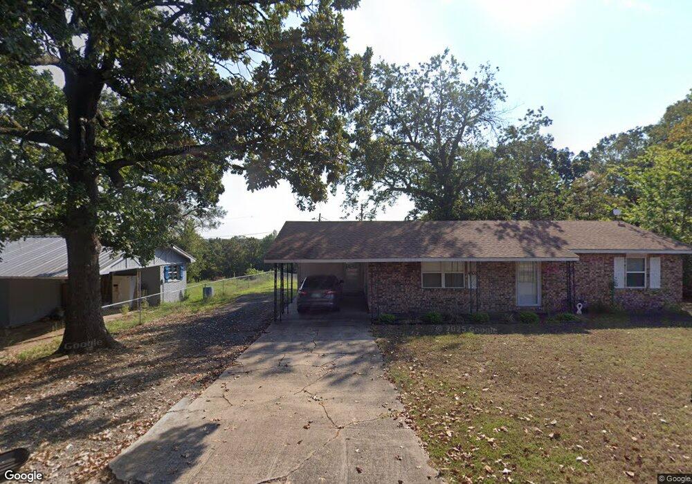
700 Carter St Poteau, OK 74953
Estimated Value: $85,000 - $95,000
3
Beds
1
Bath
1,104
Sq Ft
$81/Sq Ft
Est. Value
About This Home
This home is located at 700 Carter St, Poteau, OK 74953 and is currently estimated at $89,329, approximately $80 per square foot. 700 Carter St is a home located in Le Flore County with nearby schools including Poteau Primary Elementary School, Poteau Upper Elementary School, and Pansy Kidd Middle School.
Ownership History
Date
Name
Owned For
Owner Type
Purchase Details
Closed on
Dec 19, 2019
Sold by
French Caron Dkn and Anderson Kiane Dian French
Bought by
Anderson Kiane Dian French and French Kevin
Current Estimated Value
Purchase Details
Closed on
Aug 31, 2006
Sold by
French Bobby D
Bought by
Lindsey Donna
Purchase Details
Closed on
May 25, 2006
Sold by
Webster R Jason and Webster Jana
Bought by
French Bobby D
Home Financials for this Owner
Home Financials are based on the most recent Mortgage that was taken out on this home.
Original Mortgage
$30,000
Interest Rate
6.5%
Mortgage Type
New Conventional
Create a Home Valuation Report for This Property
The Home Valuation Report is an in-depth analysis detailing your home's value as well as a comparison with similar homes in the area
Home Values in the Area
Average Home Value in this Area
Purchase History
| Date | Buyer | Sale Price | Title Company |
|---|---|---|---|
| Anderson Kiane Dian French | -- | None Available | |
| Lindsey Donna | -- | -- | |
| French Bobby D | $40,000 | -- |
Source: Public Records
Mortgage History
| Date | Status | Borrower | Loan Amount |
|---|---|---|---|
| Previous Owner | French Bobby D | $30,000 |
Source: Public Records
Tax History Compared to Growth
Tax History
| Year | Tax Paid | Tax Assessment Tax Assessment Total Assessment is a certain percentage of the fair market value that is determined by local assessors to be the total taxable value of land and additions on the property. | Land | Improvement |
|---|---|---|---|---|
| 2025 | $340 | $4,944 | $506 | $4,438 |
| 2023 | $340 | $4,660 | $506 | $4,154 |
| 2022 | $315 | $4,524 | $506 | $4,018 |
| 2021 | $303 | $4,392 | $506 | $3,886 |
| 2020 | $312 | $4,485 | $506 | $3,979 |
| 2019 | $341 | $4,792 | $506 | $4,286 |
| 2018 | $329 | $4,853 | $506 | $4,347 |
| 2017 | $318 | $4,712 | $506 | $4,206 |
| 2016 | $304 | $4,575 | $506 | $4,069 |
| 2015 | $298 | $4,441 | $506 | $3,935 |
| 2014 | $308 | $4,532 | $506 | $4,026 |
Source: Public Records
Map
Nearby Homes
- 207 Thompson Ave
- 301 Wilson Ave
- 301 Turman St
- 104 Clark Ave
- 701 N Witte St
- 516 Beeler St
- 606 Torby Ave
- TBD Tract #1 Coggins Ave
- TBD Tract #2 Coggins Ave
- 000 Coggins Ave
- 2601 N Witte St
- 308 Peters St
- 104 Craigway St
- 204 Bowlin Dr
- 205 Bowlin Dr
- 206 Green Ave
- 315 College Ave
- 307 Mission Dr
- TBD Mission Dr
- TBD Tbd Rural Near Oklahoma Peak