Estimated Value: $461,279 - $535,000
--
Bed
3
Baths
1,926
Sq Ft
$261/Sq Ft
Est. Value
About This Home
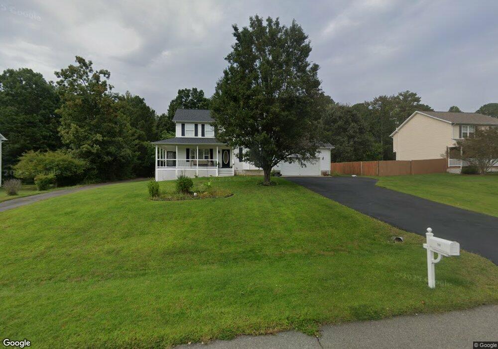
This home is located at 700 Miriam Ln, Lusby, MD 20657 and is currently estimated at $502,320, approximately $260 per square foot. 700 Miriam Ln is a home located in Calvert County with nearby schools including Dowell Elementary School, Mill Creek Middle School, and Patuxent High School.
Ownership History
Date
Name
Owned For
Owner Type
Purchase Details
Closed on
Apr 23, 2007
Sold by
Vega Asenati O
Bought by
Easley Dale R and Easley Asenati O
Current Estimated Value
Home Financials for this Owner
Home Financials are based on the most recent Mortgage that was taken out on this home.
Original Mortgage
$275,000
Outstanding Balance
$169,450
Interest Rate
6.5%
Mortgage Type
Stand Alone Second
Estimated Equity
$332,870
Purchase Details
Closed on
Feb 19, 2007
Sold by
Vega Asenati O
Bought by
Easley Dale R and Easley Asenati O
Home Financials for this Owner
Home Financials are based on the most recent Mortgage that was taken out on this home.
Original Mortgage
$275,000
Interest Rate
6.5%
Mortgage Type
Stand Alone Second
Purchase Details
Closed on
Jun 25, 1998
Sold by
Al Banna Emad R Ira
Bought by
Vega Asenati O
Create a Home Valuation Report for This Property
The Home Valuation Report is an in-depth analysis detailing your home's value as well as a comparison with similar homes in the area
Home Values in the Area
Average Home Value in this Area
Purchase History
| Date | Buyer | Sale Price | Title Company |
|---|---|---|---|
| Easley Dale R | -- | -- | |
| Easley Dale R | -- | -- | |
| Vega Asenati O | $170,750 | -- |
Source: Public Records
Mortgage History
| Date | Status | Borrower | Loan Amount |
|---|---|---|---|
| Open | Easley Dale R | $275,000 | |
| Previous Owner | Easley Dale R | $275,000 | |
| Closed | Vega Asenati O | -- |
Source: Public Records
Tax History Compared to Growth
Tax History
| Year | Tax Paid | Tax Assessment Tax Assessment Total Assessment is a certain percentage of the fair market value that is determined by local assessors to be the total taxable value of land and additions on the property. | Land | Improvement |
|---|---|---|---|---|
| 2025 | $4,051 | $378,833 | $0 | $0 |
| 2024 | $4,051 | $355,367 | $0 | $0 |
| 2023 | $3,662 | $331,900 | $119,900 | $212,000 |
| 2022 | $3,576 | $323,833 | $0 | $0 |
| 2021 | $3,417 | $315,767 | $0 | $0 |
| 2020 | $3,417 | $307,700 | $119,900 | $187,800 |
| 2019 | $3,402 | $305,067 | $0 | $0 |
| 2018 | $3,362 | $302,433 | $0 | $0 |
| 2017 | $3,376 | $299,800 | $0 | $0 |
| 2016 | -- | $293,733 | $0 | $0 |
| 2015 | $3,521 | $287,667 | $0 | $0 |
| 2014 | $3,521 | $281,600 | $0 | $0 |
Source: Public Records
Map
Nearby Homes
- 12609 Olivet Rd
- 383 Red Cloud Rd
- 232 Thunderbird Dr
- 228 Thunderbird Dr
- 11615 Big Bear Ln
- 389 Thunderbird Dr
- 291 Red Cloud Rd
- 285 Red Cloud Rd
- 965 Bruno Ln
- 11722 Big Bear Ln
- 880 Johnswoods Rd
- 11522 Buckskin Ct
- 12361 Silver Rock Cir
- 30 American Ln
- 11850 Hg Trueman Rd
- 542 Chisholm Trail
- 513 Bridle Ct
- 11616 Deadwood Dr
- 548 Antelope Trail
- 11609 Deadwood Dr
- 710 Miriam Ln
- 680 Miriam Ln
- 715 Miriam Ln
- 720 Miriam Ln
- 12311 Rashad Cir
- 660 Miriam Ln
- 690 Miriam Ln
- 730 Miriam Ln
- 12310 Rashad Cir
- 630 Miriam Ln
- 655 Miriam Ln
- 725 Miriam Ln
- 12255 Rousby Hall Rd
- 12205 Rousby Hall Rd
- 665 Miriam Ln
- 750 Miriam Ln
- 12322 Rashad Cir
- 731 Miriam Ln
- 610 Miriam Ln
- 12245 Rousby Hall Rd