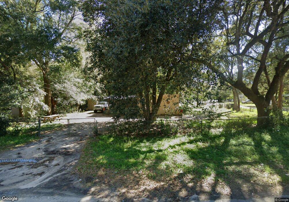
700 New York Dr Pensacola, FL 32505
Estimated Value: $89,000 - $119,000
--
Bed
1
Bath
1,224
Sq Ft
$85/Sq Ft
Est. Value
About This Home
This home is located at 700 New York Dr, Pensacola, FL 32505 and is currently estimated at $103,536, approximately $84 per square foot. 700 New York Dr is a home located in Escambia County with nearby schools including Oakcrest Elementary School, Warrington Middle School, and Escambia High School.
Ownership History
Date
Name
Owned For
Owner Type
Purchase Details
Closed on
Jun 28, 2022
Sold by
Cornell Avenue Llc
Bought by
In All Things Give Thanks Llc
Current Estimated Value
Purchase Details
Closed on
Jun 30, 2017
Sold by
Wood Roger L and Wood Karen E
Bought by
Cornell Ave Llc
Purchase Details
Closed on
Sep 2, 2014
Sold by
Chavers Bob W
Bought by
Wood Roger L and Wood Karen E
Purchase Details
Closed on
Mar 27, 2001
Sold by
Hale John H
Bought by
Griffith Anita M
Create a Home Valuation Report for This Property
The Home Valuation Report is an in-depth analysis detailing your home's value as well as a comparison with similar homes in the area
Home Values in the Area
Average Home Value in this Area
Purchase History
| Date | Buyer | Sale Price | Title Company |
|---|---|---|---|
| In All Things Give Thanks Llc | -- | Penton Law Center | |
| Cornell Ave Llc | $25,000 | West Florida Title Co | |
| Wood Roger L | $20,000 | West Florida Title Company O | |
| Griffith Anita M | $20,000 | -- |
Source: Public Records
Mortgage History
| Date | Status | Borrower | Loan Amount |
|---|---|---|---|
| Closed | Cornell Ave Llc | $0 |
Source: Public Records
Tax History Compared to Growth
Tax History
| Year | Tax Paid | Tax Assessment Tax Assessment Total Assessment is a certain percentage of the fair market value that is determined by local assessors to be the total taxable value of land and additions on the property. | Land | Improvement |
|---|---|---|---|---|
| 2024 | $1,248 | $85,728 | $20,000 | $65,728 |
| 2023 | $1,248 | $82,239 | $20,000 | $62,239 |
| 2022 | $661 | $49,303 | $8,000 | $41,303 |
| 2021 | $596 | $37,511 | $0 | $0 |
| 2020 | $516 | $25,698 | $0 | $0 |
| 2019 | $528 | $27,444 | $0 | $0 |
| 2018 | $487 | $22,923 | $0 | $0 |
| 2017 | $397 | $16,047 | $0 | $0 |
| 2016 | $468 | $20,842 | $0 | $0 |
| 2015 | $491 | $23,868 | $0 | $0 |
| 2014 | $512 | $25,912 | $0 | $0 |
Source: Public Records
Map
Nearby Homes
- 213 Emerald Ave
- 901 S Madison Dr
- 200 Georgia Dr
- 837 S Madison Dr
- 835 S Madison Dr
- 1014 Kearny Dr
- 102 Tennessee Dr
- 1020 E Madison Dr
- 6 Georgia Dr
- 823 S Madison Dr
- 245 Aquamarine Ave
- 2208 Oakwood Ave
- 814 S Madison Dr
- 1005 Revere Dr
- 112 Saint Regis Dr
- 1414 Clio Dr
- 305 N Madison Dr
- 4639 Wabash Ave
- 3905 W Avery St
- 3917 W Mallory St
- 308 Louisiana Dr
- 702 New York Dr
- 704 New York Dr
- 306 Louisiana Dr
- 703 New York Dr
- 610 New York Dr
- 701 New York Dr
- 705 New York Dr
- 706 New York Dr
- 615 New York Dr
- 307 Louisiana Dr
- 11 Nevada Cir
- 707 New York Dr
- 13 Nevada Cir
- 305 Louisiana Dr
- 613 New York Dr
- 9 Nevada Cir
- 708 New York Dr
- 608 New York Dr
- 709 New York Dr