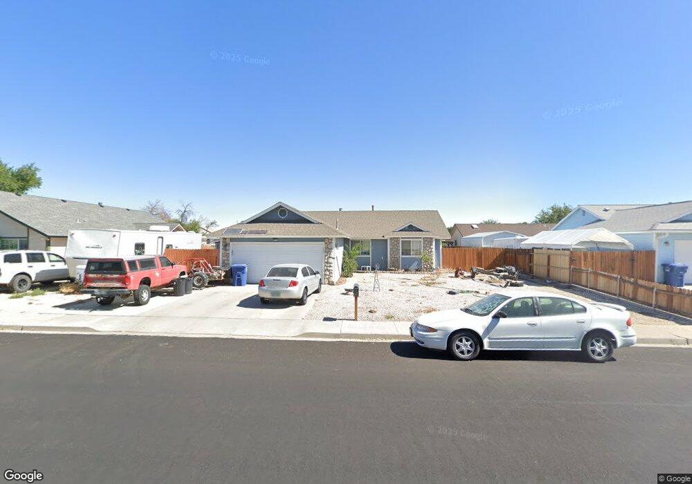
700 W D St Fallon, NV 89406
Estimated Value: $325,000 - $336,000
3
Beds
2
Baths
1,366
Sq Ft
$243/Sq Ft
Est. Value
About This Home
This home is located at 700 W D St, Fallon, NV 89406 and is currently estimated at $331,362, approximately $242 per square foot. 700 W D St is a home located in Churchill County with nearby schools including Lahontan Elementary School, E.C. Best Elementary School, and Numa Elementary School.
Ownership History
Date
Name
Owned For
Owner Type
Purchase Details
Closed on
Aug 8, 2012
Sold by
Henning Howard E and Henning Patricia D
Bought by
Smith Robert and Smith Loree
Current Estimated Value
Home Financials for this Owner
Home Financials are based on the most recent Mortgage that was taken out on this home.
Original Mortgage
$79,700
Outstanding Balance
$63,136
Interest Rate
3.56%
Mortgage Type
USDA
Estimated Equity
$268,226
Purchase Details
Closed on
Apr 19, 2006
Sold by
Henning Clint D
Bought by
Henning Howard E and Henning Patricia D
Purchase Details
Closed on
Jan 3, 2005
Sold by
Henning Kurt D and Henning Deborah K
Bought by
Henning Clint D
Purchase Details
Closed on
Dec 31, 2004
Sold by
Henning Kurt D and Kenning Deborah K
Bought by
Henning Clint D
Create a Home Valuation Report for This Property
The Home Valuation Report is an in-depth analysis detailing your home's value as well as a comparison with similar homes in the area
Home Values in the Area
Average Home Value in this Area
Purchase History
| Date | Buyer | Sale Price | Title Company |
|---|---|---|---|
| Smith Robert | $79,700 | Western Nevada Title Company | |
| Henning Howard E | $200,000 | Western Nevada Title Company | |
| Henning Clint D | -- | None Available | |
| Henning Clint D | -- | None Available |
Source: Public Records
Mortgage History
| Date | Status | Borrower | Loan Amount |
|---|---|---|---|
| Open | Smith Robert | $79,700 |
Source: Public Records
Tax History Compared to Growth
Tax History
| Year | Tax Paid | Tax Assessment Tax Assessment Total Assessment is a certain percentage of the fair market value that is determined by local assessors to be the total taxable value of land and additions on the property. | Land | Improvement |
|---|---|---|---|---|
| 2025 | $1,621 | $58,400 | $21,700 | $36,700 |
| 2024 | $1,621 | $57,344 | $19,950 | $37,394 |
| 2023 | $1,621 | $55,427 | $19,950 | $35,477 |
| 2022 | $1,455 | $42,934 | $11,900 | $31,034 |
| 2021 | $1,412 | $42,269 | $11,900 | $30,369 |
| 2020 | $1,368 | $42,306 | $11,900 | $30,406 |
| 2019 | $1,321 | $41,819 | $11,900 | $29,919 |
| 2018 | $1,283 | $41,289 | $11,900 | $29,389 |
| 2017 | $1,245 | $40,138 | $10,500 | $29,638 |
| 2016 | $1,213 | $34,758 | $7,000 | $27,758 |
| 2015 | $1,189 | $31,806 | $7,000 | $24,806 |
| 2014 | $1,161 | $30,655 | $7,875 | $22,780 |
Source: Public Records
Map
Nearby Homes
- 410 Heron Ln
- 641 Megan Way
- 714 Noel Ln
- 738 Noel Ln
- 775 Karry Way
- 365 Kathy St Unit 3
- 1004 Conifer Dr
- 751 Colorado Ln
- 654 Sycamore Dr
- 126 S Laverne St
- 250 S Taylor St
- 009-291-74 00929174
- 1755 Coleman Rd
- 505 Hunter Park Way
- 815 Great Basin Ln
- 12017 Power Line Rd
- 696 Sunrise Terrace
- 365 W Richards St
- 981 Mckay Ct
- 882 Great Basin Ln
- 720 W D St
- 640 W D St
- 421 Michael Dr
- 620 W D St
- 400 Venturacci Ln
- 414 Venturacci Ln
- 411 Michael Dr
- 441 Michael Dr
- 428 Venturacci Ln
- 600 W D St
- 401 Michael Dr
- 442 Venturacci Ln Unit 8
- 451 Michael Dr
- 440 Michael Dr
- 456 Venturacci Ln
- 430 Michael Dr
- 461 Michael Dr
- 478 Venturacci Ln
- 450 Michael Dr
- 400 Pintail Dr