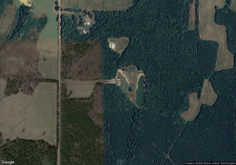
7000 Lester McFarland Rd Oxford, NC 27565
Estimated Value: $387,000 - $1,366,430
3
Beds
2
Baths
2,213
Sq Ft
$396/Sq Ft
Est. Value
About This Home
This home is located at 7000 Lester McFarland Rd, Oxford, NC 27565 and is currently estimated at $876,715, approximately $396 per square foot. 7000 Lester McFarland Rd is a home with nearby schools including West Oxford Elementary School, Northern Granville Middle School, and J.F. Webb High School.
Ownership History
Date
Name
Owned For
Owner Type
Purchase Details
Closed on
Jan 27, 2014
Sold by
Atlantic Funding Corp
Bought by
Marywood Farm Llc
Current Estimated Value
Purchase Details
Closed on
Jan 6, 2014
Sold by
Goldston J D and Goldston Louise F
Bought by
Atlantic Funding Corp
Purchase Details
Closed on
Sep 19, 2013
Sold by
Scoggins Mary Woods and Douglas Scoggins G
Bought by
Goldston J D
Create a Home Valuation Report for This Property
The Home Valuation Report is an in-depth analysis detailing your home's value as well as a comparison with similar homes in the area
Home Values in the Area
Average Home Value in this Area
Purchase History
| Date | Buyer | Sale Price | Title Company |
|---|---|---|---|
| Marywood Farm Llc | $405,000 | None Available | |
| Atlantic Funding Corp | $282,000 | None Available | |
| Goldston J D | $204,000 | None Available |
Source: Public Records
Tax History Compared to Growth
Tax History
| Year | Tax Paid | Tax Assessment Tax Assessment Total Assessment is a certain percentage of the fair market value that is determined by local assessors to be the total taxable value of land and additions on the property. | Land | Improvement |
|---|---|---|---|---|
| 2025 | $3,414 | $484,335 | $0 | $0 |
| 2024 | $3,414 | $396,211 | $0 | $0 |
| 2023 | $2,163 | $226,558 | $0 | $0 |
| 2022 | $2,142 | $226,558 | $0 | $0 |
| 2021 | $2,001 | $226,558 | $0 | $0 |
| 2020 | $2,001 | $226,558 | $0 | $0 |
| 2019 | $2,001 | $456,057 | $294,099 | $161,958 |
| 2018 | $2,001 | $456,057 | $294,099 | $161,958 |
| 2016 | $2,021 | $300,215 | $169,838 | $130,377 |
| 2015 | $1,907 | $300,215 | $169,838 | $130,377 |
| 2013 | -- | $172,572 | $172,072 | $500 |
Source: Public Records
Map
Nearby Homes
- 6688 Goshen Rd
- 6708 Old Roxboro Rd
- 0 Old Roxboro Rd Unit 10027603
- 1806 Polk Huff Rd
- 1 McCoy Jeffers Dr
- 0 Noel Tuck Rd
- 652 Hazel Lawson Rd
- 6079 Zachary Ln
- 1387 Saint Paul Church Rd
- 204 Deep Woods Trail
- 24 Acres Bob Daniel Rd
- 1002 Dennys Store Rd
- 0 Webb Chapel Rd Unit 10099652
- 1060 Saint Paul Church Rd
- 1665 Satterwhite Rd
- 670 Tingen Mine Rd
- 7701 Goshen Rd
- 316 Acorn Ct
- 00 Pulliam-Tingen Mine Rd
- 153 Ninovan Place
- 535 Baxter Huff Rd
- 7010 Lester McFarland Rd
- 6565 Lester McFarland Rd
- Lot 2 Lester McFarland Rd
- 003 Lester McFarland Rd
- 002 Lester McFarland Rd
- 001 Lester McFarland Rd
- 1 Lester McFarland Rd
- 6569 Lester McFarland Rd
- Lot 2 Lester McFarland Rd Unit 6573 Lester McFarlan
- 0 Lester McFarland Rd Unit 2445287
- 0 Lester McFarland Rd Unit 2422406
- Lot 2 Lester McFarland Rd Unit Dennys Store Road
- 000 Lester McFarland Rd
- Lot 3 Lester McFarland Rd
- 0 Baxter Huff Rd Unit 10030692
- 0 Baxter Huff Rd Unit 684366
- 0 Baxter Huff Rd Unit 877652
- 0 Baxter Huff Rd Unit na TR1904893
- 0 Baxter Huff Rd Unit 984524
