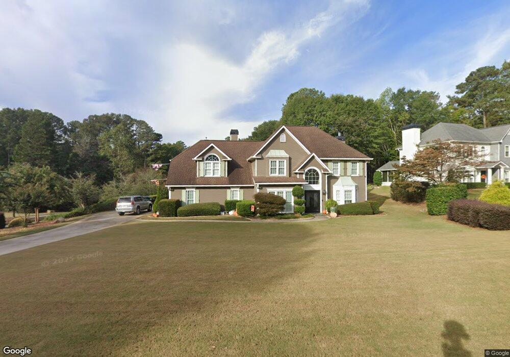
701 Cirrus Ct Peachtree City, GA 30269
Estimated Value: $588,481 - $725,000
--
Bed
1
Bath
2,914
Sq Ft
$229/Sq Ft
Est. Value
About This Home
This home is located at 701 Cirrus Ct, Peachtree City, GA 30269 and is currently estimated at $666,120, approximately $228 per square foot. 701 Cirrus Ct is a home located in Fayette County with nearby schools including Kedron Elementary School, Booth Middle School, and McIntosh High School.
Ownership History
Date
Name
Owned For
Owner Type
Purchase Details
Closed on
Mar 11, 2019
Sold by
Conover Scott
Bought by
Conover Pamela
Current Estimated Value
Purchase Details
Closed on
May 8, 2003
Sold by
Proenza Pamela
Bought by
Conover Scott and Conover Pamela
Home Financials for this Owner
Home Financials are based on the most recent Mortgage that was taken out on this home.
Original Mortgage
$110,000
Interest Rate
5.76%
Mortgage Type
New Conventional
Create a Home Valuation Report for This Property
The Home Valuation Report is an in-depth analysis detailing your home's value as well as a comparison with similar homes in the area
Home Values in the Area
Average Home Value in this Area
Purchase History
| Date | Buyer | Sale Price | Title Company |
|---|---|---|---|
| Conover Pamela | -- | -- | |
| Conover Scott | -- | -- |
Source: Public Records
Mortgage History
| Date | Status | Borrower | Loan Amount |
|---|---|---|---|
| Previous Owner | Conover Scott | $110,000 |
Source: Public Records
Tax History Compared to Growth
Tax History
| Year | Tax Paid | Tax Assessment Tax Assessment Total Assessment is a certain percentage of the fair market value that is determined by local assessors to be the total taxable value of land and additions on the property. | Land | Improvement |
|---|---|---|---|---|
| 2024 | $3,458 | $207,204 | $28,500 | $178,704 |
| 2023 | $2,947 | $198,780 | $28,500 | $170,280 |
| 2022 | $3,363 | $186,020 | $28,500 | $157,520 |
| 2021 | $3,290 | $172,180 | $28,500 | $143,680 |
| 2020 | $3,490 | $168,180 | $28,500 | $139,680 |
| 2019 | $3,360 | $160,380 | $28,500 | $131,880 |
| 2018 | $3,363 | $157,980 | $28,500 | $129,480 |
| 2017 | $3,278 | $152,500 | $28,500 | $124,000 |
| 2016 | $3,015 | $133,700 | $28,500 | $105,200 |
| 2015 | $2,857 | $124,700 | $28,500 | $96,200 |
| 2014 | $2,737 | $117,100 | $28,500 | $88,600 |
| 2013 | -- | $114,420 | $0 | $0 |
Source: Public Records
Map
Nearby Homes
- 718 Avalon Way
- 833 Southern Shore Dr
- 134 Mellington Ln
- 112 Bridgewater Dr
- 319 Corrigan Trace
- 544 Colebrook Way
- 308 Corrigan Trace
- 132 Sea Island Dr
- 200 Doe Run
- 311 Longer Dr
- 107 Rolling Green
- 512 Las Brasis Ct
- 404 Las Brasis Ct
- 203 Lenox Dr
- 206 Las Brasis Ct
- 522 Golf View Dr
- 522 Golfview Dr
- 103 Creek Bed Ct
- 115 Cottage Grove
- 103 Ardenlee Dr
- 703 Cirrus Ct
- 0 Cirrus Ct
- 441 Blue Smoke Trail
- 700 Cirrus Ct
- 702 Cirrus Ct
- 705 Cirrus Ct
- 438 Blue Smoke Trail
- 704 Cirrus Ct
- 706 Cirrus Ct
- 707 Cirrus Ct
- 409 Taberon Rd Unit 5
- 409 Taberon Rd
- 407 Taberon Rd Unit 4
- 407 Taberon Rd
- 437 Blue Smoke Trail
- 411 Taberon Rd Unit 6
- 411 Taberon Rd
- 436 Blue Smoke Trail
- 607 Bellenden Dr
- 604 Bellenden Dr