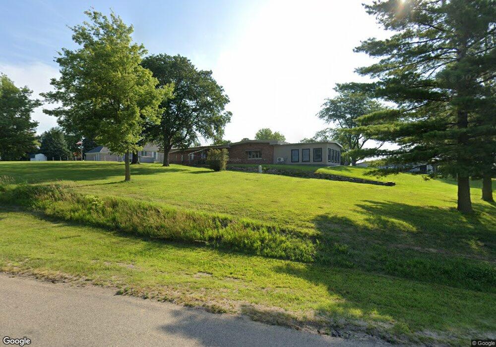
701 N 19th St Norfolk, NE 68701
Estimated Value: $372,000 - $549,000
3
Beds
5
Baths
3,275
Sq Ft
$142/Sq Ft
Est. Value
About This Home
This home is located at 701 N 19th St, Norfolk, NE 68701 and is currently estimated at $463,965, approximately $141 per square foot. 701 N 19th St is a home located in Madison County with nearby schools including Norfolk Senior High School, St. Paul's Lutheran School, and Norfolk Catholic School.
Ownership History
Date
Name
Owned For
Owner Type
Purchase Details
Closed on
Nov 1, 2019
Sold by
Dolesh Robin Sue
Bought by
Nixon Scott D and Nixon Janette K
Current Estimated Value
Home Financials for this Owner
Home Financials are based on the most recent Mortgage that was taken out on this home.
Original Mortgage
$192,000
Outstanding Balance
$169,078
Interest Rate
3.65%
Mortgage Type
New Conventional
Estimated Equity
$294,887
Purchase Details
Closed on
Oct 27, 2004
Sold by
Nixon Tr Jayne B
Bought by
Nixon Trs Burton E and Nixon Jayne B
Create a Home Valuation Report for This Property
The Home Valuation Report is an in-depth analysis detailing your home's value as well as a comparison with similar homes in the area
Home Values in the Area
Average Home Value in this Area
Purchase History
| Date | Buyer | Sale Price | Title Company |
|---|---|---|---|
| Nixon Scott D | $120,000 | None Available | |
| Nixon Trs Burton E | -- | -- |
Source: Public Records
Mortgage History
| Date | Status | Borrower | Loan Amount |
|---|---|---|---|
| Open | Nixon Scott D | $192,000 |
Source: Public Records
Tax History Compared to Growth
Tax History
| Year | Tax Paid | Tax Assessment Tax Assessment Total Assessment is a certain percentage of the fair market value that is determined by local assessors to be the total taxable value of land and additions on the property. | Land | Improvement |
|---|---|---|---|---|
| 2024 | $5,240 | $424,492 | $30,000 | $394,492 |
| 2023 | $7,435 | $402,162 | $30,000 | $372,162 |
| 2022 | $5,243 | $282,844 | $30,000 | $252,844 |
| 2021 | $4,847 | $261,967 | $30,000 | $231,967 |
| 2020 | $4,832 | $261,967 | $30,000 | $231,967 |
| 2019 | $4,675 | $244,784 | $30,000 | $214,784 |
| 2018 | $4,445 | $236,599 | $30,000 | $206,599 |
| 2017 | $4,142 | $220,239 | $30,000 | $190,239 |
| 2016 | $4,150 | $220,239 | $30,000 | $190,239 |
| 2015 | $4,151 | $220,239 | $30,000 | $190,239 |
| 2014 | $3,689 | $190,050 | $20,299 | $169,751 |
| 2013 | $3,586 | $178,945 | $20,299 | $158,646 |
Source: Public Records
Map
Nearby Homes
- 1709 Skyline Dr
- 908 Ferguson Dr
- 1108 Longhorn Dr
- 1109 Longhorn Dr
- 1116 Longhorn Dr
- 1604 Bel Air Rd
- 1504 Glenmore Dr
- 2301 Random Rd
- 1203 Greenlawn Dr
- 2109 W Prospect Ave
- 1704 Laurel Ln
- 1705 Clark St
- 2005 Koenigstein Ave
- 1407 Homewood Dr
- 709 Northdale Dr
- 507 N 13th St
- 303 N 13th Place
- 1415 Charolais Dr
- 1703 Miles Dr
- 1613 Miles Dr
- 703 N 19th St
- 702 N 19th St
- 704 N 19th St
- 1812 W Maple Ave
- 705 N 19th St
- 706 N 19th St
- 1813 Imperial Rd
- 1811 Imperial Rd
- 1006 Darrus Dr
- 1815 Imperial Rd
- 1004 Darrus Dr
- 1809 Imperial Rd
- 1010 Darrus Dr
- 1817 Imperial Rd
- 1807 Imperial Rd
- 1814 Imperial Rd
- 1000 Darrus Dr
- 1819 Imperial Rd
- 1806 Imperial Rd
- 1005 Darrus Dr