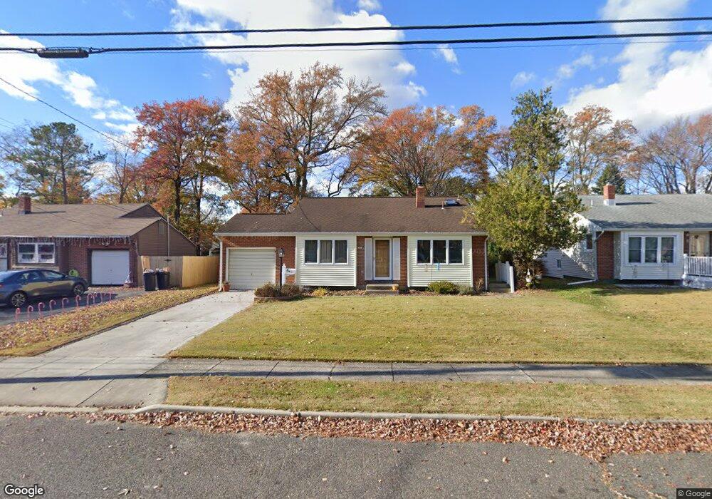
701 Shields Ave West Deptford, NJ 08096
West Deptford Township NeighborhoodEstimated Value: $264,104 - $373,000
--
Bed
--
Bath
1,584
Sq Ft
$215/Sq Ft
Est. Value
About This Home
This home is located at 701 Shields Ave, West Deptford, NJ 08096 and is currently estimated at $340,776, approximately $215 per square foot. 701 Shields Ave is a home located in Gloucester County with nearby schools including Oakview Elementary School, Red Bank Elementary School, and Green-Fields Elementary School.
Ownership History
Date
Name
Owned For
Owner Type
Purchase Details
Closed on
Jun 30, 2025
Sold by
Parsons Patricia C
Bought by
Parsons Patricia C and Parsons Robert Edward
Current Estimated Value
Create a Home Valuation Report for This Property
The Home Valuation Report is an in-depth analysis detailing your home's value as well as a comparison with similar homes in the area
Home Values in the Area
Average Home Value in this Area
Purchase History
| Date | Buyer | Sale Price | Title Company |
|---|---|---|---|
| Parsons Patricia C | -- | None Listed On Document | |
| Parsons Patricia C | -- | None Listed On Document |
Source: Public Records
Tax History Compared to Growth
Tax History
| Year | Tax Paid | Tax Assessment Tax Assessment Total Assessment is a certain percentage of the fair market value that is determined by local assessors to be the total taxable value of land and additions on the property. | Land | Improvement |
|---|---|---|---|---|
| 2025 | $6,355 | $182,000 | $57,200 | $124,800 |
| 2024 | $6,274 | $182,000 | $57,200 | $124,800 |
| 2023 | $6,274 | $182,000 | $57,200 | $124,800 |
| 2022 | $6,244 | $182,000 | $57,200 | $124,800 |
| 2021 | $5,656 | $182,000 | $57,200 | $124,800 |
| 2020 | $6,208 | $182,000 | $57,200 | $124,800 |
| 2019 | $6,035 | $182,000 | $57,200 | $124,800 |
| 2018 | $5,871 | $182,000 | $57,200 | $124,800 |
| 2017 | $5,735 | $182,000 | $57,200 | $124,800 |
| 2016 | $5,325 | $182,000 | $57,200 | $124,800 |
| 2015 | $5,061 | $182,000 | $57,200 | $124,800 |
| 2014 | $4,797 | $182,000 | $57,200 | $124,800 |
Source: Public Records
Map
Nearby Homes
- 654 Frances Ave
- 193 Dubois Ave
- 210 Lawnton Ave
- 302 W Red Bank Ave
- 131 Watkins Ave
- 121 Crescent Ave
- 815 Harker Ave
- 46 Lynn Dr
- 7 Victorian Way
- 70 Crescent Ave
- 38 Watkins Ave
- 3 Victorian Way
- 2 Victorian Way
- 41 Crescent Ave
- 17 Watkins Ave
- 1029 Tatum St
- 120 Progress Ave
- 112 Progress Ave
- 83 Lynn Dr
- 626 Green St
- 711 Shields Ave
- 691 Shields Ave
- 681 Shields Ave
- 700 Carter Ave
- 710 Carter Ave
- 690 Carter Ave
- 729 Shields Ave
- 673 Shields Ave
- 720 Carter Ave
- 680 Carter Ave
- 700 Shields Ave
- 690 Shields Ave
- 712 Shields Ave
- 667 Shields Ave
- 735 Shields Ave
- 728 Carter Ave
- 672 Carter Ave
- 680 Shields Ave
- 728 Shields Ave
- 672 Shields Ave