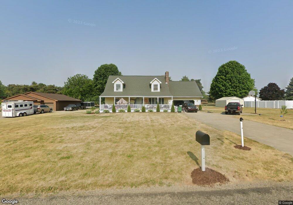
70132 Carolyn Ave Sturgis, MI 49091
Estimated Value: $299,900 - $339,000
3
Beds
2
Baths
2,454
Sq Ft
$131/Sq Ft
Est. Value
About This Home
This home is located at 70132 Carolyn Ave, Sturgis, MI 49091 and is currently estimated at $321,475, approximately $131 per square foot. 70132 Carolyn Ave is a home located in St. Joseph County with nearby schools including Sturgis High School and Sturgis Christian School.
Ownership History
Date
Name
Owned For
Owner Type
Purchase Details
Closed on
May 24, 2022
Sold by
Shoup John L and Shoup Diane M
Bought by
Bond Joy
Current Estimated Value
Home Financials for this Owner
Home Financials are based on the most recent Mortgage that was taken out on this home.
Original Mortgage
$176,000
Outstanding Balance
$167,196
Interest Rate
5.25%
Mortgage Type
New Conventional
Estimated Equity
$154,279
Create a Home Valuation Report for This Property
The Home Valuation Report is an in-depth analysis detailing your home's value as well as a comparison with similar homes in the area
Home Values in the Area
Average Home Value in this Area
Purchase History
| Date | Buyer | Sale Price | Title Company |
|---|---|---|---|
| Bond Joy | $220,000 | Calhoun Title |
Source: Public Records
Mortgage History
| Date | Status | Borrower | Loan Amount |
|---|---|---|---|
| Open | Bond Joy | $176,000 |
Source: Public Records
Tax History Compared to Growth
Tax History
| Year | Tax Paid | Tax Assessment Tax Assessment Total Assessment is a certain percentage of the fair market value that is determined by local assessors to be the total taxable value of land and additions on the property. | Land | Improvement |
|---|---|---|---|---|
| 2025 | $4,050 | $156,300 | $8,300 | $148,000 |
| 2024 | $1,407 | $146,700 | $8,300 | $138,400 |
| 2023 | $1,340 | $127,400 | $8,800 | $118,600 |
| 2022 | $0 | $123,600 | $9,400 | $114,200 |
| 2021 | $1,834 | $107,300 | $8,700 | $98,600 |
| 2020 | $1,807 | $100,300 | $7,900 | $92,400 |
| 2019 | $1,773 | $88,100 | $7,100 | $81,000 |
| 2018 | $1,561 | $81,900 | $7,100 | $74,800 |
| 2017 | $1,570 | $79,700 | $79,700 | $0 |
| 2016 | -- | $77,700 | $77,700 | $0 |
| 2015 | -- | $62,100 | $0 | $0 |
| 2014 | -- | $54,200 | $54,200 | $0 |
| 2012 | -- | $60,500 | $60,500 | $0 |
Source: Public Records
Map
Nearby Homes
- 69760 White School Rd
- 0 Deer Rd
- 26137 Diana Dr
- 26945 Fawn River Rd
- 0 S Centerville Rd
- 69375 Vicky Dr
- 539 Fawn River Rd
- 501 W Ohio Ct
- 702 S Orange St
- 26865 Us Highway 12
- 69819 S Nottawa Rd
- 501 Norwood St
- 650 W 800 N
- 203 Grove St
- 210 Grove St
- 2770 S Centerville Rd
- 206 1st St
- 202 N Centerville Rd
- 303 Williams St
- 200 Broadus St
- 70100 Carolyn Ave
- 70164 Carolyn Ave
- 26158 Cinda Lou Ln
- 26158 Cinda Lou Ln
- 0 Cinda Lou Ln Unit 2408695
- Lots 9&10 Nathan Place
- Lot 10 Nathan Place
- Lot 9 Nathan Place
- 26178 Nathan Place
- 26178 Nathan Place
- 26127 Nathan Place
- 70077 Carolyn Ave
- 70077 Carolyn Ave
- 70077 Carolyn Ave
- 26187 Cinda Lou Ln
- 26187 Cinda Lou Ln
- 26114 Cinda Lou Ln
- 26105 Nathan Place
- 26124 Nathan Place
- 26096 Cinda Lou Ln