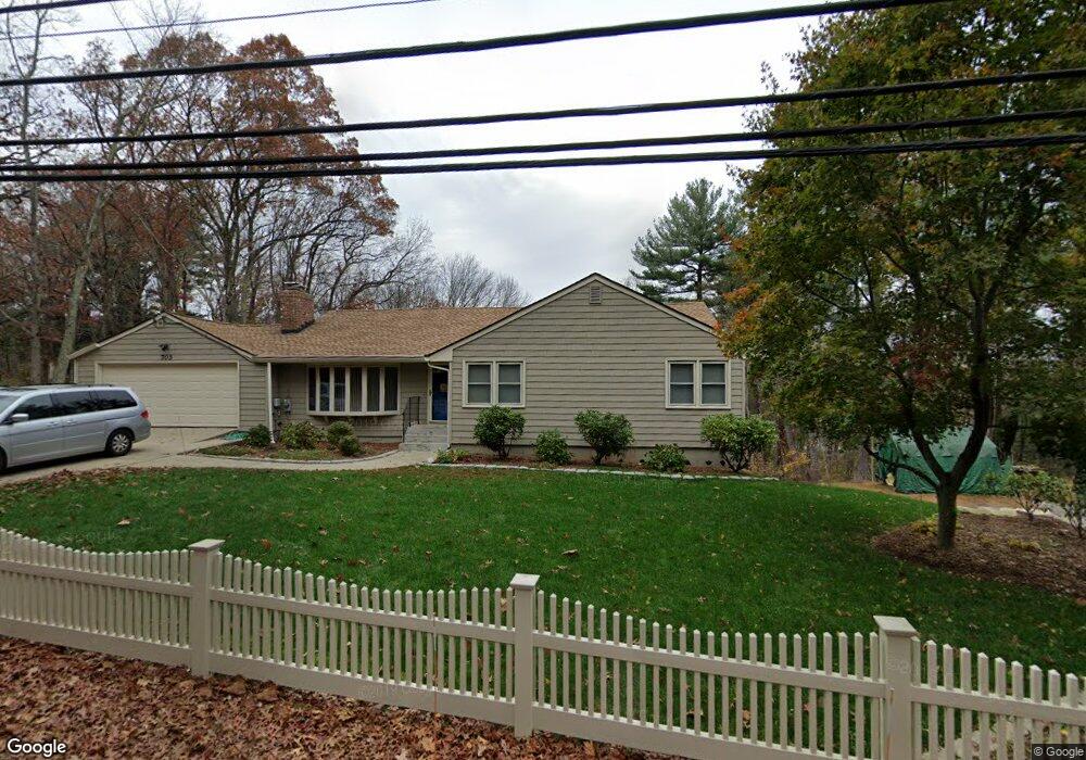
703 Pound Hill Rd North Smithfield, RI 02896
Estimated Value: $495,368 - $606,000
3
Beds
2
Baths
1,570
Sq Ft
$355/Sq Ft
Est. Value
About This Home
This home is located at 703 Pound Hill Rd, North Smithfield, RI 02896 and is currently estimated at $557,842, approximately $355 per square foot. 703 Pound Hill Rd is a home located in Providence County with nearby schools including North Smithfield Elementary School, North Smithfield Middle School, and North Smithfield High School.
Ownership History
Date
Name
Owned For
Owner Type
Purchase Details
Closed on
Jan 22, 2021
Sold by
Molloy Thomas W and Molloy Donna M
Bought by
Molloy Ft
Current Estimated Value
Purchase Details
Closed on
May 28, 1991
Sold by
Searle Herbert V
Bought by
Molloy Thomas W
Home Financials for this Owner
Home Financials are based on the most recent Mortgage that was taken out on this home.
Original Mortgage
$108,800
Interest Rate
9.36%
Mortgage Type
Purchase Money Mortgage
Create a Home Valuation Report for This Property
The Home Valuation Report is an in-depth analysis detailing your home's value as well as a comparison with similar homes in the area
Home Values in the Area
Average Home Value in this Area
Purchase History
| Date | Buyer | Sale Price | Title Company |
|---|---|---|---|
| Molloy Ft | -- | None Available | |
| Molloy Thomas W | $136,000 | -- |
Source: Public Records
Mortgage History
| Date | Status | Borrower | Loan Amount |
|---|---|---|---|
| Previous Owner | Molloy Thomas W | $110,250 | |
| Previous Owner | Molloy Thomas W | $108,800 |
Source: Public Records
Tax History Compared to Growth
Tax History
| Year | Tax Paid | Tax Assessment Tax Assessment Total Assessment is a certain percentage of the fair market value that is determined by local assessors to be the total taxable value of land and additions on the property. | Land | Improvement |
|---|---|---|---|---|
| 2024 | $5,861 | $396,800 | $88,300 | $308,500 |
| 2023 | $5,654 | $396,800 | $88,300 | $308,500 |
| 2022 | $5,519 | $396,800 | $88,300 | $308,500 |
| 2021 | $5,299 | $325,300 | $70,300 | $255,000 |
| 2020 | $5,299 | $325,300 | $70,300 | $255,000 |
| 2019 | $5,163 | $325,300 | $70,300 | $255,000 |
| 2018 | $4,729 | $274,300 | $77,100 | $197,200 |
| 2017 | $4,614 | $274,300 | $77,100 | $197,200 |
| 2016 | $4,488 | $274,300 | $77,100 | $197,200 |
| 2015 | $4,654 | $279,000 | $95,300 | $183,700 |
| 2014 | $4,470 | $279,000 | $95,300 | $183,700 |
Source: Public Records
Map
Nearby Homes
- 0 Brentwood Dr
- 815 Pound Hill Rd
- 170 Providence Pike Unit 64
- 170 Providence Pike Unit 47
- 53 Maple Ave
- 5 Laurel Ln
- 5 Branch Ave
- 612 Great Rd
- 14 Lapre Rd
- 5 Lincoln Dr
- 88 Homestead Ave
- 470 Saint Paul St
- 7 Stone Ridge Dr
- 104 Old Great Rd
- 34 Smithfield Rd
- 595 S Main St
- 4 Sharon Pkwy
- 724 Fairmount St
- 0 Taber Hill Rd Unit 1396868
- 291 Old Oxford Rd
- 697 Pound Hill Rd
- 709 Pound Hill Rd
- 700 Pound Hill Rd
- 691 Pound Hill Rd
- 720 Pound Hill Rd
- 676 Pound Hill Rd
- 165 Comstock Rd
- 715 Pound Hill Rd
- 750 Pound Hill Rd
- 1 Taber Hill Rd
- 770 Pound Hill Rd
- 7 Taber Hill Rd
- 161 Comstock Rd
- 783 Pound Hill Rd
- 603 Pound Hill Rd
- 621 Pound Hill Rd Unit A
- 621 Pound Hill Rd
- 778 Pound Hill Rd
- Lot 1 Tabor Rd
- 787 Pound Hill Rd