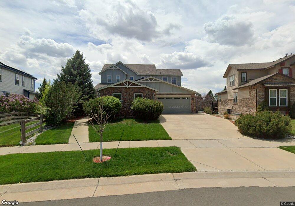
7044 S Fultondale Cir Aurora, CO 80016
Tallyn's Reach NeighborhoodEstimated Value: $786,000 - $863,341
5
Beds
4
Baths
5,057
Sq Ft
$164/Sq Ft
Est. Value
About This Home
This home is located at 7044 S Fultondale Cir, Aurora, CO 80016 and is currently estimated at $830,085, approximately $164 per square foot. 7044 S Fultondale Cir is a home located in Arapahoe County with nearby schools including Coyote Hills Elementary School, Cherokee Trail High School, and Our Lady of Loreto School.
Ownership History
Date
Name
Owned For
Owner Type
Purchase Details
Closed on
Jan 26, 2017
Sold by
Williams Matthew M and Williams Georgina P
Bought by
Das Moumita and Desai Aprajit
Current Estimated Value
Home Financials for this Owner
Home Financials are based on the most recent Mortgage that was taken out on this home.
Original Mortgage
$48,400
Outstanding Balance
$40,185
Interest Rate
4.3%
Mortgage Type
Credit Line Revolving
Estimated Equity
$789,900
Purchase Details
Closed on
Jan 12, 2005
Sold by
Beazer Homes Holdings Corp
Bought by
Williams Matthew M and Williams Georgina P
Home Financials for this Owner
Home Financials are based on the most recent Mortgage that was taken out on this home.
Original Mortgage
$293,100
Interest Rate
4.87%
Mortgage Type
Purchase Money Mortgage
Create a Home Valuation Report for This Property
The Home Valuation Report is an in-depth analysis detailing your home's value as well as a comparison with similar homes in the area
Home Values in the Area
Average Home Value in this Area
Purchase History
| Date | Buyer | Sale Price | Title Company |
|---|---|---|---|
| Das Moumita | $485,000 | Land Title Guarantee Co | |
| Williams Matthew M | $418,726 | Land Title |
Source: Public Records
Mortgage History
| Date | Status | Borrower | Loan Amount |
|---|---|---|---|
| Open | Das Moumita | $48,400 | |
| Previous Owner | Williams Matthew M | $293,100 | |
| Closed | Williams Matthew M | $104,600 |
Source: Public Records
Tax History Compared to Growth
Tax History
| Year | Tax Paid | Tax Assessment Tax Assessment Total Assessment is a certain percentage of the fair market value that is determined by local assessors to be the total taxable value of land and additions on the property. | Land | Improvement |
|---|---|---|---|---|
| 2024 | $6,013 | $56,568 | -- | -- |
| 2023 | $6,013 | $56,568 | $0 | $0 |
| 2022 | $5,351 | $45,377 | $0 | $0 |
| 2021 | $5,361 | $45,377 | $0 | $0 |
| 2020 | $5,443 | $42,929 | $0 | $0 |
| 2019 | $5,333 | $42,929 | $0 | $0 |
| 2018 | $5,284 | $41,177 | $0 | $0 |
| 2017 | $5,240 | $41,177 | $0 | $0 |
| 2016 | $4,256 | $41,488 | $0 | $0 |
| 2015 | $4,129 | $41,488 | $0 | $0 |
| 2014 | $3,561 | $34,793 | $0 | $0 |
| 2013 | -- | $33,560 | $0 | $0 |
Source: Public Records
Map
Nearby Homes
- 24277 E Davies Place
- 24378 E Roxbury Cir
- 24723 E Quarto Place
- 24248 E Roxbury Cir
- 24395 E Briarwood Ave
- 23901 E Easter Place
- 24622 E Ontario Dr
- 24536 E Ottawa Ave
- 6995 S Buchanan Ct
- 7370 S Catawba Way
- 2132 S Irvington Ct
- 24329 E Glasgow Cir
- 24846 E Calhoun Place Unit A
- 25338 E Costilla Place
- 24887 E Calhoun Place Unit C
- 24880 E Euclid Place
- 24583 E Hoover Place Unit B
- 6648 S Catawba Way
- 24702 E Hoover Place
- 7463 S Biloxi Ct
- 7034 S Fultondale Cir
- 7024 S Fultondale Cir
- 7064 S Fultondale Cir
- 7055 S Fultondale Cir
- 24402 E Davies Way
- 7014 S Fultondale Cir
- 7045 S Fultondale Cir
- 24422 E Davies Way
- 7004 S Fultondale Cir
- 24398 E Davies Place
- 24442 E Davies Way
- 7035 S Fultondale Cir
- 24378 E Davies Place
- 24462 E Davies Way
- 7025 S Fultondale Cir
- 24348 E Davies Place
- 24482 E Davies Way
- 6984 S Fultondale Cir
- 24328 E Davies Place
- 7015 S Fultondale Cir