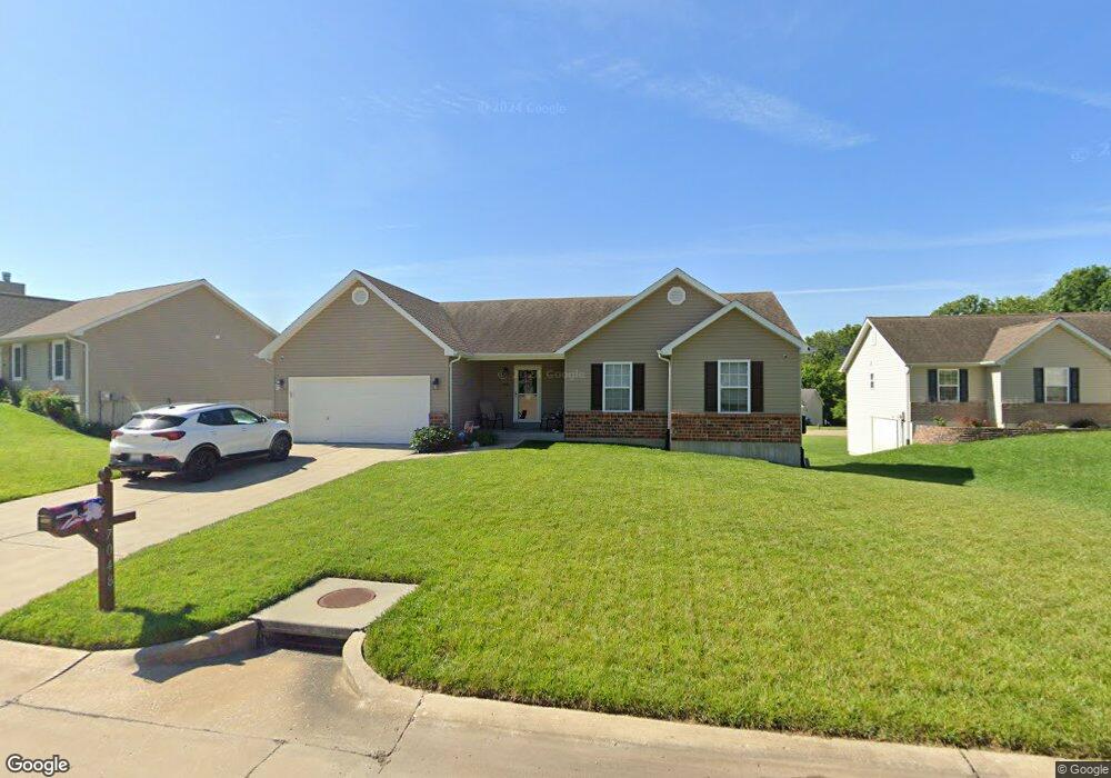
7048 Brooks Farm Dr House Springs, MO 63051
Estimated Value: $323,630 - $386,000
3
Beds
2
Baths
1,420
Sq Ft
$242/Sq Ft
Est. Value
About This Home
This home is located at 7048 Brooks Farm Dr, House Springs, MO 63051 and is currently estimated at $343,408, approximately $241 per square foot. 7048 Brooks Farm Dr is a home located in Jefferson County with nearby schools including Northwest High School and St. Anthony School.
Ownership History
Date
Name
Owned For
Owner Type
Purchase Details
Closed on
Jul 12, 2013
Sold by
Countryside Homes Ii Llc
Bought by
Rabior Timothy and Rabior Christine
Current Estimated Value
Home Financials for this Owner
Home Financials are based on the most recent Mortgage that was taken out on this home.
Original Mortgage
$183,673
Outstanding Balance
$133,048
Interest Rate
3.83%
Mortgage Type
New Conventional
Estimated Equity
$210,360
Create a Home Valuation Report for This Property
The Home Valuation Report is an in-depth analysis detailing your home's value as well as a comparison with similar homes in the area
Home Values in the Area
Average Home Value in this Area
Purchase History
| Date | Buyer | Sale Price | Title Company |
|---|---|---|---|
| Rabior Timothy | -- | None Available |
Source: Public Records
Mortgage History
| Date | Status | Borrower | Loan Amount |
|---|---|---|---|
| Open | Rabior Timothy | $183,673 |
Source: Public Records
Tax History Compared to Growth
Tax History
| Year | Tax Paid | Tax Assessment Tax Assessment Total Assessment is a certain percentage of the fair market value that is determined by local assessors to be the total taxable value of land and additions on the property. | Land | Improvement |
|---|---|---|---|---|
| 2025 | $2,924 | $43,900 | $7,700 | $36,200 |
| 2024 | $2,924 | $40,500 | $7,700 | $32,800 |
| 2023 | $2,924 | $40,500 | $7,700 | $32,800 |
| 2022 | $2,893 | $40,500 | $7,700 | $32,800 |
| 2021 | $2,893 | $40,500 | $7,700 | $32,800 |
| 2020 | $2,656 | $36,300 | $7,000 | $29,300 |
| 2019 | $2,653 | $36,300 | $7,000 | $29,300 |
| 2018 | $2,688 | $36,300 | $7,000 | $29,300 |
| 2017 | $2,456 | $36,300 | $7,000 | $29,300 |
| 2016 | $2,348 | $34,400 | $7,300 | $27,100 |
| 2015 | $2,413 | $34,400 | $7,300 | $27,100 |
| 2013 | -- | $18,100 | $7,300 | $10,800 |
Source: Public Records
Map
Nearby Homes
- 172 Cardinal Ln Unit 172
- 173 Cardinal Ln Unit 173
- 6042 Carol St
- 185 Bobwhite Ln Unit 185
- 74 Mockingbird Hill Unit 74
- 0 Manor Crest Dr Unit MIS25054810
- 65 Mockingbird Hill Unit 65
- 192 Bobwhite Ln Unit 192
- 6144 Misty Meadow Dr
- 5916 Roger Rd
- 5899 Midridge Dr
- 3833 Dorchester Ct
- 5814 Mayfair Ct
- 6302 Upper Byrnes Mill Rd
- 4138 Elizabeth Dr
- 3734 Carol Park Rd
- 0 Old Gravois Rd
- 5919 Brookside Place
- 5916 Brookside Place
- 0 High Ridge Manor Resub Lot 6 Unit MIS25049757
- 7042 Brooks Farm Dr
- 7052 Brooks Farm Dr
- 121 Brooks Farm Ct
- 7034 Brooks Farm Dr
- 7058 Brooks Farm Dr
- 7056 Brooks Farm Dr
- 7056 Brooks Farm Dr
- 7049 Brooks Farm Dr
- 7045 Brooks Farm Dr
- 7053 Brooks Farm Dr
- 1234TBB Brooks Farm
- 7028 Brooks Farm Rd
- 7060 Brooks Farm Dr
- 7041 Brooks Farm Dr
- 132 Brooks Farm Ct
- 7061 Brooks Farm Dr
- 7057 Brooks Farm Dr
- 7037 Brooks Farm Dr
- 109 Brooks Farm Ct
- 128 Brooks Farm Ct