Estimated Value: $447,241 - $491,000
4
Beds
4
Baths
2,790
Sq Ft
$166/Sq Ft
Est. Value
About This Home
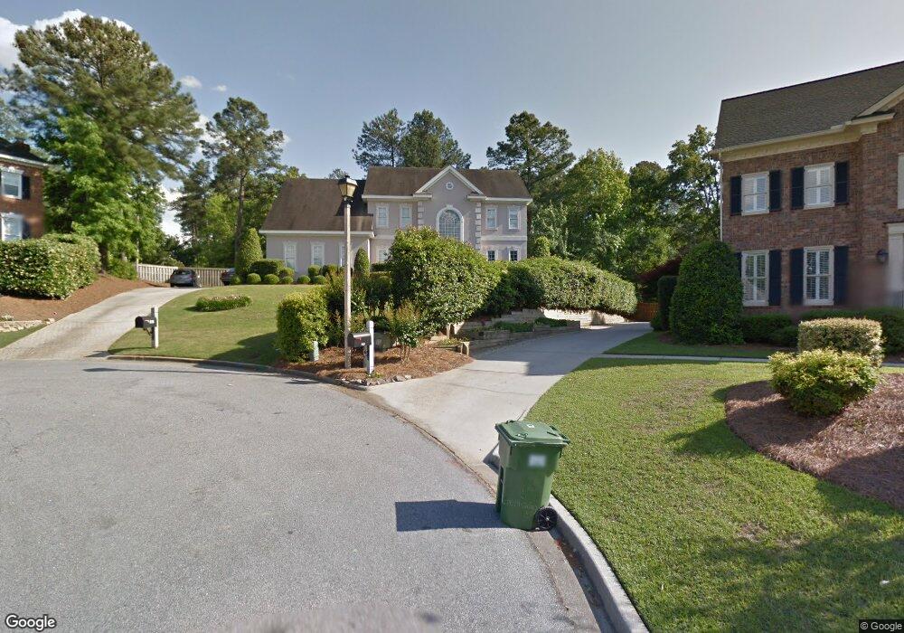
This home is located at 705 Fosters Ct, Evans, GA 30809 and is currently estimated at $463,560, approximately $166 per square foot. 705 Fosters Ct is a home located in Columbia County with nearby schools including Northmore Elementary School, Lincoln Elementary School, and Blue Ridge Elementary School.
Ownership History
Date
Name
Owned For
Owner Type
Purchase Details
Closed on
Aug 15, 2003
Sold by
Slavens Allen E and Slavens Candace W
Bought by
Perkins James A and Perkins Leanne C
Current Estimated Value
Home Financials for this Owner
Home Financials are based on the most recent Mortgage that was taken out on this home.
Original Mortgage
$232,750
Outstanding Balance
$101,747
Interest Rate
5.52%
Mortgage Type
Purchase Money Mortgage
Estimated Equity
$361,813
Purchase Details
Closed on
May 23, 2002
Sold by
Bank Of America Na
Bought by
Slavens Allen E and Slavens Candace W
Home Financials for this Owner
Home Financials are based on the most recent Mortgage that was taken out on this home.
Original Mortgage
$196,033
Interest Rate
6.92%
Purchase Details
Closed on
Apr 3, 2001
Sold by
Milici Antonio and Irizarry Tannya L
Bought by
Bank Of America Na
Create a Home Valuation Report for This Property
The Home Valuation Report is an in-depth analysis detailing your home's value as well as a comparison with similar homes in the area
Home Values in the Area
Average Home Value in this Area
Purchase History
| Date | Buyer | Sale Price | Title Company |
|---|---|---|---|
| Perkins James A | $245,000 | -- | |
| Slavens Allen E | $194,000 | -- | |
| Bank Of America Na | $177,022 | -- |
Source: Public Records
Mortgage History
| Date | Status | Borrower | Loan Amount |
|---|---|---|---|
| Open | Perkins James A | $232,750 | |
| Previous Owner | Slavens Allen E | $196,033 |
Source: Public Records
Tax History Compared to Growth
Tax History
| Year | Tax Paid | Tax Assessment Tax Assessment Total Assessment is a certain percentage of the fair market value that is determined by local assessors to be the total taxable value of land and additions on the property. | Land | Improvement |
|---|---|---|---|---|
| 2025 | $1,398 | $177,878 | $46,804 | $131,074 |
| 2024 | $1,479 | $182,187 | $41,304 | $140,883 |
| 2023 | $1,479 | $164,322 | $39,204 | $125,118 |
| 2022 | $1,288 | $144,320 | $42,804 | $101,516 |
| 2021 | $1,211 | $128,713 | $31,504 | $97,209 |
| 2020 | $3,479 | $123,228 | $30,604 | $92,624 |
| 2019 | $3,363 | $119,056 | $29,604 | $89,452 |
| 2018 | $3,352 | $118,246 | $28,904 | $89,342 |
| 2017 | $3,438 | $120,927 | $29,704 | $91,223 |
| 2016 | $3,180 | $115,832 | $30,480 | $85,352 |
| 2015 | $2,979 | $108,146 | $31,180 | $76,966 |
| 2014 | $2,828 | $101,308 | $29,780 | $71,528 |
Source: Public Records
Map
Nearby Homes
- 701 Fosters Ct
- 516 McKinnes Park
- 4172 Tindall Dr
- 1009 Barrett Dr
- 4305 Southern Pines Dr
- 1062 Emerald Place
- 579 Litchfield Ct
- 1013 Emerald Place
- 2025 Grace Ave
- 612 Emerald Crossing
- 4190 Litchfield Ln
- 593 Blue Ridge Crossing
- 628 Emerald Crossing
- 0 Commons Dr
- 644 Emerald Crossing
- 598 Bradford Ln
- 735 Michaels Creek
- 4209 Fairfield Cir
- 4110 Heritage Ridge
- 4213 Blue Heron Ln
- 703 Fosters Ct
- 707 Foster's Ct
- 707 Fosters Ct
- 648 McKinnes Ct
- 646 McKinnes Ct
- 701 Foster's Ct
- 709 Fosters Ct
- 708 Foster's Ct
- 650 McKinnes Ct
- 641 McKinnes Branch
- 699 Fosters Ct
- 706 Fosters Ct
- 642 McKinne's Ct
- 642 McKinnes Ct
- 639 McKinnes Branch
- 652 McKinnes Ct
- 724 Magruder Ct
- 704 Fosters Ct
- 722 Magruder Ct
- 726 Magruder Ct