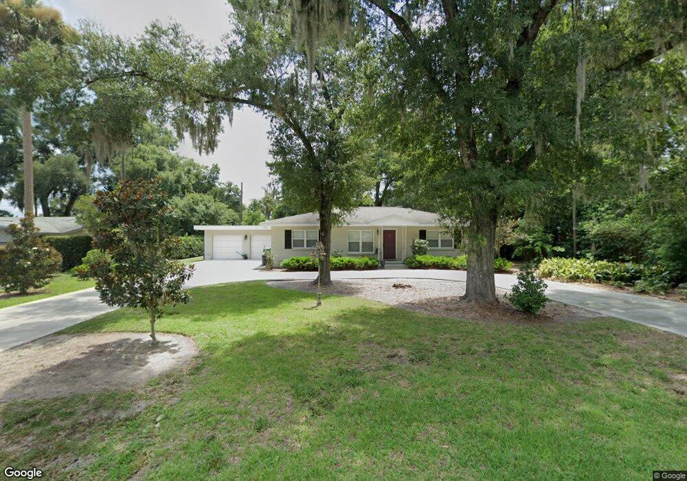
709 N Boston Ave Deland, FL 32724
Estimated Value: $294,034 - $345,000
3
Beds
2
Baths
1,830
Sq Ft
$174/Sq Ft
Est. Value
About This Home
This home is located at 709 N Boston Ave, Deland, FL 32724 and is currently estimated at $317,509, approximately $173 per square foot. 709 N Boston Ave is a home located in Volusia County with nearby schools including Deland High School, George W. Marks Elementary School, and Deland Middle School.
Ownership History
Date
Name
Owned For
Owner Type
Purchase Details
Closed on
Dec 20, 2013
Sold by
Birnie Todd H and Oldaker Holly A
Bought by
Birnie Todd H
Current Estimated Value
Purchase Details
Closed on
Aug 29, 2007
Sold by
Rhodes H Vann
Bought by
Birnie Todd H and Oldaker Holly A
Home Financials for this Owner
Home Financials are based on the most recent Mortgage that was taken out on this home.
Original Mortgage
$180,000
Outstanding Balance
$114,721
Interest Rate
6.7%
Mortgage Type
Purchase Money Mortgage
Estimated Equity
$202,788
Purchase Details
Closed on
Nov 15, 1988
Bought by
Birnie Todd H
Purchase Details
Closed on
Dec 15, 1987
Bought by
Birnie Todd H
Purchase Details
Closed on
Jun 15, 1983
Bought by
Birnie Todd H
Purchase Details
Closed on
Sep 15, 1982
Bought by
Birnie Todd H
Create a Home Valuation Report for This Property
The Home Valuation Report is an in-depth analysis detailing your home's value as well as a comparison with similar homes in the area
Home Values in the Area
Average Home Value in this Area
Purchase History
| Date | Buyer | Sale Price | Title Company |
|---|---|---|---|
| Birnie Todd H | -- | None Available | |
| Birnie Todd H | $200,000 | Westside Title Services Inc | |
| Birnie Todd H | $65,000 | -- | |
| Birnie Todd H | $100 | -- | |
| Birnie Todd H | $100 | -- | |
| Birnie Todd H | $100 | -- |
Source: Public Records
Mortgage History
| Date | Status | Borrower | Loan Amount |
|---|---|---|---|
| Open | Birnie Todd H | $180,000 |
Source: Public Records
Tax History Compared to Growth
Tax History
| Year | Tax Paid | Tax Assessment Tax Assessment Total Assessment is a certain percentage of the fair market value that is determined by local assessors to be the total taxable value of land and additions on the property. | Land | Improvement |
|---|---|---|---|---|
| 2025 | $951 | $99,084 | -- | -- |
| 2024 | $951 | $96,292 | -- | -- |
| 2023 | $951 | $93,488 | $0 | $0 |
| 2022 | $915 | $90,765 | $0 | $0 |
| 2021 | $928 | $88,121 | $0 | $0 |
| 2020 | $908 | $86,904 | $0 | $0 |
| 2019 | $907 | $84,950 | $0 | $0 |
| 2018 | $908 | $83,366 | $0 | $0 |
| 2017 | $901 | $81,651 | $0 | $0 |
| 2016 | $860 | $79,972 | $0 | $0 |
| 2015 | $878 | $79,416 | $0 | $0 |
| 2014 | $882 | $78,786 | $0 | $0 |
Source: Public Records
Map
Nearby Homes
- 851 E Pennsylvania Ave
- 612 E Plymouth Ave
- 708 Montreville Ave
- 45 S University Cir
- 927 Azalea Walk Cir
- 931 Azalea Walk Cir
- 818 Eastover Cir
- 505 E Plymouth Ave
- 3 S University Cir
- 437 N Boston Ave Unit 437
- 605 John Thomas Ave
- 717 E Grove Place
- 503 E Minnesota Ave
- 701 N Tuxedo Ave
- 706 E Minnesota Ave Unit C
- 419 N Frankfort Ave
- 907 Marlboro Dr
- 1005 Crescent Pkwy
- 1007 Crescent Pkwy
- 406 N Kentucky Ave
- 711 N Boston Ave
- 708 Pine Tree Ct
- 711 E Pennsylvania Ave
- 710 Pine Tree Ct
- 716 N Boston Ave
- 715 N Boston Ave
- 718 N Boston Ave
- 700 N Boston Ave
- 722 N Boston Ave
- 712 Pine Tree Ct
- 724 N Boston Ave
- 721 N Boston Ave
- 641 E Pennsylvania Ave
- 711 Pine Tree Ct
- 714 Pine Tree Ct
- 726 N Boston Ave
- 639 E Pennsylvania Ave
- 707 Pine Tree Ct
- 616 E Pennsylvania Ave
- 801 N Boston Ave