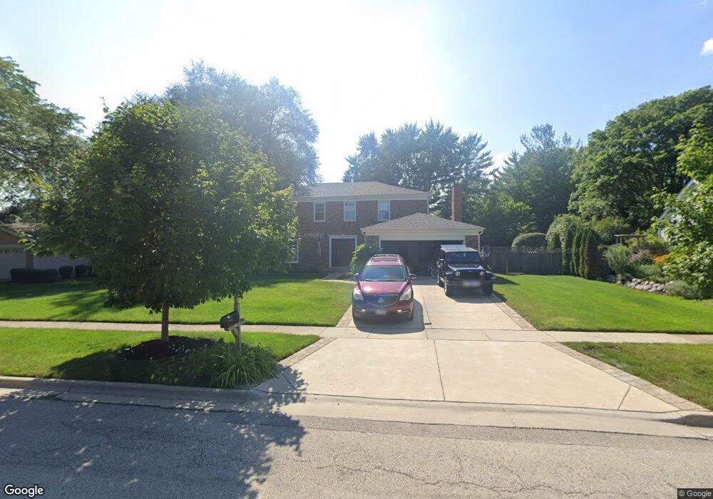
709 Sedgwick Dr Libertyville, IL 60048
Estimated Value: $639,000 - $724,000
--
Bed
3
Baths
2,370
Sq Ft
$289/Sq Ft
Est. Value
About This Home
This home is located at 709 Sedgwick Dr, Libertyville, IL 60048 and is currently estimated at $685,096, approximately $289 per square foot. 709 Sedgwick Dr is a home located in Lake County with nearby schools including Butterfield School, Highland Middle School, and Libertyville High School.
Ownership History
Date
Name
Owned For
Owner Type
Purchase Details
Closed on
Sep 30, 1995
Sold by
Peterson Dale L and Peterson Jennifer L
Bought by
Stuhr David L and Stuhr Lee Ann
Current Estimated Value
Home Financials for this Owner
Home Financials are based on the most recent Mortgage that was taken out on this home.
Original Mortgage
$261,000
Interest Rate
7.61%
Create a Home Valuation Report for This Property
The Home Valuation Report is an in-depth analysis detailing your home's value as well as a comparison with similar homes in the area
Home Values in the Area
Average Home Value in this Area
Purchase History
| Date | Buyer | Sale Price | Title Company |
|---|---|---|---|
| Stuhr David L | $290,000 | Ticor Title Insurance Compan |
Source: Public Records
Mortgage History
| Date | Status | Borrower | Loan Amount |
|---|---|---|---|
| Closed | Stuhr David L | $261,000 |
Source: Public Records
Tax History Compared to Growth
Tax History
| Year | Tax Paid | Tax Assessment Tax Assessment Total Assessment is a certain percentage of the fair market value that is determined by local assessors to be the total taxable value of land and additions on the property. | Land | Improvement |
|---|---|---|---|---|
| 2024 | $14,646 | $205,850 | $75,680 | $130,170 |
| 2023 | $10,603 | $189,864 | $69,803 | $120,061 |
| 2022 | $10,603 | $138,582 | $74,547 | $64,035 |
| 2021 | $10,207 | $135,599 | $72,942 | $62,657 |
| 2020 | $9,822 | $133,320 | $71,716 | $61,604 |
| 2019 | $13,157 | $179,188 | $71,034 | $108,154 |
| 2018 | $12,662 | $176,013 | $77,692 | $98,321 |
| 2017 | $12,316 | $170,456 | $75,239 | $95,217 |
| 2016 | $11,909 | $161,616 | $71,337 | $90,279 |
| 2015 | $11,804 | $151,057 | $66,676 | $84,381 |
| 2014 | $11,882 | $149,030 | $65,781 | $83,249 |
| 2012 | $10,727 | $150,323 | $66,352 | $83,971 |
Source: Public Records
Map
Nearby Homes
- 832 Interlaken Ln
- 223 Kenloch Ave
- 1330 W Park Ave
- 694 Parkside Ct
- 1338 Trinity Place
- 662 Parkside Ct
- 1137 Pine Tree Ln
- 619 Parkside Ct
- 420 W Cook Ave
- 616 Parkside Ct
- 551 W Park Ave Unit E
- 505 Lange Ct
- 20924 & 20902 W Park Ave
- 1512 Sunnyview Rd
- 533 Drake St
- 212 W Ellis Ave
- 212 Elm Ct
- 208 W Ellis Ave
- 204 W Ellis Ave
- 423 Ames St
- 719 Sedgwick Dr
- 701 Sedgwick Dr
- 701 Sedgewick Dr
- 716 Hillcrest Dr
- 706 Hillcrest Dr
- 714 Sedgwick Dr Unit 1
- 667 Sedgwick Dr
- 729 Sedgwick Dr
- 726 Hillcrest Dr
- 658 Hillcrest Dr
- 724 Sedgwick Dr
- 738 Hillcrest Dr
- 650 Hillcrest Dr
- 1044 Blackburn Cir
- 657 Sedgwick Dr
- 662 Sedgwick Dr
- 1049 Lake St
- 1207 St James Place
- 1207 Saint James Place
- 1212 Saint James Place