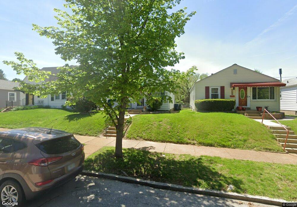
7090 Pernod Ave Saint Louis, MO 63139
Lindenwood Park NeighborhoodEstimated Value: $196,000 - $230,000
--
Bed
1
Bath
1,728
Sq Ft
$122/Sq Ft
Est. Value
About This Home
This home is located at 7090 Pernod Ave, Saint Louis, MO 63139 and is currently estimated at $210,625, approximately $121 per square foot. 7090 Pernod Ave is a home located in St. Louis City with nearby schools including Mason Elementary School, Long International Middle School, and Roosevelt High School.
Ownership History
Date
Name
Owned For
Owner Type
Purchase Details
Closed on
Nov 29, 2021
Sold by
Wand Charles and Wilson Margaret A
Bought by
Wilson Margaret A
Current Estimated Value
Purchase Details
Closed on
Feb 12, 2007
Sold by
Wilson Margaret A and Wilson Charles
Bought by
Wilson Charles and Wilson Margaret A
Home Financials for this Owner
Home Financials are based on the most recent Mortgage that was taken out on this home.
Original Mortgage
$130,500
Outstanding Balance
$83,797
Interest Rate
7.59%
Mortgage Type
Stand Alone Refi Refinance Of Original Loan
Estimated Equity
$126,828
Purchase Details
Closed on
Feb 14, 2003
Sold by
Ramer Catherine L
Bought by
Wilson Margaret A
Purchase Details
Closed on
Feb 25, 1999
Sold by
Commerce Bank Na
Bought by
Ramer Catherine L
Home Financials for this Owner
Home Financials are based on the most recent Mortgage that was taken out on this home.
Original Mortgage
$55,453
Interest Rate
6.8%
Mortgage Type
FHA
Create a Home Valuation Report for This Property
The Home Valuation Report is an in-depth analysis detailing your home's value as well as a comparison with similar homes in the area
Home Values in the Area
Average Home Value in this Area
Purchase History
| Date | Buyer | Sale Price | Title Company |
|---|---|---|---|
| Wilson Margaret A | -- | None Available | |
| Wilson Charles | -- | Archway Title Agency Inc | |
| Wilson Margaret A | -- | -- | |
| Ramer Catherine L | -- | -- |
Source: Public Records
Mortgage History
| Date | Status | Borrower | Loan Amount |
|---|---|---|---|
| Open | Wilson Charles | $130,500 | |
| Previous Owner | Ramer Catherine L | $55,453 |
Source: Public Records
Tax History Compared to Growth
Tax History
| Year | Tax Paid | Tax Assessment Tax Assessment Total Assessment is a certain percentage of the fair market value that is determined by local assessors to be the total taxable value of land and additions on the property. | Land | Improvement |
|---|---|---|---|---|
| 2025 | $2,178 | $30,450 | $1,820 | $28,630 |
| 2024 | $1,522 | $25,680 | $1,820 | $23,860 |
| 2023 | $1,522 | $25,680 | $1,820 | $23,860 |
| 2022 | $1,971 | $23,510 | $1,820 | $21,690 |
| 2021 | $1,969 | $23,510 | $1,820 | $21,690 |
| 2020 | $1,777 | $21,360 | $1,820 | $19,540 |
| 2019 | $1,771 | $21,350 | $1,820 | $19,530 |
| 2018 | $1,549 | $18,070 | $1,670 | $16,400 |
| 2017 | $1,523 | $18,070 | $1,670 | $16,400 |
| 2016 | $1,445 | $16,910 | $1,670 | $15,240 |
| 2015 | $1,311 | $16,910 | $1,670 | $15,240 |
| 2014 | $1,293 | $16,910 | $1,670 | $15,240 |
| 2013 | -- | $16,680 | $1,670 | $15,010 |
Source: Public Records
Map
Nearby Homes
- 3558 Wabash Ave
- 7047 Tholozan Ave
- 7038 Pernod Ave
- 3815 Mccausland Ave Unit 4
- 7114 Drury Ln
- 7081 Winona Ave
- 7081 Bancroft Ave
- 7127 Bancroft Ave
- 6973 Winona Ave
- 7114 Bancroft Ave
- 7120 Bancroft Ave
- 6953 Arthur Ave
- 7059 Lansdowne Ave
- 6811 Marquette Ave
- 6962 Sutherland Ave
- 7048 Lansdowne Ave
- 3316 Commonwealth Ave
- 7044 Lansdowne Ave
- 3723 Commonwealth Ave
- 6659 Tholozan Ave
- 7094 Pernod Ave
- 7086 Pernod Ave
- 7098 Pernod Ave
- 7082 Pernod Ave
- 7078 Pernod Ave
- 7087 Tholozan Ave
- 7081 Tholozan Ave
- 7091 Pernod Ave
- 7070 Pernod Ave
- 7075 Tholozan Ave
- 7093 Tholozan Ave
- 7095 Tholozan Ave
- 7081 Pernod Ave
- 7083 Pernod Ave
- 7071 Tholozan Ave
- 7066 Pernod Ave
- 7077 Pernod Ave
- 7075 Pernod Ave
- 7065 Tholozan Ave