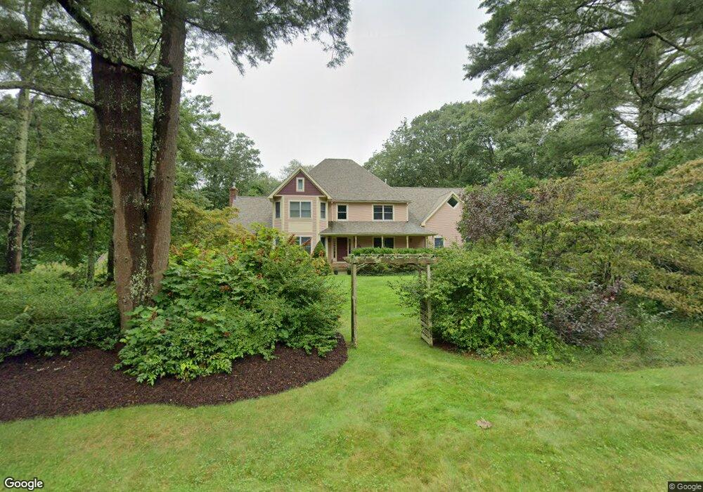
71 Forsythia Ln Westport, MA 02790
North Westport NeighborhoodEstimated Value: $739,000 - $944,000
4
Beds
2
Baths
3,004
Sq Ft
$281/Sq Ft
Est. Value
About This Home
This home is located at 71 Forsythia Ln, Westport, MA 02790 and is currently estimated at $845,514, approximately $281 per square foot. 71 Forsythia Ln is a home located in Bristol County with nearby schools including Alice A. Macomber Primary School, Westport Elementary School, and Westport Middle-High School.
Ownership History
Date
Name
Owned For
Owner Type
Purchase Details
Closed on
Apr 7, 2025
Sold by
Swift David G and Duby Carolyn K
Bought by
David G Swift T G and David Swift
Current Estimated Value
Purchase Details
Closed on
Aug 7, 1992
Sold by
Equitable North Rt
Bought by
Swift David G and Duby Carolyn K
Create a Home Valuation Report for This Property
The Home Valuation Report is an in-depth analysis detailing your home's value as well as a comparison with similar homes in the area
Home Values in the Area
Average Home Value in this Area
Purchase History
| Date | Buyer | Sale Price | Title Company |
|---|---|---|---|
| David G Swift T G | -- | None Available | |
| David G Swift T G | -- | None Available | |
| David G Swift T G | -- | None Available | |
| Swift David G | $60,000 | -- | |
| Swift David G | $60,000 | -- |
Source: Public Records
Mortgage History
| Date | Status | Borrower | Loan Amount |
|---|---|---|---|
| Previous Owner | Swift David G | $200,000 | |
| Previous Owner | Swift David G | $196,500 | |
| Previous Owner | Swift David G | $55,000 |
Source: Public Records
Tax History Compared to Growth
Tax History
| Year | Tax Paid | Tax Assessment Tax Assessment Total Assessment is a certain percentage of the fair market value that is determined by local assessors to be the total taxable value of land and additions on the property. | Land | Improvement |
|---|---|---|---|---|
| 2025 | $5,391 | $723,600 | $210,700 | $512,900 |
| 2024 | $5,383 | $696,400 | $195,300 | $501,100 |
| 2023 | $5,434 | $665,900 | $186,000 | $479,900 |
| 2022 | $5,176 | $610,400 | $186,000 | $424,400 |
| 2021 | $3,099 | $576,300 | $169,100 | $407,200 |
| 2020 | $4,802 | $569,600 | $162,400 | $407,200 |
| 2019 | $2,984 | $558,400 | $162,400 | $396,000 |
| 2018 | $2,857 | $527,000 | $179,000 | $348,000 |
| 2017 | $2,614 | $522,900 | $179,000 | $343,900 |
| 2016 | $3,841 | $485,600 | $179,000 | $306,600 |
| 2015 | $3,728 | $470,100 | $179,000 | $291,100 |
Source: Public Records
Map
Nearby Homes
- 75 Forsythia Ln
- 69 Forsythia Ln
- 70 Forsythia Ln
- 14 Brookside Ave
- 2 Fieldstone Dr
- 81 Forsythia Ln
- 6 Brookside Ave
- 10 Brookside Ave
- 76 Forsythia Ln
- 64 Forsythia Ln
- 20 Brookside Ave
- 8 Fieldstone Dr
- 2 Brookside Ave
- 59 Forsythia Ln
- 24 Brookside Ave
- 5 Brookside Ave
- 16 Fieldstone Dr
- 19 Brookside Ave
- 58 Forsythia Ln
- 15 Brookside Ave