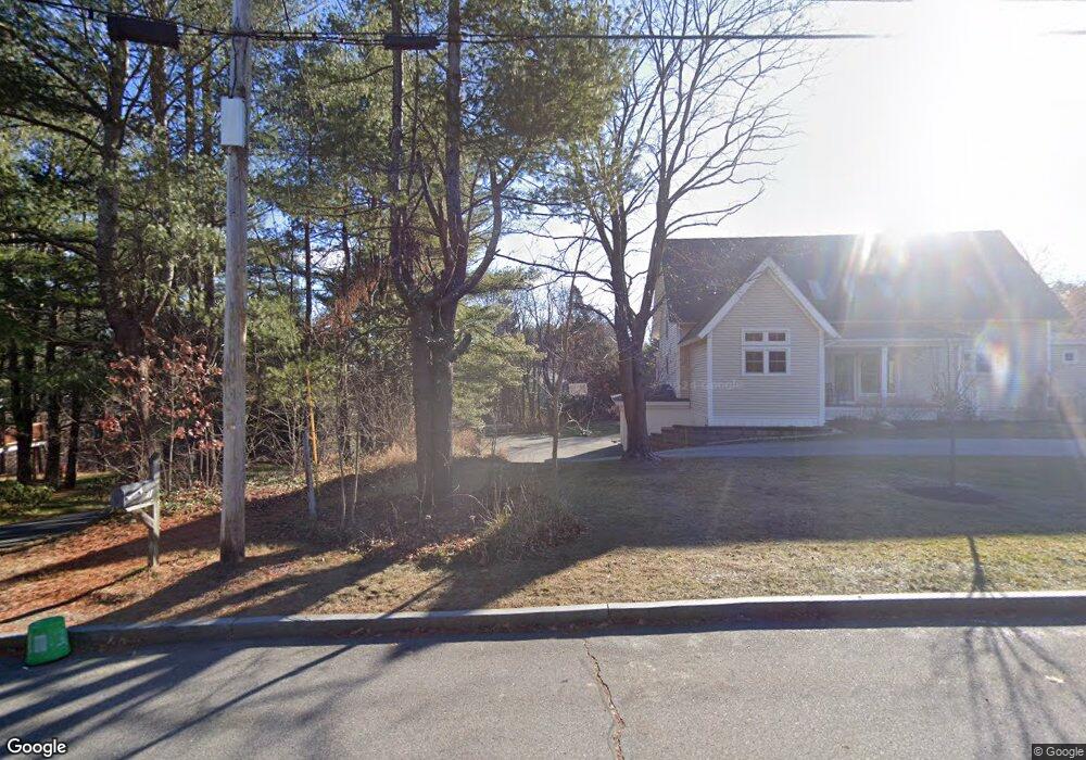
71 Stroudwater Rd Portland, ME 04102
Stroudwater NeighborhoodEstimated Value: $931,000 - $1,073,381
4
Beds
3
Baths
3,808
Sq Ft
$271/Sq Ft
Est. Value
About This Home
This home is located at 71 Stroudwater Rd, Portland, ME 04102 and is currently estimated at $1,033,845, approximately $271 per square foot. 71 Stroudwater Rd is a home located in Cumberland County with nearby schools including Amanda C Rowe School, King Middle School, and Levey Day School.
Ownership History
Date
Name
Owned For
Owner Type
Purchase Details
Closed on
Oct 17, 2024
Sold by
Burmeister Parke A and Plimpton Sarah T
Bought by
Parke A Burmeister Ret and Burmeister
Current Estimated Value
Purchase Details
Closed on
Nov 18, 2010
Sold by
Peck Ft
Bought by
Nadzo Elaine J and Nadzo Nicholas S
Home Financials for this Owner
Home Financials are based on the most recent Mortgage that was taken out on this home.
Original Mortgage
$368,000
Interest Rate
4.3%
Mortgage Type
Unknown
Create a Home Valuation Report for This Property
The Home Valuation Report is an in-depth analysis detailing your home's value as well as a comparison with similar homes in the area
Home Values in the Area
Average Home Value in this Area
Purchase History
| Date | Buyer | Sale Price | Title Company |
|---|---|---|---|
| Parke A Burmeister Ret | -- | None Available | |
| Parke A Burmeister Ret | -- | None Available | |
| Nadzo Elaine J | -- | -- | |
| Nadzo Elaine J | -- | -- |
Source: Public Records
Mortgage History
| Date | Status | Borrower | Loan Amount |
|---|---|---|---|
| Previous Owner | Nadzo Elaine J | $368,000 | |
| Previous Owner | Nadzo Elaine J | $46,000 | |
| Previous Owner | Nadzo Elaine J | $377,000 |
Source: Public Records
Tax History Compared to Growth
Tax History
| Year | Tax Paid | Tax Assessment Tax Assessment Total Assessment is a certain percentage of the fair market value that is determined by local assessors to be the total taxable value of land and additions on the property. | Land | Improvement |
|---|---|---|---|---|
| 2024 | $10,690 | $712,200 | $150,800 | $561,400 |
| 2023 | $10,263 | $712,200 | $150,800 | $561,400 |
| 2022 | $9,693 | $712,200 | $150,800 | $561,400 |
| 2021 | $9,251 | $712,200 | $150,800 | $561,400 |
| 2020 | $9,135 | $391,900 | $148,800 | $243,100 |
| 2019 | $9,135 | $391,900 | $148,800 | $243,100 |
| 2018 | $8,810 | $391,900 | $148,800 | $243,100 |
| 2017 | $8,485 | $391,900 | $148,800 | $243,100 |
| 2016 | $8,273 | $391,900 | $148,800 | $243,100 |
| 2015 | $8,085 | $391,900 | $148,800 | $243,100 |
| 2014 | $7,838 | $391,900 | $148,800 | $243,100 |
Source: Public Records
Map
Nearby Homes
- 1346 Westbrook St
- 1549 Westbrook St
- 16 Black Sparrow Dr
- 2 Firefly St Unit 303
- 63A Capisic St
- 1 Firefly St Unit 402
- 1 Firefly St Unit 201
- 1 Firefly St Unit 303
- 1 Firefly St Unit 302
- 1 Firefly St Unit 403/103
- 1 Firefly St Unit 301
- 1 Firefly St Unit 401
- 1 Firefly St Unit 403
- 1 Firefly St Unit 202
- 159 Bancroft St
- 1542 Congress St
- 89 Cobb Ave
- 155 Owls Nest Rd
- 0 Hillcrest Ave
- 149 Owls Nest Rd
- 47 Roundabout Ln
- 79 Stroudwater Rd
- 55 Stroudwater Rd
- 99 Stroudwater Rd
- 63 Stroudwater Rd
- 107 Stroudwater Rd
- 54 Penrith Rd
- 35 Roundabout Ln
- 48 Penrith Rd
- 125 Stroudwater Rd
- 54 Roundabout Ln
- 54 Stroudwater Rd
- 80 Stroudwater Rd
- 42 Penrith Rd
- 110 Stroudwater Rd
- 96 Stroudwater Rd
- 33 Stroudwater Rd
- 55 Penrith Rd
- 126 Stroudwater Rd
- 21 Roundabout Ln