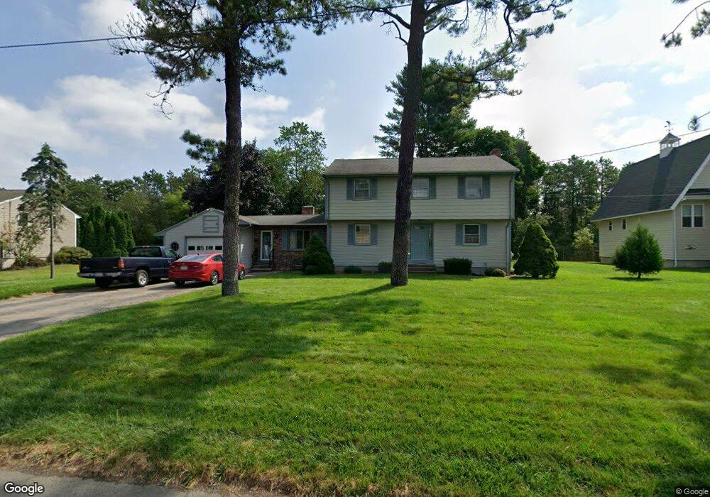
71 Willow St North Attleboro, MA 02760
North Attleboro NeighborhoodEstimated Value: $640,912 - $682,000
4
Beds
2
Baths
1,988
Sq Ft
$333/Sq Ft
Est. Value
About This Home
This home is located at 71 Willow St, North Attleboro, MA 02760 and is currently estimated at $661,978, approximately $332 per square foot. 71 Willow St is a home located in Bristol County with nearby schools including North Attleboro High School, Cadence Academy Preschool - North Attleborough, and Bishop Feehan High School.
Ownership History
Date
Name
Owned For
Owner Type
Purchase Details
Closed on
Nov 17, 2017
Sold by
Rountree John D and Rountree Karen L
Bought by
Rountree Ft
Current Estimated Value
Purchase Details
Closed on
Jan 1, 1972
Bought by
Rountree John D and Rountree Karen L
Create a Home Valuation Report for This Property
The Home Valuation Report is an in-depth analysis detailing your home's value as well as a comparison with similar homes in the area
Home Values in the Area
Average Home Value in this Area
Purchase History
| Date | Buyer | Sale Price | Title Company |
|---|---|---|---|
| Rountree Ft | -- | -- | |
| Rountree John D | -- | -- |
Source: Public Records
Mortgage History
| Date | Status | Borrower | Loan Amount |
|---|---|---|---|
| Previous Owner | Rountree John D | $10,000 |
Source: Public Records
Tax History Compared to Growth
Tax History
| Year | Tax Paid | Tax Assessment Tax Assessment Total Assessment is a certain percentage of the fair market value that is determined by local assessors to be the total taxable value of land and additions on the property. | Land | Improvement |
|---|---|---|---|---|
| 2025 | $5,666 | $480,600 | $140,400 | $340,200 |
| 2024 | $5,696 | $493,600 | $140,400 | $353,200 |
| 2023 | $5,498 | $429,900 | $140,400 | $289,500 |
| 2022 | $5,245 | $376,500 | $140,400 | $236,100 |
| 2021 | $5,233 | $366,700 | $140,400 | $226,300 |
| 2020 | $5,169 | $360,200 | $140,400 | $219,800 |
| 2019 | $4,948 | $347,500 | $127,700 | $219,800 |
| 2018 | $4,464 | $334,600 | $127,700 | $206,900 |
| 2017 | $4,423 | $334,600 | $127,700 | $206,900 |
| 2016 | $4,328 | $327,400 | $141,800 | $185,600 |
| 2015 | $4,157 | $316,400 | $141,800 | $174,600 |
| 2014 | $3,960 | $299,100 | $124,500 | $174,600 |
Source: Public Records
Map
Nearby Homes
- 16 Raymond Hall Dr
- 10 Sleepy Hollow Cir
- 11 Landry Ave
- 116 George St
- 15 Old Wood Rd
- 57 Vine St
- Lot 5 Jeffrey Dr
- 28 Messenger St
- 17 Peters Way
- Lot 2 Jeffrey Dr
- 115 Westfield Dr
- 33 Dublin Way
- 36 Cranberry Rd
- 2 George St Unit C
- 9 Sunnyside Dr Unit 9
- 166 E Bacon St Unit 4
- 47 Old Farm Rd
- 24 Red Coat Ln
- 12 Houde St
- 2 Woodridge St Unit 2