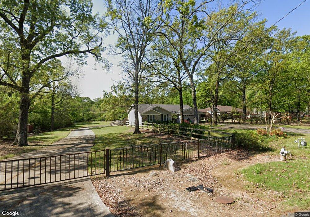
710 E Lee Ave Sherwood, AR 72120
Estimated Value: $159,860 - $186,000
--
Bed
2
Baths
1,354
Sq Ft
$131/Sq Ft
Est. Value
About This Home
This home is located at 710 E Lee Ave, Sherwood, AR 72120 and is currently estimated at $177,965, approximately $131 per square foot. 710 E Lee Ave is a home located in Pulaski County with nearby schools including Sherwood Elementary School, Sylvan Hills Middle School, and Sylvan Hills High School.
Ownership History
Date
Name
Owned For
Owner Type
Purchase Details
Closed on
Mar 1, 2001
Sold by
Krain Ben H and Krain Summer
Bought by
Beard Ray Edward and Beard Virginia Suzanne
Current Estimated Value
Home Financials for this Owner
Home Financials are based on the most recent Mortgage that was taken out on this home.
Original Mortgage
$84,245
Outstanding Balance
$30,681
Interest Rate
7.19%
Mortgage Type
FHA
Estimated Equity
$147,284
Purchase Details
Closed on
May 22, 1998
Sold by
Thielking Cynthia Brooks Crittenden and Thielking Frank
Bought by
Krain Mark and Krain Doris
Home Financials for this Owner
Home Financials are based on the most recent Mortgage that was taken out on this home.
Original Mortgage
$65,200
Interest Rate
6.84%
Mortgage Type
Purchase Money Mortgage
Create a Home Valuation Report for This Property
The Home Valuation Report is an in-depth analysis detailing your home's value as well as a comparison with similar homes in the area
Home Values in the Area
Average Home Value in this Area
Purchase History
| Date | Buyer | Sale Price | Title Company |
|---|---|---|---|
| Beard Ray Edward | -- | Stewart Title | |
| Beard Ray Edward | $90,000 | Stewart Title | |
| Krain Mark | $82,000 | American Abstract & Title Co |
Source: Public Records
Mortgage History
| Date | Status | Borrower | Loan Amount |
|---|---|---|---|
| Open | Beard Ray Edward | $84,245 | |
| Previous Owner | Krain Mark | $65,200 |
Source: Public Records
Tax History Compared to Growth
Tax History
| Year | Tax Paid | Tax Assessment Tax Assessment Total Assessment is a certain percentage of the fair market value that is determined by local assessors to be the total taxable value of land and additions on the property. | Land | Improvement |
|---|---|---|---|---|
| 2025 | $1,319 | $25,323 | $1,288 | $24,035 |
| 2024 | $1,289 | $25,323 | $1,288 | $24,035 |
| 2023 | $1,289 | $25,323 | $1,288 | $24,035 |
| 2022 | $1,386 | $25,323 | $1,288 | $24,035 |
| 2021 | $1,288 | $22,500 | $4,400 | $18,100 |
| 2020 | $907 | $22,500 | $4,400 | $18,100 |
| 2019 | $907 | $22,500 | $4,400 | $18,100 |
| 2018 | $932 | $22,500 | $4,400 | $18,100 |
| 2017 | $917 | $22,500 | $4,400 | $18,100 |
| 2016 | $969 | $23,500 | $7,000 | $16,500 |
| 2015 | $1,192 | $23,500 | $7,000 | $16,500 |
| 2014 | $1,192 | $23,464 | $7,000 | $16,464 |
Source: Public Records
Map
Nearby Homes
- 701 Club Rd
- 8320 Holiday Dr
- 208 E Kiehl Ave Unit out parcel
- 4636 Brandywine Cove
- 135 W Lee Ave
- 8602 Patricia Lynn Ln
- 00 E Kiehl Ave
- 125 Almond Cove
- 7625 Highway 107
- 1109 Brice Rd
- 8000 Pinto Trail
- 11 Daniel Dr
- 8109 Oak Ridge Rd
- 9125 Woodbine St
- 4690 Hollyridge Cove
- 59 Wesley Dr
- 6 Ridgewell Ct
- 9016 Wilhite Ln
- 8921 Claremont Ave
- 8218 Park Ave