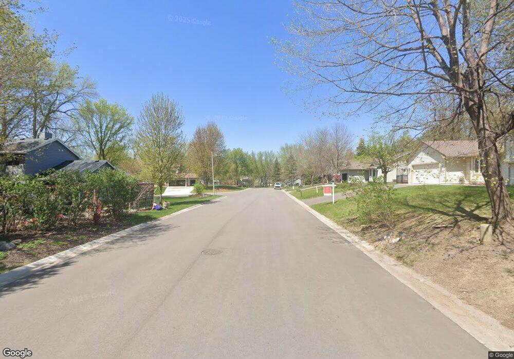
711 10th St S Delano, MN 55328
Estimated Value: $360,000 - $406,000
4
Beds
2
Baths
1,952
Sq Ft
$200/Sq Ft
Est. Value
About This Home
This home is located at 711 10th St S, Delano, MN 55328 and is currently estimated at $389,531, approximately $199 per square foot. 711 10th St S is a home located in Wright County with nearby schools including Delano Elementary School, Delano Middle School, and Delano Senior High School.
Ownership History
Date
Name
Owned For
Owner Type
Purchase Details
Closed on
Sep 22, 2021
Sold by
Mielke Candace J and Mielke Michael J
Bought by
Costa Jerry A
Current Estimated Value
Home Financials for this Owner
Home Financials are based on the most recent Mortgage that was taken out on this home.
Original Mortgage
$289,500
Outstanding Balance
$263,423
Interest Rate
2.8%
Mortgage Type
New Conventional
Estimated Equity
$126,108
Create a Home Valuation Report for This Property
The Home Valuation Report is an in-depth analysis detailing your home's value as well as a comparison with similar homes in the area
Home Values in the Area
Average Home Value in this Area
Purchase History
| Date | Buyer | Sale Price | Title Company |
|---|---|---|---|
| Costa Jerry A | $336,500 | Watermark Title Agcy Qualia | |
| Costa Jerry Jerry | $336,500 | -- |
Source: Public Records
Mortgage History
| Date | Status | Borrower | Loan Amount |
|---|---|---|---|
| Open | Costa Jerry A | $289,500 | |
| Closed | Costa Jerry Jerry | $289,500 |
Source: Public Records
Tax History Compared to Growth
Tax History
| Year | Tax Paid | Tax Assessment Tax Assessment Total Assessment is a certain percentage of the fair market value that is determined by local assessors to be the total taxable value of land and additions on the property. | Land | Improvement |
|---|---|---|---|---|
| 2025 | $4,178 | $367,300 | $74,000 | $293,300 |
| 2024 | $4,236 | $357,600 | $77,000 | $280,600 |
| 2023 | $4,232 | $368,900 | $77,000 | $291,900 |
| 2022 | $3,108 | $339,800 | $73,500 | $266,300 |
| 2021 | $2,910 | $228,900 | $51,500 | $177,400 |
| 2020 | $2,956 | $214,500 | $46,500 | $168,000 |
| 2019 | $2,908 | $208,900 | $0 | $0 |
| 2018 | $2,720 | $181,200 | $0 | $0 |
| 2017 | $2,454 | $167,900 | $0 | $0 |
| 2016 | $2,434 | $0 | $0 | $0 |
| 2015 | $1,900 | $0 | $0 | $0 |
| 2014 | -- | $0 | $0 | $0 |
Source: Public Records
Map
Nearby Homes
- 1216 Northwood Dr
- 986 Eastwood Cir
- 1401 Woods Creek Dr
- 1157 Woods Creek Dr
- 916 Big Woods Dr
- 1257 Willowbrook Cir
- 1234 Willowbrook Cir
- 932 Crossing Way
- 1170 Woods Creek Dr S
- 257 6th St NW
- 897 Big Woods Dr
- 899 Big Woods Dr
- 1192 Woods Creek Dr
- 978 Big Woods Dr
- 986 Big Woods Dr
- 1198 Woods Creek Dr S
- 9560 Us Highway 12
- 1141 Woods Creek Dr S
- 428 Saint Peter Ave E
- xxxx Lincoln St
- 707 10th St S
- 904 Maplewood Dr
- 900 Maplewood Dr
- 901 Northwood Dr
- 710 10th St S
- 706 10th St S
- 1004 Maplewood Dr
- 817 Northwood Dr
- 816 Maplewood Dr
- 906 Northwood Dr
- 902 Northwood Dr
- 801 10th St S
- 910 Northwood Dr
- 901 Maplewood Dr
- 802 10th St S
- 802 802 10th-Street-s
- 1008 Maplewood Dr
- 1000 Northwood Dr
- 1003 Northwood Dr
- 812 Maplewood Dr
