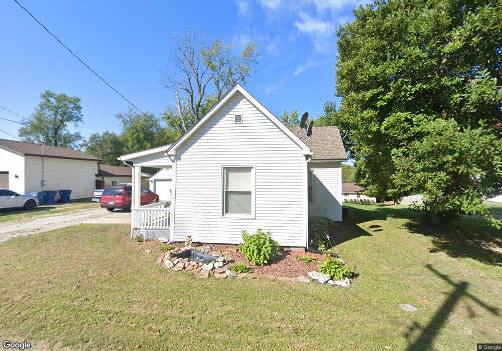
711 Strong Ave Collinsville, IL 62234
Estimated Value: $109,000 - $162,000
3
Beds
1
Bath
1,135
Sq Ft
$122/Sq Ft
Est. Value
About This Home
This home is located at 711 Strong Ave, Collinsville, IL 62234 and is currently estimated at $138,651, approximately $122 per square foot. 711 Strong Ave is a home located in Madison County with nearby schools including John A Renfro Elementary School, Dorris Intermediate School, and Collinsville Middle School.
Ownership History
Date
Name
Owned For
Owner Type
Purchase Details
Closed on
Mar 6, 2003
Sold by
Bandy Francis H and Bandy Shirley E
Bought by
Buxton Sharon K
Current Estimated Value
Home Financials for this Owner
Home Financials are based on the most recent Mortgage that was taken out on this home.
Original Mortgage
$41,000
Interest Rate
6.7%
Mortgage Type
Purchase Money Mortgage
Create a Home Valuation Report for This Property
The Home Valuation Report is an in-depth analysis detailing your home's value as well as a comparison with similar homes in the area
Home Values in the Area
Average Home Value in this Area
Purchase History
| Date | Buyer | Sale Price | Title Company |
|---|---|---|---|
| Buxton Sharon K | -- | Abstracts & Titles Inc |
Source: Public Records
Mortgage History
| Date | Status | Borrower | Loan Amount |
|---|---|---|---|
| Closed | Buxton Sharon K | $41,000 |
Source: Public Records
Tax History Compared to Growth
Tax History
| Year | Tax Paid | Tax Assessment Tax Assessment Total Assessment is a certain percentage of the fair market value that is determined by local assessors to be the total taxable value of land and additions on the property. | Land | Improvement |
|---|---|---|---|---|
| 2024 | $2,639 | $41,280 | $4,780 | $36,500 |
| 2023 | $2,639 | $38,200 | $4,420 | $33,780 |
| 2022 | $2,514 | $34,300 | $3,960 | $30,340 |
| 2021 | $2,226 | $32,220 | $3,720 | $28,500 |
| 2020 | $2,146 | $30,740 | $3,550 | $27,190 |
| 2019 | $2,089 | $29,690 | $3,430 | $26,260 |
| 2018 | $1,794 | $24,710 | $3,570 | $21,140 |
| 2017 | $1,797 | $24,220 | $3,500 | $20,720 |
| 2016 | $1,893 | $24,220 | $3,500 | $20,720 |
| 2015 | $1,766 | $23,590 | $3,410 | $20,180 |
| 2014 | $1,766 | $23,590 | $3,410 | $20,180 |
| 2013 | $1,766 | $23,590 | $3,410 | $20,180 |
Source: Public Records
Map
Nearby Homes
- 0 Strong Ave
- 123 Elliot St
- 123 W Wickliffe Ave
- 617 N Morrison Ave
- 580 N Guernsey St
- 510 N Combs Ave
- 308 Brown Ave
- 1224 Cedar Ridge Ct
- 5 Brookwood Dr
- 0 Elm St
- 22 Brookwood Dr
- 300 N Combs Ave
- 419 Bell St
- 1120 Williams St
- 1210 Constance St
- 221 N Hesperia St Unit 221 A and 221 B
- 501 Spring
- 414 Bunker Hill Dr
- 506 W Clay St
- 1121 Carraway Ct
- 705 Strong Ave
- 715 Strong Ave
- 215 W Lincoln St
- 24118 W Park Ave
- 701 Strong Ave
- 717 Strong Ave
- 210 W Park Ave
- 205 W Lincoln St
- 801 Strong Ave
- 815 Hadley St
- 803 Strong Ave
- 201 W Lincoln St
- 209 W Park Ave
- 235 W Park Ave
- 313 Garnet St
- 214 W Lincoln St
- 216 W Lincoln St
- 0 Hadley St
- 312 W Juda Ave
- 211 W Lincoln St