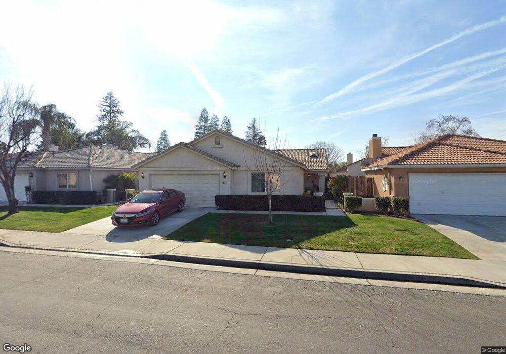
7111 Silver Spray Ave Bakersfield, CA 93313
Silver Creek NeighborhoodEstimated Value: $332,506 - $383,000
4
Beds
2
Baths
1,502
Sq Ft
$236/Sq Ft
Est. Value
About This Home
This home is located at 7111 Silver Spray Ave, Bakersfield, CA 93313 and is currently estimated at $354,127, approximately $235 per square foot. 7111 Silver Spray Ave is a home located in Kern County with nearby schools including Donald E. Suburu School, General Shafter Elementary School, and Independence High School.
Ownership History
Date
Name
Owned For
Owner Type
Purchase Details
Closed on
Jun 13, 2002
Sold by
G W Homes Inc
Bought by
Metcalf John O and Metcalf Judith L
Current Estimated Value
Home Financials for this Owner
Home Financials are based on the most recent Mortgage that was taken out on this home.
Original Mortgage
$129,534
Interest Rate
6.74%
Mortgage Type
VA
Purchase Details
Closed on
Nov 27, 2001
Sold by
Castle & Cooke California Inc
Bought by
G W Homes Inc
Home Financials for this Owner
Home Financials are based on the most recent Mortgage that was taken out on this home.
Original Mortgage
$14,250
Interest Rate
6.63%
Mortgage Type
Purchase Money Mortgage
Create a Home Valuation Report for This Property
The Home Valuation Report is an in-depth analysis detailing your home's value as well as a comparison with similar homes in the area
Home Values in the Area
Average Home Value in this Area
Purchase History
| Date | Buyer | Sale Price | Title Company |
|---|---|---|---|
| Metcalf John O | $127,000 | Fidelity National Title Co | |
| G W Homes Inc | -- | American Title Co |
Source: Public Records
Mortgage History
| Date | Status | Borrower | Loan Amount |
|---|---|---|---|
| Previous Owner | Metcalf John O | $129,534 | |
| Previous Owner | G W Homes Inc | $14,250 |
Source: Public Records
Tax History Compared to Growth
Tax History
| Year | Tax Paid | Tax Assessment Tax Assessment Total Assessment is a certain percentage of the fair market value that is determined by local assessors to be the total taxable value of land and additions on the property. | Land | Improvement |
|---|---|---|---|---|
| 2025 | $2,757 | $187,594 | $36,921 | $150,673 |
| 2024 | $2,691 | $183,917 | $36,198 | $147,719 |
| 2023 | $2,691 | $180,312 | $35,489 | $144,823 |
| 2022 | $2,627 | $176,778 | $34,794 | $141,984 |
| 2021 | $2,528 | $173,312 | $34,112 | $139,200 |
| 2020 | $2,544 | $171,536 | $33,763 | $137,773 |
| 2019 | $2,371 | $171,536 | $33,763 | $137,773 |
| 2018 | $2,362 | $164,876 | $32,452 | $132,424 |
| 2017 | $2,333 | $161,644 | $31,816 | $129,828 |
| 2016 | $2,200 | $158,476 | $31,193 | $127,283 |
| 2015 | $2,192 | $156,097 | $30,725 | $125,372 |
| 2014 | $2,156 | $153,041 | $30,124 | $122,917 |
Source: Public Records
Map
Nearby Homes
- 6930 Water Wheel Dr
- 5000 Rogue Water Ct
- 4825 Shadow Stone St
- 7507 Hidden Bridge Dr
- 5417 Sierra Caves Ave
- 7511 Stone Breakers Ave
- 5315 Silvergate St
- 5123 Shadow Lake Dr
- 6709 Tenstrike Dr
- 7415 Canyon Clover Dr
- 5510 Stillwater Dr
- 5621 Greenhorn Mountain Ct
- 6213 Key Dr W
- 5816 Greenhorn Mountain Ct Unit E
- 5825 Sky Lakes Ave
- 5717 Arc Dome Ave
- 7000 Iberia Ct
- 5912 Arc Dome Ave
- 6901 Shelby Loop
- 6005 Indian Peaks Ave
- 7115 Silver Spray Ave
- 7107 Silver Spray Ave
- 7119 Silver Spray Ave
- 7103 Silver Spray Ave
- 7106 Rogue River Dr
- 7110 Rogue River Dr
- 7123 Silver Spray Ave
- 7015 Silver Spray Ave
- 7110 Silver Spray Ave
- 7106 Silver Spray Ave
- 7114 Silver Spray Ave
- 7102 Silver Spray Ave
- 7114 Rogue River Dr
- 7201 Silver Spray Ave
- 7012 Silver Spray Ave
- 7001 Silver Spray Ave
- 7118 Rogue River Dr
- 7122 Silver Spray Ave
- 7008 Silver Spray Ave
- 5001 Wild Song Ct