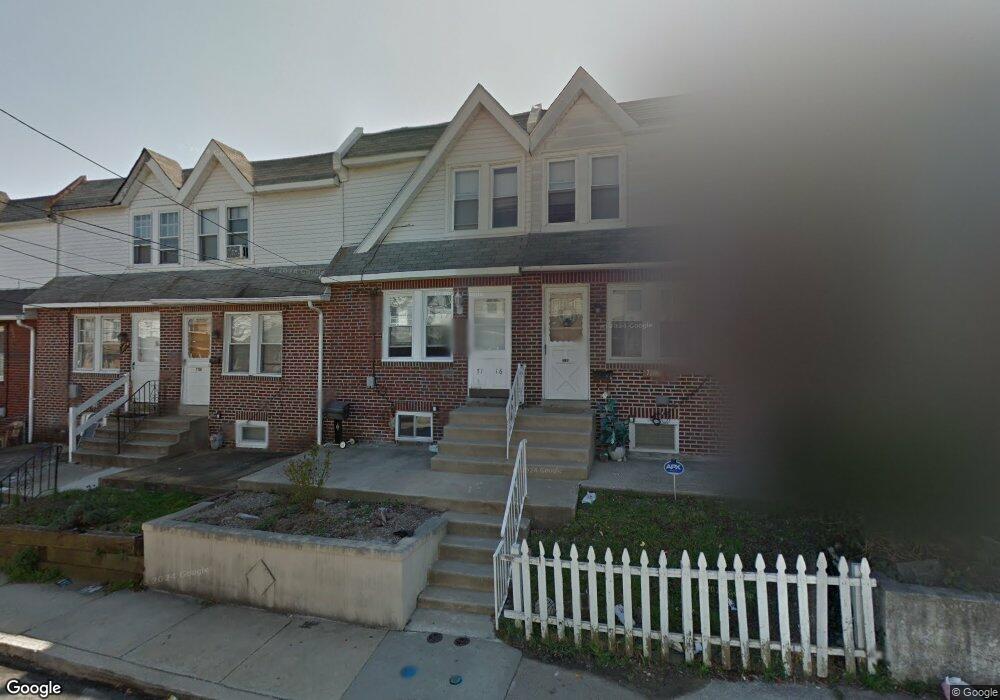
7116 Seaford Rd Upper Darby, PA 19082
Estimated Value: $128,000 - $149,000
2
Beds
1
Bath
996
Sq Ft
$136/Sq Ft
Est. Value
About This Home
This home is located at 7116 Seaford Rd, Upper Darby, PA 19082 and is currently estimated at $135,499, approximately $136 per square foot. 7116 Seaford Rd is a home located in Delaware County with nearby schools including Upper Darby High School, Vision Academy Charter School, and Lansdowne Friends School.
Ownership History
Date
Name
Owned For
Owner Type
Purchase Details
Closed on
Jan 25, 2005
Sold by
Stroh James M and Sinchi Marco
Bought by
Morrow Michael D
Current Estimated Value
Home Financials for this Owner
Home Financials are based on the most recent Mortgage that was taken out on this home.
Original Mortgage
$68,400
Outstanding Balance
$34,949
Interest Rate
5.83%
Mortgage Type
Fannie Mae Freddie Mac
Estimated Equity
$100,550
Purchase Details
Closed on
Jul 7, 2004
Sold by
Bristow Sandra
Bought by
Stroh James M and Sinchi Marco
Home Financials for this Owner
Home Financials are based on the most recent Mortgage that was taken out on this home.
Original Mortgage
$26,666
Interest Rate
6.28%
Mortgage Type
Fannie Mae Freddie Mac
Create a Home Valuation Report for This Property
The Home Valuation Report is an in-depth analysis detailing your home's value as well as a comparison with similar homes in the area
Home Values in the Area
Average Home Value in this Area
Purchase History
| Date | Buyer | Sale Price | Title Company |
|---|---|---|---|
| Morrow Michael D | $72,000 | -- | |
| Stroh James M | $33,333 | -- |
Source: Public Records
Mortgage History
| Date | Status | Borrower | Loan Amount |
|---|---|---|---|
| Open | Morrow Michael D | $68,400 | |
| Previous Owner | Stroh James M | $26,666 |
Source: Public Records
Tax History Compared to Growth
Tax History
| Year | Tax Paid | Tax Assessment Tax Assessment Total Assessment is a certain percentage of the fair market value that is determined by local assessors to be the total taxable value of land and additions on the property. | Land | Improvement |
|---|---|---|---|---|
| 2025 | $2,787 | $65,900 | $13,490 | $52,410 |
| 2024 | $2,787 | $65,900 | $13,490 | $52,410 |
| 2023 | $2,761 | $65,900 | $13,490 | $52,410 |
| 2022 | $2,687 | $65,900 | $13,490 | $52,410 |
| 2021 | $3,622 | $65,900 | $13,490 | $52,410 |
| 2020 | $2,894 | $44,740 | $12,260 | $32,480 |
| 2019 | $2,843 | $44,740 | $12,260 | $32,480 |
| 2018 | $2,811 | $44,740 | $0 | $0 |
| 2017 | $2,737 | $44,740 | $0 | $0 |
| 2016 | $246 | $44,740 | $0 | $0 |
| 2015 | $246 | $44,740 | $0 | $0 |
| 2014 | $246 | $44,740 | $0 | $0 |
Source: Public Records
Map
Nearby Homes
- 7123 Seaford Rd
- 7129 Seaford Rd
- 7026 Atlantic Ave
- 726 Copley Rd
- 7000 Greenwood Ave
- 7162 Radbourne Rd
- 7046 Radbourne Rd
- 7155 Radbourne Rd
- 7042 Clinton Rd
- 6858 Clover Ln
- 6997 Guilford Rd
- 669 Long Ln
- 7216 Clinton Rd
- 607 Littlecroft Rd
- 7229 Clinton Rd
- 608 Pembroke Ave
- 703 Briarcliff Rd
- 558 Snowden Rd
- 540 Snowden Rd
- 7154 Ruskin Ln
- 7118 Seaford Rd
- 7120 Seaford Rd
- 7112 Seaford Rd
- 7124 Seaford Ave
- 7122 Seaford Rd
- 7110 Seaford Rd
- 7117 Emerson Ave
- 7115 Emerson Ave
- 7119 Emerson Ave
- 7108 Seaford Rd
- 7113 Emerson Ave
- 7121 Emerson Ave
- 7126 Seaford Rd
- 7111 Emerson Ave
- 7106 Seaford Rd
- 7123 Emerson Ave
- 7109 Emerson Ave
- 7128 Seaford Rd
- 7125 Emerson Ave
- 7104 Seaford Rd