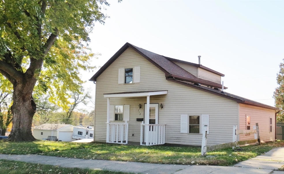
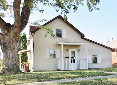
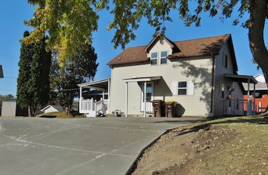
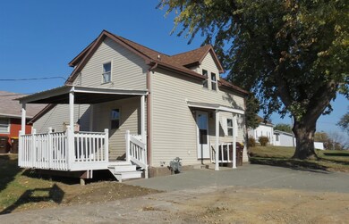
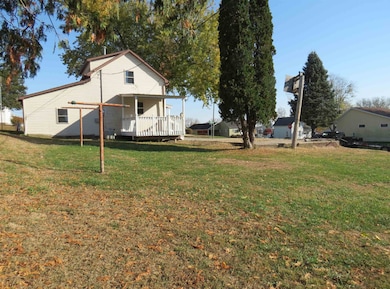
712 S 2nd St Maquoketa, IA 52060
Estimated payment $806/month
Highlights
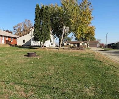
- City View
- Porch
- Forced Air Heating and Cooling System
- Deck
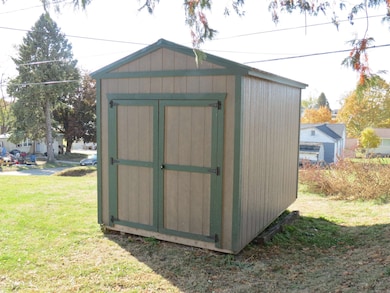
- Shed
About This Home
Great starter home or investment opportunity with many improvements, is move in ready. 4 BR, 1 BA, main floor laundry, shed, covered deck. Updates include bathroom, flooring, water heater, roof, newer furnace/AC, windows, smoke alarms, paint, driveway, interior doors, exterior lights. Refrigerator included. Take a look at this affordable home today!
Home Details
Home Type
- Single Family
Est. Annual Taxes
- $929
Year Built
- Built in 1880
Lot Details
- 7,841 Sq Ft Lot
- Lot Dimensions are 60 x 128
Home Design
- Stone Foundation
- Composition Shingle Roof
- Vinyl Siding
Interior Spaces
- 1.5-Story Property
- City Views
- Partial Basement
- Microwave
- Laundry on main level
Bedrooms and Bathrooms
- 1 Full Bathroom
Outdoor Features
- Deck
- Shed
- Porch
Utilities
- Forced Air Heating and Cooling System
- Gas Available
Listing and Financial Details
- Assessor Parcel Number 821725229041000
Map
Home Values in the Area
Average Home Value in this Area
Tax History
| Year | Tax Paid | Tax Assessment Tax Assessment Total Assessment is a certain percentage of the fair market value that is determined by local assessors to be the total taxable value of land and additions on the property. | Land | Improvement |
|---|---|---|---|---|
| 2025 | $928 | $79,100 | $13,800 | $65,300 |
| 2024 | $928 | $58,500 | $10,700 | $47,800 |
| 2023 | $942 | $58,500 | $10,700 | $47,800 |
| 2022 | $908 | $48,500 | $10,700 | $37,800 |
| 2021 | $914 | $48,500 | $10,700 | $37,800 |
| 2020 | $914 | $47,000 | $10,700 | $36,300 |
| 2019 | $808 | $41,800 | $0 | $0 |
| 2018 | $768 | $41,800 | $0 | $0 |
| 2017 | $850 | $44,700 | $0 | $0 |
| 2016 | $818 | $44,700 | $0 | $0 |
| 2015 | $818 | $44,700 | $0 | $0 |
| 2014 | $860 | $44,700 | $0 | $0 |
Property History
| Date | Event | Price | List to Sale | Price per Sq Ft |
|---|---|---|---|---|
| 11/05/2025 11/05/25 | For Sale | $139,000 | -- | $103 / Sq Ft |
Purchase History
| Date | Type | Sale Price | Title Company |
|---|---|---|---|
| Special Warranty Deed | $30,000 | Direct Title Insurance Agenc | |
| Sheriffs Deed | $44,000 | None Available | |
| Interfamily Deed Transfer | -- | None Available |
Mortgage History
| Date | Status | Loan Amount | Loan Type |
|---|---|---|---|
| Previous Owner | $65,000 | New Conventional |
Source: East Central Iowa Association of REALTORS®
MLS Number: 153424
APN: 821725229041000
Disclaimer: Certain information contained herein is derived from information provided by parties other than Homes.com. All information provided is deemed reliable, but is not guaranteed to be accurate and should be independently verified.
![]() IDX information is provided exclusively for personal, non-commercial use, and may not be used for any purpose other than to identify prospective properties consumers may be interested in purchasing. Information is deemed reliable but not guaranteed.
IDX information is provided exclusively for personal, non-commercial use, and may not be used for any purpose other than to identify prospective properties consumers may be interested in purchasing. Information is deemed reliable but not guaranteed.
- 108 W Monroe St
- 407 S Niagara St
- 313 S 4th St
- 309 S Vermont St
- 302 E Maple St
- 210 S 2nd St
- 401-435 Forest Dr
- 401-435 Forest Dr Unit Meadow Park Subdivis
- 0 Nairn Dr Unit 153479
- 124 E Platt St
- 107 N Otto St
- Lot 2 Timber Dr
- Lot 3 Timber Dr
- Lot 1 Timber Dr
- 413 Rosemere Ln
- 318 N Main St
- 309 Rosemere Ln
- 706 Myatt Dr Unit A & B
- 202 W Apple St
- 1005 German St
