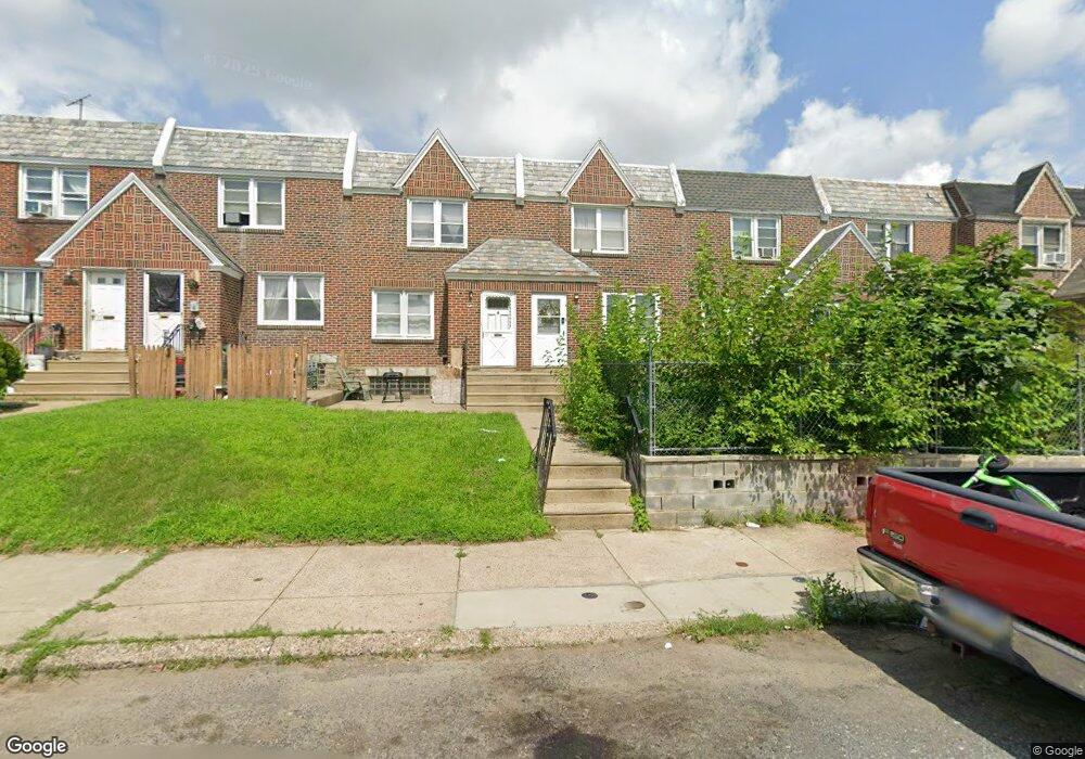
7126 Horrocks St Philadelphia, PA 19149
Castor Gardens NeighborhoodEstimated Value: $219,000 - $241,000
3
Beds
1
Bath
1,176
Sq Ft
$197/Sq Ft
Est. Value
About This Home
This home is located at 7126 Horrocks St, Philadelphia, PA 19149 and is currently estimated at $231,857, approximately $197 per square foot. 7126 Horrocks St is a home located in Philadelphia County with nearby schools including Solomon Solis-Cohen School, Castor Gardens Middle School, and Northeast High School.
Ownership History
Date
Name
Owned For
Owner Type
Purchase Details
Closed on
May 19, 2017
Sold by
Lye Hazel Thandar and Lye Cindy Thuzar
Bought by
Swin Ko and Swin Khin
Current Estimated Value
Purchase Details
Closed on
Aug 24, 2012
Bought by
Lye Hazel Thandar and Lye Cindy Thuzar
Purchase Details
Closed on
Nov 9, 2009
Sold by
Lye Steven K
Bought by
Thuzar Kyaw Moe Thandar and Thuzar Kyaw Moe
Purchase Details
Closed on
Jul 26, 1996
Sold by
Seabra Antonio S and Seabra Hope M
Bought by
Lye Steven K
Create a Home Valuation Report for This Property
The Home Valuation Report is an in-depth analysis detailing your home's value as well as a comparison with similar homes in the area
Home Values in the Area
Average Home Value in this Area
Purchase History
| Date | Buyer | Sale Price | Title Company |
|---|---|---|---|
| Swin Ko | $100,000 | Statewide Abstract Group Inc | |
| Lye Hazel Thandar | -- | -- | |
| Thuzar Kyaw Moe Thandar | $100,000 | Accommodation | |
| Lye Steven K | $70,000 | -- |
Source: Public Records
Tax History Compared to Growth
Tax History
| Year | Tax Paid | Tax Assessment Tax Assessment Total Assessment is a certain percentage of the fair market value that is determined by local assessors to be the total taxable value of land and additions on the property. | Land | Improvement |
|---|---|---|---|---|
| 2025 | $2,697 | $232,000 | $46,400 | $185,600 |
| 2024 | $2,697 | $232,000 | $46,400 | $185,600 |
| 2023 | $2,697 | $192,700 | $38,540 | $154,160 |
| 2022 | $2,068 | $147,700 | $38,540 | $109,160 |
| 2021 | $1,907 | $0 | $0 | $0 |
| 2020 | $1,907 | $0 | $0 | $0 |
| 2019 | $1,830 | $0 | $0 | $0 |
| 2018 | $1,279 | $0 | $0 | $0 |
| 2017 | $1,699 | $0 | $0 | $0 |
| 2016 | $1,279 | $0 | $0 | $0 |
| 2015 | -- | $0 | $0 | $0 |
| 2014 | -- | $121,400 | $20,613 | $100,787 |
| 2012 | -- | $15,584 | $1,623 | $13,961 |
Source: Public Records
Map
Nearby Homes
- 7123 Souder St
- 7231 Eastwood St
- 7247 Eastwood St
- 7034 Souder St
- 7039 Kindred St
- 7155 Saul St
- 7153 Saul St
- 7219 Rutland St
- 7050 Lynford St
- 7123 Castor Ave
- 7214 Bradford St
- 2105 Friendship St
- 7035 Rutland St
- 7019 Rutland St
- 7223 Hanford St
- 2140 Princeton Ave
- 1405 Saint Vincent St
- 2162 Princeton Ave
- 1403 Englewood St
- 7204 Rupert St
- 7128 Horrocks St
- 7130 Horrocks St
- 7124 Horrocks St
- 7132 Horrocks St
- 7122 Horrocks St
- 7134 Horrocks St
- 7136 Horrocks St
- 7120 Horrocks St
- 7138 Horrocks St
- 7129 Souder St
- 7125 Souder St
- 7127 Souder St
- 7131 Souder St
- 7140 Horrocks St
- 7121 Souder St
- 7133 Souder St
- 7135 Souder St
- 7142 Horrocks St
- 7119 Souder St
- 7137 Souder St