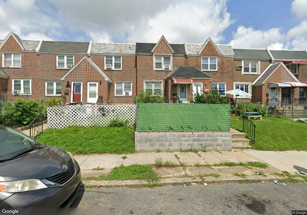
7132 Horrocks St Philadelphia, PA 19149
Castor Gardens NeighborhoodEstimated Value: $230,691 - $244,000
3
Beds
1
Bath
1,176
Sq Ft
$204/Sq Ft
Est. Value
About This Home
This home is located at 7132 Horrocks St, Philadelphia, PA 19149 and is currently estimated at $240,173, approximately $204 per square foot. 7132 Horrocks St is a home located in Philadelphia County with nearby schools including Solomon Solis-Cohen School, Castor Gardens Middle School, and Northeast High School.
Ownership History
Date
Name
Owned For
Owner Type
Purchase Details
Closed on
May 9, 2025
Sold by
Deli Hong and Lu Lie
Bought by
Lee Jonathan
Current Estimated Value
Purchase Details
Closed on
Sep 28, 2007
Sold by
Tsvilikhovskiy Semen and Tsvilikhovskiy Galina
Bought by
Lu Lie
Purchase Details
Closed on
Feb 25, 2000
Sold by
Matlis Michael and Matlis Lina Amanda
Bought by
Tsvilikhovskiy Semen and Tsvilikhovskiy Galina
Home Financials for this Owner
Home Financials are based on the most recent Mortgage that was taken out on this home.
Original Mortgage
$58,125
Interest Rate
8.21%
Mortgage Type
Stand Alone First
Create a Home Valuation Report for This Property
The Home Valuation Report is an in-depth analysis detailing your home's value as well as a comparison with similar homes in the area
Home Values in the Area
Average Home Value in this Area
Purchase History
| Date | Buyer | Sale Price | Title Company |
|---|---|---|---|
| Lee Jonathan | -- | None Listed On Document | |
| Lu Lie | $139,000 | None Available | |
| Tsvilikhovskiy Semen | $62,000 | Lawyers Title Insurance Co |
Source: Public Records
Mortgage History
| Date | Status | Borrower | Loan Amount |
|---|---|---|---|
| Previous Owner | Tsvilikhovskiy Semen | $58,125 |
Source: Public Records
Tax History Compared to Growth
Tax History
| Year | Tax Paid | Tax Assessment Tax Assessment Total Assessment is a certain percentage of the fair market value that is determined by local assessors to be the total taxable value of land and additions on the property. | Land | Improvement |
|---|---|---|---|---|
| 2025 | $2,697 | $232,000 | $46,400 | $185,600 |
| 2024 | $2,697 | $232,000 | $46,400 | $185,600 |
| 2023 | $2,697 | $192,700 | $38,540 | $154,160 |
| 2022 | $2,068 | $147,700 | $38,540 | $109,160 |
| 2021 | $1,907 | $0 | $0 | $0 |
| 2020 | $1,907 | $0 | $0 | $0 |
| 2019 | $1,830 | $0 | $0 | $0 |
| 2018 | $1,830 | $0 | $0 | $0 |
| 2017 | $1,699 | $0 | $0 | $0 |
| 2016 | -- | $0 | $0 | $0 |
| 2015 | -- | $0 | $0 | $0 |
| 2014 | -- | $121,400 | $20,664 | $100,736 |
| 2012 | -- | $15,584 | $1,623 | $13,961 |
Source: Public Records
Map
Nearby Homes
- 7123 Souder St
- 7231 Eastwood St
- 7247 Eastwood St
- 7034 Souder St
- 7039 Kindred St
- 7155 Saul St
- 7153 Saul St
- 7219 Rutland St
- 7050 Lynford St
- 7123 Castor Ave
- 7214 Bradford St
- 2105 Friendship St
- 7035 Rutland St
- 7019 Rutland St
- 7223 Hanford St
- 2140 Princeton Ave
- 1405 Saint Vincent St
- 2162 Princeton Ave
- 1403 Englewood St
- 7204 Rupert St
- 7130 Horrocks St
- 7134 Horrocks St
- 7128 Horrocks St
- 7136 Horrocks St
- 7126 Horrocks St
- 7138 Horrocks St
- 7124 Horrocks St
- 7140 Horrocks St
- 7122 Horrocks St
- 7142 Horrocks St
- 7129 Souder St
- 7131 Souder St
- 7135 Souder St
- 7133 Souder St
- 7127 Souder St
- 7125 Souder St
- 7144 Horrocks St
- 7137 Souder St
- 7120 Horrocks St
- 7139 Souder St