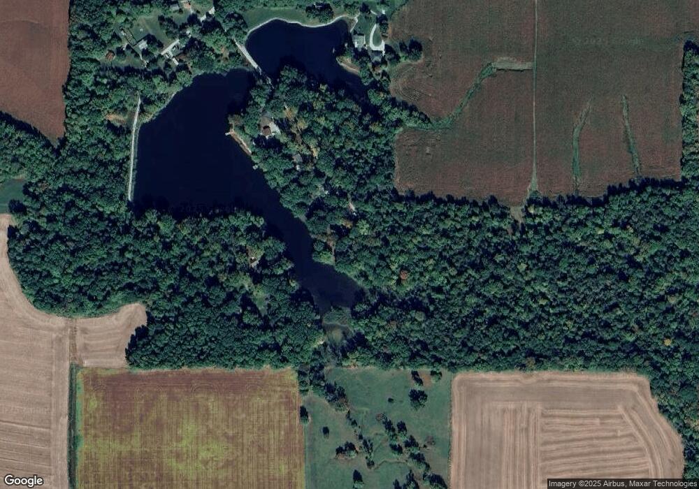
7132 N Upper Lake Dr Martinsville, IN 46151
Estimated Value: $192,620 - $237,000
3
Beds
1
Bath
1,096
Sq Ft
$198/Sq Ft
Est. Value
About This Home
This home is located at 7132 N Upper Lake Dr, Martinsville, IN 46151 and is currently estimated at $216,655, approximately $197 per square foot. 7132 N Upper Lake Dr is a home with nearby schools including Martinsville High School.
Ownership History
Date
Name
Owned For
Owner Type
Purchase Details
Closed on
Apr 25, 2018
Sold by
Gagnon Judith A
Bought by
Parrish Tricia D
Current Estimated Value
Purchase Details
Closed on
Dec 27, 2012
Sold by
Gagnon Judith A
Bought by
Parrish Tricia D
Home Financials for this Owner
Home Financials are based on the most recent Mortgage that was taken out on this home.
Original Mortgage
$64,000
Interest Rate
4.4%
Mortgage Type
FHA
Purchase Details
Closed on
Apr 23, 2010
Sold by
Gagnon Judith A
Bought by
Gagnon Judith A and Parrish Tricia D
Create a Home Valuation Report for This Property
The Home Valuation Report is an in-depth analysis detailing your home's value as well as a comparison with similar homes in the area
Home Values in the Area
Average Home Value in this Area
Purchase History
| Date | Buyer | Sale Price | Title Company |
|---|---|---|---|
| Parrish Tricia D | -- | None Available | |
| Parrish Tricia D | -- | None Available | |
| Gagnon Judith A | -- | -- |
Source: Public Records
Mortgage History
| Date | Status | Borrower | Loan Amount |
|---|---|---|---|
| Previous Owner | Parrish Tricia D | $64,000 |
Source: Public Records
Tax History Compared to Growth
Tax History
| Year | Tax Paid | Tax Assessment Tax Assessment Total Assessment is a certain percentage of the fair market value that is determined by local assessors to be the total taxable value of land and additions on the property. | Land | Improvement |
|---|---|---|---|---|
| 2024 | $327 | $134,400 | $45,500 | $88,900 |
| 2023 | $291 | $132,800 | $45,500 | $87,300 |
| 2022 | $289 | $128,700 | $45,500 | $83,200 |
| 2021 | $75 | $97,700 | $31,500 | $66,200 |
| 2020 | $61 | $94,300 | $31,500 | $62,800 |
| 2019 | $32 | $90,400 | $31,500 | $58,900 |
| 2018 | $10 | $74,600 | $20,600 | $54,000 |
| 2017 | $10 | $71,800 | $20,600 | $51,200 |
| 2016 | $10 | $71,800 | $20,600 | $51,200 |
| 2014 | -- | $70,700 | $20,600 | $50,100 |
| 2013 | -- | $70,700 | $20,600 | $50,100 |
Source: Public Records
Map
Nearby Homes
- 200 Bailliere Dr
- 105 Wood Place
- 589 Valley Dr
- 1675 Lincoln Hill Rd
- 105 Byram Blvd
- 80 E College Ave
- 863 E Harrison St
- 490 N Jefferson St
- 0 E Cunningham St Unit MBR21973837
- 359 N Jefferson St
- 110 E Harrison St
- 610 E Morgan St
- 389 N Main St
- 1440 E Morgan St
- 890 E Washington St
- 990 E Washington St
- 210 W Cunningham St
- 909 E Washington St
- 1701 E Woodcrest Dr S
- 445 E Washington St
- 1070 Lincoln Hill Rd
- 1065 Lincoln Hill Rd
- 1070 Lincoln Hill Rd
- 3320 Lincoln Hill Rd
- L18 Lincoln Hill Rd
- L1 Lincoln Hill Rd
- 2920 Lincoln Hill Rd
- 920 Lincoln Hill Rd
- 864 N Lincoln Hill Ln
- 1170 Lincoln Hill Rd
- 1175 Lincoln Hill Rd
- 906 N Lincoln Hill Ln
- 0 N Lincoln Hill Ln
- 1743 N Lincoln Hill Ln
- 897 N Lincoln Hill Ln
- 823 Lincoln Hill Rd
- 961 N Lincoln Hill Ln
- 800 Lincoln Hill Rd
- 1015 N Lincoln Hill Ln
- 933 N Lincoln Hill Ln
