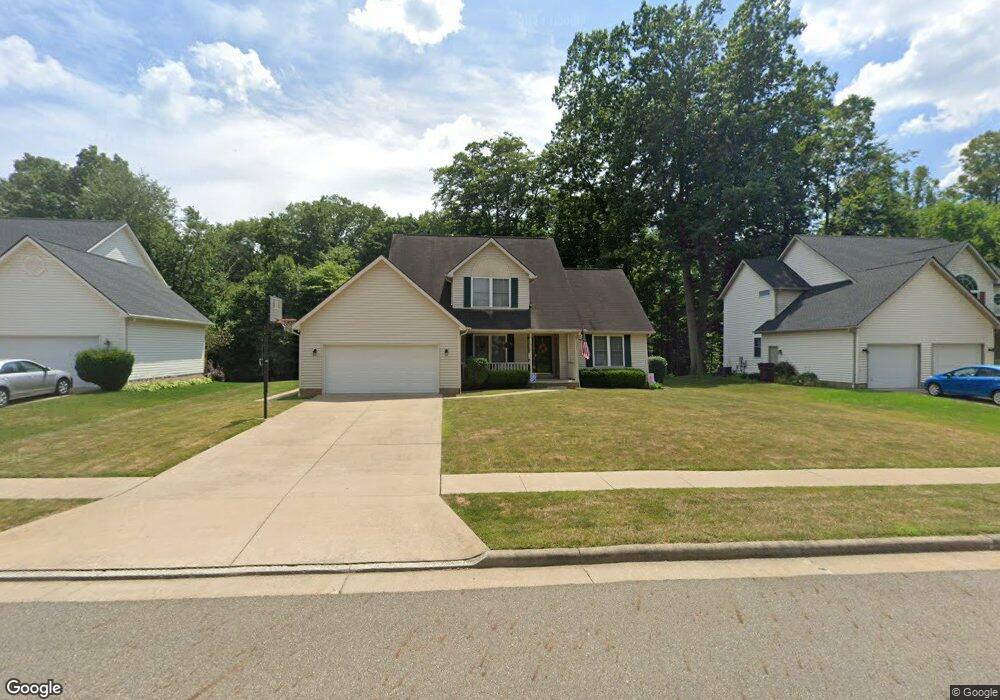
714 E Reno Dr Louisville, OH 44641
Estimated Value: $298,000 - $364,000
3
Beds
3
Baths
2,136
Sq Ft
$154/Sq Ft
Est. Value
About This Home
This home is located at 714 E Reno Dr, Louisville, OH 44641 and is currently estimated at $328,407, approximately $153 per square foot. 714 E Reno Dr is a home located in Stark County with nearby schools including Louisville High School and St. Thomas Aquinas High School & Middle School.
Ownership History
Date
Name
Owned For
Owner Type
Purchase Details
Closed on
Sep 1, 2005
Sold by
Davis Joshua A and Davis Jennifer J
Bought by
Hoffman Daniel B and Hoffman Joni A
Current Estimated Value
Home Financials for this Owner
Home Financials are based on the most recent Mortgage that was taken out on this home.
Original Mortgage
$150,400
Outstanding Balance
$80,313
Interest Rate
5.82%
Mortgage Type
Fannie Mae Freddie Mac
Estimated Equity
$248,094
Purchase Details
Closed on
Aug 9, 1999
Sold by
Mckinley Development Company
Bought by
Davis Joshua A and Davis Jennifer J
Home Financials for this Owner
Home Financials are based on the most recent Mortgage that was taken out on this home.
Original Mortgage
$140,975
Interest Rate
7.77%
Mortgage Type
Purchase Money Mortgage
Create a Home Valuation Report for This Property
The Home Valuation Report is an in-depth analysis detailing your home's value as well as a comparison with similar homes in the area
Home Values in the Area
Average Home Value in this Area
Purchase History
| Date | Buyer | Sale Price | Title Company |
|---|---|---|---|
| Hoffman Daniel B | $188,000 | -- | |
| Davis Joshua A | $177,000 | -- |
Source: Public Records
Mortgage History
| Date | Status | Borrower | Loan Amount |
|---|---|---|---|
| Open | Hoffman Daniel B | $150,400 | |
| Closed | Davis Joshua A | $140,975 |
Source: Public Records
Tax History Compared to Growth
Tax History
| Year | Tax Paid | Tax Assessment Tax Assessment Total Assessment is a certain percentage of the fair market value that is determined by local assessors to be the total taxable value of land and additions on the property. | Land | Improvement |
|---|---|---|---|---|
| 2025 | -- | $109,690 | $28,700 | $80,990 |
| 2024 | -- | $109,690 | $28,700 | $80,990 |
| 2023 | $3,086 | $71,830 | $16,980 | $54,850 |
| 2022 | $3,093 | $71,830 | $16,980 | $54,850 |
| 2021 | $3,101 | $71,830 | $16,980 | $54,850 |
| 2020 | $2,538 | $63,850 | $15,300 | $48,550 |
| 2019 | $2,549 | $63,850 | $15,300 | $48,550 |
| 2018 | $2,539 | $63,850 | $15,300 | $48,550 |
| 2017 | $2,282 | $55,380 | $12,010 | $43,370 |
| 2016 | $2,329 | $55,380 | $12,010 | $43,370 |
| 2015 | $2,336 | $55,380 | $12,010 | $43,370 |
| 2014 | $273 | $50,090 | $10,850 | $39,240 |
| 2013 | $1,140 | $50,090 | $10,850 | $39,240 |
Source: Public Records
Map
Nearby Homes
- 316 E Reno Dr
- 910 Crosswyck Cir
- 1170 Winding Ridge Ave
- 5474 Ravenna Ave
- 428 Honeycrisp Dr NE
- 3047 Mcintosh Dr NE
- 432 Honeycrisp Dr NE
- 2962 Mcintosh Dr NE
- 2963 Mcintosh Dr NE
- 430 Honeycrisp Dr NE
- 2957 Mcintosh Dr NE
- 524 Glenbar St
- 614 Reno Dr
- 300 Kennedy St
- 0 Glenbar St
- 325 Lincoln Ave
- 0 Michigan Blvd
- 0 Brookridge Ave
- 3580 Brookridge Ave Lot 15
- 308 Superior St
- 722 E Reno Dr
- 704 E Reno Dr
- 802 E Reno Dr
- 715 E Reno Dr
- 705 E Reno Dr
- 723 E Reno Dr
- 812 E Reno Dr
- 803 E Reno Dr
- 824 E Reno Dr
- 805 Crosswyck Cir
- 813 E Reno Dr
- 800 Crosswyck Cir
- 1300 Wynridge Ave Unit 1A
- 1292 Wynridge Ave Unit 2A
- 1296 Wynridge Ave Unit 1A1B
- 1296 Wynridge Ave Unit 1B
- 1296 Wynridge Ave
- 1288 Wynridge Ave Unit 2B
- 825 E Reno Dr
- 811 Crosswyck Cir