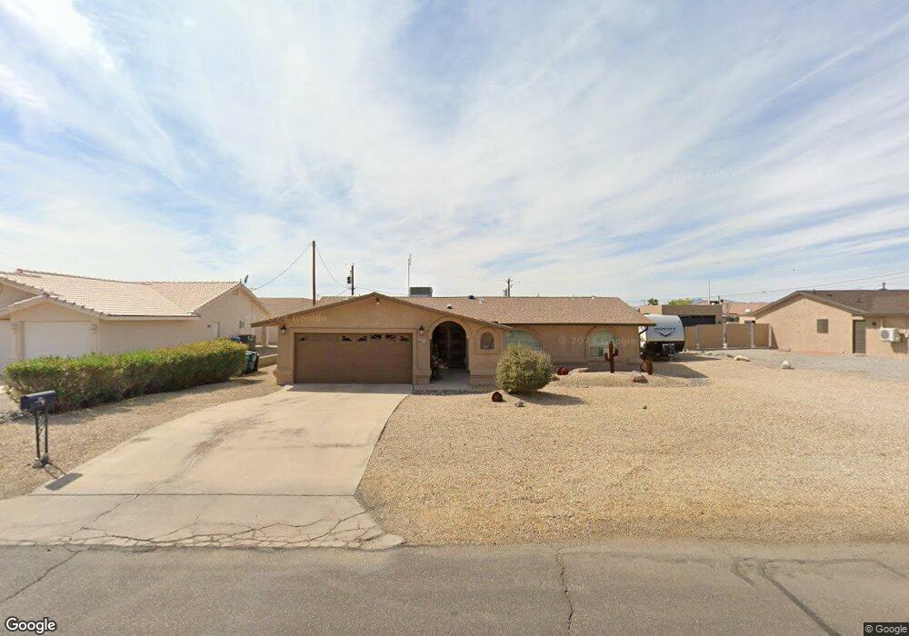
715 Satellite Dr Lake Havasu City, AZ 86404
Estimated Value: $327,000 - $463,000
3
Beds
1
Bath
1,661
Sq Ft
$234/Sq Ft
Est. Value
About This Home
This home is located at 715 Satellite Dr, Lake Havasu City, AZ 86404 and is currently estimated at $388,480, approximately $233 per square foot. 715 Satellite Dr is a home located in Mohave County with nearby schools including Havasupai Elementary School, Thunderbolt Middle School, and Lake Havasu High School.
Ownership History
Date
Name
Owned For
Owner Type
Purchase Details
Closed on
Nov 8, 2021
Sold by
Messmer Sarah B
Bought by
Messmer Sarah B and Thayer Laura Lynn
Current Estimated Value
Purchase Details
Closed on
Mar 22, 2005
Sold by
Chase Candice Kay
Bought by
Messmer Sarah B
Home Financials for this Owner
Home Financials are based on the most recent Mortgage that was taken out on this home.
Original Mortgage
$132,800
Interest Rate
5.25%
Mortgage Type
New Conventional
Create a Home Valuation Report for This Property
The Home Valuation Report is an in-depth analysis detailing your home's value as well as a comparison with similar homes in the area
Home Values in the Area
Average Home Value in this Area
Purchase History
| Date | Buyer | Sale Price | Title Company |
|---|---|---|---|
| Messmer Sarah B | -- | None Listed On Document | |
| Messmer Sarah B | $166,000 | State Title Agency Inc |
Source: Public Records
Mortgage History
| Date | Status | Borrower | Loan Amount |
|---|---|---|---|
| Previous Owner | Messmer Sarah B | $132,800 |
Source: Public Records
Tax History Compared to Growth
Tax History
| Year | Tax Paid | Tax Assessment Tax Assessment Total Assessment is a certain percentage of the fair market value that is determined by local assessors to be the total taxable value of land and additions on the property. | Land | Improvement |
|---|---|---|---|---|
| 2026 | $374 | -- | -- | -- |
| 2025 | $757 | $0 | $0 | $0 |
| 2024 | $757 | $33,699 | $0 | $0 |
| 2023 | $757 | $26,766 | $0 | $0 |
| 2022 | $729 | $18,445 | $0 | $0 |
| 2021 | $896 | $16,652 | $0 | $0 |
| 2019 | $855 | $12,654 | $0 | $0 |
| 2018 | $828 | $12,029 | $0 | $0 |
| 2017 | $815 | $10,420 | $0 | $0 |
| 2016 | $730 | $8,810 | $0 | $0 |
| 2015 | $713 | $8,030 | $0 | $0 |
Source: Public Records
Map
Nearby Homes
- 2875 Swirl Dr
- 2880 Sombrero Dr
- 2735 Poseidon Dr
- 710 Meadows Dr
- 2699 Poseidon Dr
- 2825 Pepperwood Dr
- 2815 Pepperwood Dr
- 3000 Applewood Dr
- 2775 Briarcrest Dr
- 3030 Green Acres Dr
- 600 Stone Acre Dr
- 3056 Ironwood Dr
- 2953 Canyon Oak Dr
- 2820 Briarcrest Dr
- 2774 Hidden Valley Dr
- 3070 Dogwood Dr
- 2528 Tanglewood Dr
- 2740 Arcadia Dr
- 2980 Kiowa Blvd N
- 3040 Gatewood Dr
- 719 Satellite Dr
- 705 Satellite Dr
- 2825 Papeete Dr
- 725 Satellite Dr
- 725 Satellite Dr
- 710 Satellite Dr
- 737 Satellite Ct
- 739 Satellite Ct
- 2845 Papeete Dr
- 2815 Papeete Dr
- 2845 Swirl Dr
- 731 Satellite Dr
- 2830 Papeete Dr
- 2844 Swirl Dr
- 2840 Papeete Dr
- 2805 Papeete Dr
- 2855 Papeete Dr
- 2820 Papeete Dr
- 730 Satellite Dr
- 735 Satellite Ct