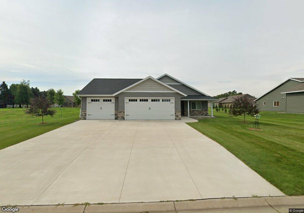
716 4th St NW Richmond, MN 56368
Estimated Value: $391,572 - $452,000
3
Beds
--
Bath
1,844
Sq Ft
$228/Sq Ft
Est. Value
About This Home
This home is located at 716 4th St NW, Richmond, MN 56368 and is currently estimated at $420,143, approximately $227 per square foot. 716 4th St NW is a home located in Stearns County with nearby schools including Rocori Senior High School and Saints Peter & Paul Catholic School.
Ownership History
Date
Name
Owned For
Owner Type
Purchase Details
Closed on
Jan 12, 2022
Sold by
Smart'N Construction Llc
Bought by
Meemken Walter Walter
Current Estimated Value
Home Financials for this Owner
Home Financials are based on the most recent Mortgage that was taken out on this home.
Interest Rate
3.22%
Purchase Details
Closed on
May 21, 2021
Sold by
Lumber 1 Cold Spg Inc
Bought by
Smartn Construction Llc
Create a Home Valuation Report for This Property
The Home Valuation Report is an in-depth analysis detailing your home's value as well as a comparison with similar homes in the area
Home Values in the Area
Average Home Value in this Area
Purchase History
| Date | Buyer | Sale Price | Title Company |
|---|---|---|---|
| Meemken Walter Walter | $395,900 | -- | |
| Smartn Construction Llc | $41,000 | None Available | |
| -- | $41,000 | -- |
Source: Public Records
Mortgage History
| Date | Status | Borrower | Loan Amount |
|---|---|---|---|
| Closed | Meemken Walter Walter | -- | |
| Closed | -- | $36,900 |
Source: Public Records
Tax History Compared to Growth
Tax History
| Year | Tax Paid | Tax Assessment Tax Assessment Total Assessment is a certain percentage of the fair market value that is determined by local assessors to be the total taxable value of land and additions on the property. | Land | Improvement |
|---|---|---|---|---|
| 2025 | $4,298 | $360,200 | $41,000 | $319,200 |
| 2024 | $4,112 | $341,400 | $41,000 | $300,400 |
| 2023 | $3,844 | $330,200 | $40,000 | $290,200 |
| 2022 | $682 | $37,500 | $37,500 | $0 |
| 2021 | $698 | $37,500 | $37,500 | $0 |
| 2020 | $628 | $37,500 | $37,500 | $0 |
| 2019 | $566 | $32,000 | $32,000 | $0 |
| 2018 | $576 | $28,000 | $28,000 | $0 |
| 2017 | $592 | $28,000 | $28,000 | $0 |
| 2016 | $586 | $0 | $0 | $0 |
| 2015 | $616 | $0 | $0 | $0 |
| 2014 | -- | $0 | $0 | $0 |
Source: Public Records
Map
Nearby Homes
- 101 Barry Loop NW
- 577 Main St W
- 261 Main St W
- 148 Main St W
- 205 Grant Ave SW
- 153 Central Ave S
- 21107 State Highway 23
- 448 1st St NE
- 464 Main St E
- 22296 Hall Ave SW
- XXX Eastfield Dr
- 20734 Black Cherry Dr
- 22579 Fordham Rd
- 21312 State Highway 22 #4
- 21312 State Highway 22 Unit 20
- 21312 State Highway 22 Unit 25
- 22213 Big Lake Ct
- 22225 Big Lake Ct
- 21488 Big Lake Rd
- 22314 Mallard Ct
- 712 4th St NW
- 720 4th St NW
- 106 Barry Loop NW
- 104 Barry Loop NW
- 108 Barry Loop NW
- 102 Barry Loop NW
- 100 Barry Loop NW
- 110 Barry Loop NW
- 713 4th St NW
- 708 4th St NW
- 717 4th St NW
- 709 4th St NW
- 112 Barry Loop NW
- 112 Barry Loop NW
- 112 Barry Loop NW
- 112 Barry Loop NW
- 651 4th St NW
- 105 Barry Loop NW
- 107 Barry Loop NW
- 721 4th St NW