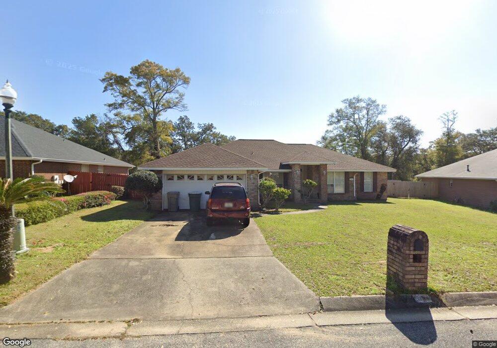
7162 Rampart Way Pensacola, FL 32505
Estimated Value: $288,316 - $333,000
--
Bed
2
Baths
2,263
Sq Ft
$140/Sq Ft
Est. Value
About This Home
This home is located at 7162 Rampart Way, Pensacola, FL 32505 and is currently estimated at $316,579, approximately $139 per square foot. 7162 Rampart Way is a home located in Escambia County with nearby schools including Montclair Elementary School, Warrington Middle School, and Pine Forest High School.
Ownership History
Date
Name
Owned For
Owner Type
Purchase Details
Closed on
Jun 25, 2014
Sold by
Davis Kelvin L
Bought by
Davis Syndey T
Current Estimated Value
Purchase Details
Closed on
Jul 30, 2001
Sold by
Adams Homes Nw Fl Inc
Bought by
Davis Kelvin L and Davis Sydney T
Home Financials for this Owner
Home Financials are based on the most recent Mortgage that was taken out on this home.
Original Mortgage
$134,538
Outstanding Balance
$52,253
Interest Rate
7.09%
Mortgage Type
VA
Estimated Equity
$264,326
Create a Home Valuation Report for This Property
The Home Valuation Report is an in-depth analysis detailing your home's value as well as a comparison with similar homes in the area
Home Values in the Area
Average Home Value in this Area
Purchase History
| Date | Buyer | Sale Price | Title Company |
|---|---|---|---|
| Davis Syndey T | -- | None Available | |
| Davis Kelvin L | $131,900 | -- |
Source: Public Records
Mortgage History
| Date | Status | Borrower | Loan Amount |
|---|---|---|---|
| Open | Davis Kelvin L | $134,538 |
Source: Public Records
Tax History Compared to Growth
Tax History
| Year | Tax Paid | Tax Assessment Tax Assessment Total Assessment is a certain percentage of the fair market value that is determined by local assessors to be the total taxable value of land and additions on the property. | Land | Improvement |
|---|---|---|---|---|
| 2024 | $1,641 | $159,213 | -- | -- |
| 2023 | $1,641 | $154,576 | $0 | $0 |
| 2022 | $1,598 | $150,074 | $0 | $0 |
| 2021 | $1,592 | $145,703 | $0 | $0 |
| 2020 | $1,550 | $143,692 | $0 | $0 |
| 2019 | $1,519 | $140,462 | $0 | $0 |
| 2018 | $1,515 | $137,843 | $0 | $0 |
| 2017 | $1,509 | $135,008 | $0 | $0 |
| 2016 | $1,496 | $132,232 | $0 | $0 |
| 2015 | $1,482 | $131,313 | $0 | $0 |
| 2014 | $1,474 | $130,271 | $0 | $0 |
Source: Public Records
Map
Nearby Homes
- 6001 Toulouse Dr
- 1309 Belair Rd
- 7036 Rampart Way
- 1201 Belair Rd
- 1414 Clio Dr
- 2300 W Michigan Ave Unit 1
- 2300 W Michigan Ave Unit 8
- 305 N Madison Dr
- 4511 Saint Nazaire Rd
- 2077 Tujaques Place
- 220 Sand Trap Ln
- 206 Garfield Dr
- 2016 Pin High Dr
- 2004 Pin High Dr
- 4407 Havre Way
- 3236 Two Sisters Way
- 2303 W Michigan Ave Unit F5
- 2303 W Michigan Ave Unit F6
- 1005 Revere Dr
- 918 Belair Rd
- 7158 Rampart Way
- 7166 Rampart Way
- 4609 Bridgedale Rd
- 4611 Bridgedale Rd
- 4607 Bridgedale Rd
- 7154 Rampart Way
- 7170 Rampart Way
- 4613 Bridgedale Rd
- 7167 Rampart Way
- 4605 Bridgedale Rd
- 7157 Rampart Way
- 6000 Toulouse Dr
- 4615 Bridgedale Rd
- 7150 Rampart Way
- 7153 Rampart Way
- 4603 Bridgedale Rd
- 7174 Rampart Way
- 4606 Bridgedale Rd
- 7350 Du Monde Place
- 7175 Rampart Way