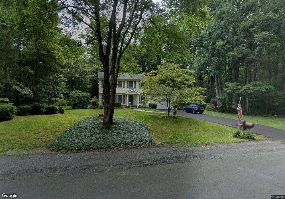
717 Doages Dr Millersville, MD 21108
Estimated Value: $554,523 - $653,000
--
Bed
3
Baths
1,792
Sq Ft
$345/Sq Ft
Est. Value
About This Home
This home is located at 717 Doages Dr, Millersville, MD 21108 and is currently estimated at $617,381, approximately $344 per square foot. 717 Doages Dr is a home located in Anne Arundel County with nearby schools including Millersville Elementary School, Old Mill High School, and Rockbridge Academy.
Ownership History
Date
Name
Owned For
Owner Type
Purchase Details
Closed on
Mar 22, 1983
Bought by
Brong John G and Brong Carol A
Current Estimated Value
Home Financials for this Owner
Home Financials are based on the most recent Mortgage that was taken out on this home.
Original Mortgage
$88,800
Interest Rate
12.81%
Create a Home Valuation Report for This Property
The Home Valuation Report is an in-depth analysis detailing your home's value as well as a comparison with similar homes in the area
Home Values in the Area
Average Home Value in this Area
Purchase History
| Date | Buyer | Sale Price | Title Company |
|---|---|---|---|
| Brong John G | $111,000 | -- |
Source: Public Records
Mortgage History
| Date | Status | Borrower | Loan Amount |
|---|---|---|---|
| Closed | Brong John G | $88,800 |
Source: Public Records
Tax History Compared to Growth
Tax History
| Year | Tax Paid | Tax Assessment Tax Assessment Total Assessment is a certain percentage of the fair market value that is determined by local assessors to be the total taxable value of land and additions on the property. | Land | Improvement |
|---|---|---|---|---|
| 2025 | $3,919 | $458,800 | $255,300 | $203,500 |
| 2024 | $3,919 | $453,100 | $0 | $0 |
| 2023 | $3,817 | $447,400 | $0 | $0 |
| 2022 | $3,584 | $441,700 | $255,300 | $186,400 |
| 2021 | $3,399 | $420,900 | $0 | $0 |
| 2020 | $3,399 | $400,100 | $0 | $0 |
| 2019 | $3,331 | $379,300 | $215,300 | $164,000 |
| 2018 | $3,756 | $370,400 | $0 | $0 |
| 2017 | $3,142 | $361,500 | $0 | $0 |
| 2016 | -- | $352,600 | $0 | $0 |
| 2015 | -- | $342,567 | $0 | $0 |
| 2014 | -- | $332,533 | $0 | $0 |
Source: Public Records
Map
Nearby Homes
- 1220 Indian Landing Rd
- 771 Generals Hwy
- 983 Wayside Dr
- 1013 Waterbury Heights Dr
- 610 Echo Cove Dr
- 1158 Blue Bird Ln
- 626 Evergreen Rd
- 1080 Generals Hwy
- 1400 Lower View Ct
- 405 Ben Oaks Dr W
- 717 Whitneys Landing Dr
- 1610 Hog Farm Rd
- 518 Lakeland Rd S
- 762 Cougar Dr
- 1037 Dockser Dr
- 596 West Dr
- 1003 Omar Dr
- 30 Highland Dr
- 8201 Longford Rd
- 1304 North Rd
- 721 Doages Dr
- 720 Doages Dr
- 716 Doages Dr
- 713 Doages Dr
- 724 Doages Dr
- 729 Lumbee Ct
- 709 Doages Dr
- 732 Conoy Ct
- 808 Richard Tongue Dr
- 712 Doages Dr
- 812 Richard Tongue Dr
- 816 Richard Tongue Dr
- 736 Conoy Ct
- 705 Doages Dr
- 737 Conoy Ct
- 733 Lumbee Ct
- 820 Richard Tongue Dr
- 804 Richard Tongue Dr
- 1127 Indian Landing Rd
- 708 Doages Dr