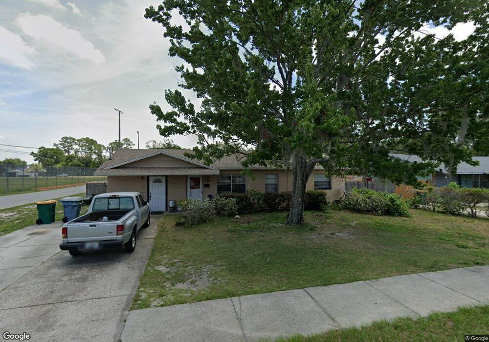
718 N Disston Ave Tavares, FL 32778
Estimated Value: $209,384 - $235,000
2
Beds
1
Bath
1,490
Sq Ft
$150/Sq Ft
Est. Value
About This Home
This home is located at 718 N Disston Ave, Tavares, FL 32778 and is currently estimated at $223,096, approximately $149 per square foot. 718 N Disston Ave is a home located in Lake County with nearby schools including Tavares Elementary School, Tavares Middle School, and Tavares High School.
Ownership History
Date
Name
Owned For
Owner Type
Purchase Details
Closed on
Jun 24, 2004
Sold by
Duncan Betty R
Bought by
Duncan Darnall E and Duncan Betty R
Current Estimated Value
Purchase Details
Closed on
Aug 7, 2002
Sold by
Latham Julie
Bought by
Duncan Betty R
Home Financials for this Owner
Home Financials are based on the most recent Mortgage that was taken out on this home.
Original Mortgage
$68,664
Outstanding Balance
$28,375
Interest Rate
6.49%
Mortgage Type
FHA
Estimated Equity
$194,721
Create a Home Valuation Report for This Property
The Home Valuation Report is an in-depth analysis detailing your home's value as well as a comparison with similar homes in the area
Home Values in the Area
Average Home Value in this Area
Purchase History
| Date | Buyer | Sale Price | Title Company |
|---|---|---|---|
| Duncan Darnall E | $38,600 | -- | |
| Duncan Betty R | $69,300 | -- |
Source: Public Records
Mortgage History
| Date | Status | Borrower | Loan Amount |
|---|---|---|---|
| Open | Duncan Betty R | $68,664 |
Source: Public Records
Tax History Compared to Growth
Tax History
| Year | Tax Paid | Tax Assessment Tax Assessment Total Assessment is a certain percentage of the fair market value that is determined by local assessors to be the total taxable value of land and additions on the property. | Land | Improvement |
|---|---|---|---|---|
| 2026 | $839 | $90,110 | -- | -- |
| 2025 | $782 | $87,660 | -- | -- |
| 2024 | $782 | $87,660 | -- | -- |
| 2023 | $782 | $82,640 | $0 | $0 |
| 2022 | $753 | $80,240 | $0 | $0 |
| 2021 | $716 | $77,912 | $0 | $0 |
| 2020 | $729 | $76,837 | $0 | $0 |
| 2019 | $707 | $75,110 | $0 | $0 |
| 2018 | $681 | $73,710 | $0 | $0 |
| 2017 | $677 | $72,194 | $0 | $0 |
| 2016 | $683 | $70,710 | $0 | $0 |
| 2015 | $688 | $70,219 | $0 | $0 |
| 2014 | $692 | $69,662 | $0 | $0 |
Source: Public Records
Map
Nearby Homes
- 811 N Disston Ave
- 1025 Capella Dr
- 1026 Capella Dr
- 1127 Belmont Cir
- 1002 N New Hampshire Ave
- 1115 Elkhart Cir
- 1113 Elkhart Cir
- 1129 Elkhart Cir
- 1116 Elkhart Cir
- 1114 Elkhart Cir
- 1112 Elkhart Cir
- 1237 Elkhart Cir
- 607 Ridge Place
- 1105 Nassau Cir
- 1359 Windsor St
- 1207 Apache Cir
- 214 N New Hampshire Ave
- 0 E Maud St
- 1312 Apache Cir
- 1332 Nassau Cir
- 716 N Disston Ave
- 715 Wood Ave
- 722 Wood Ave
- 713 Wood Ave
- 0 Wood Ave
- 717 N Disston Ave
- 715 N Disston Ave
- 321 E Givens St
- 707 N Disston Ave
- 708 N Disston Ave
- 709 N Disston Ave
- 624 N Disston Ave
- 310 E Givens St
- 703 N Disston Ave
- 714 N Saint Clair Abrams Ave
- 305 E Givens St
- 460 E Givens St
- 817 N Disston Ave
- 810 N Saint Clair Abrams Ave